

Esri GIS Education - news, curriculum, software, tools and more
- Tweets4.8K
- Following662
- Followers22K
- Likes1.9K









ALT Logo of "The UCSB Guide" featuring an open book with a winding path through fields as a bookmark.

ALT A person stands in a server room holding a tablet, facing the servers. The overlay text reads, "Governing ArcGIS: Guide for Higher Education, Chapter 3: Systems." The setting features dim lighting and rows of illuminated server racks.

ALT A group of people in a classroom setting, with one person standing and speaking near tables. Others are seated and attentive, with open laptops and notebooks. Large windows in the background allow natural light to fill the room.

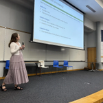
ALT A person stands in a lecture hall, holding a microphone and presenting a slide titled "Option Mapping" on a large screen. The room has empty chairs, whiteboards, and wooden paneling.

ALT A beautifully detailed, multi-story building in New Orleans’ French Quarter, featuring ornate wrought iron balconies adorned with hanging plants. The sky is bright blue with scattered clouds.

ALT A person smiling while using a laptop, with a coffee cup nearby. The background features abstract art and a digital illustration of global connectivity. The text reads, "GIS in Higher Education Chat.

ALT A diagram titled "Governing ArcGIS Guide for Higher Education" with five interconnected circular elements labeled: Mission, Governance, Systems, Engagement, and Capacity. Central circle is labeled "Geospatial framework." The background features a blue pattern.


ALT A cartoon turkey with large, colorful tail feathers in shades of rainbow hues. The turkey has a cheerful expression.

ALT Aerial view of Housesteads Roman Fort, showcasing rectangular stone ruins surrounded by green grass. Pathways and additional structures are visible around the site.

ALT A city street view with overlaid graphical elements depicting artificial intelligence integration in geographic information systems. Buildings, vehicles, and pedestrians are labeled using digital markers. The Esri logo is displayed in the corner. The text reads, "Why AI in GIS Education.


ALT A group of people are gathered around a table, focused on a laptop. The setting appears educational. The image includes logos for Esri, National Geographic, and MapMaker. Text on the image announces an "Education Industry Webinar" titled "Enhance your Learning with National Geographic MapMaker" scheduled for November 17, 2026, from 5:00 PM to 6:00 PM (PT).


