

The official Twitter account of the City of Milwaukee Health Department (MHD).
- Tweets3.8K
- Following768
- Followers3.7K
- Likes1.2K







ALT A graphic with a photo of an MHD laboratory employee testing samples and text that says Milwaukee health department launches COVID-19 wastewater testing dashboard. Read the press release at milwaukee.gov/wastewater

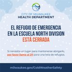
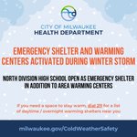
ALT A graphic with a cold weather safety announcement that says the emergency warming shelter at North Division High School has been deactivated. If anyone needs a space to stay warm, please dial 2-1-1 for a list of shelters. More information at milwaukee.gov/coldweathersafety


ALT A graphic showing all of southern Wisconsin under a Winter Weather Advisory from 9 pm tonight through Tuesday morning. 1-3 inches of snowfall may contribute to slippery conditions leading into Tuesday morning.

ALT A graphic indicating the placement of Winter Storm Warnings and Watches. Snow and rain mix along the lakeshore east of I-43 and I-41/94 led to a continued Winter Storm Watch. Greatest impacts are expected Tuesday morning through Tuesday evening with snowfall rates greater than 1 inch per hour, accumulating snow, and increasing winds.

ALT A graphic showing timing and impacts across southern Wisconsin. Snowfall begins in southwest to south-central Wisconsin this evening, in central, southeast, and southeast lakeshore counties late tonight, and in east-central Wisconsin by early Tuesday morning. The heaviest snowfall is indicated from 6 AM to 9 PM for areas away from the southeast lakeshore counties. Lakeshore counties are shown to have heavy rain and snow mix during this time. Snow then slowly ends from west to east overnight Wednesday into early Wednesday morning. Increasing northerly winds are expected Tuesday morning through Tuesday night as well.

ALT Graphics showing widespread high potential for 4 inches or more, and moderate potential of 8 inches or more. Potential for higher snowfall amounts have shifted slightly due to a northward shift in modeling. Potential lake enhancement may increase amounts just inland of Lake Michigan during the snowfall onset. A wintry mix of rain and snow due to warm temperatures may limit accumulations along the lakeshore.


ALT Illustration of a menorah against a dark blue background

ALT A graphic with a red ribbon recognizing World Aids Day as December 1, 2023 and text that says HIV testing available at the Milwaukee Health Department's Keenan Sexual Health Clinic at 3200 N. 36th St., Monday through Friday. More information at milwaukee.gov/Keenan

ALT A graphic reminding individuals to enroll in 2024 marketplace health insurance by December 15th for their coverage to start on January 1st. Visit healthcare.gov to sign up today.


ALT Salmonella Outbreak. Illness linked to cantaloupes sold in Wisconsin. Do not eat recalled melons; throw them away. Contact your doctor if you have any symptoms of salmonella infection: Abdominal pain, Diarrhea, Fever, Vomiting. Stay up to date: dhs.wisconsin.gov/outbreaks