

Vantor is forging the new frontier of spatial intelligence to unlock a more automated, interoperable world. Delivering total clarity from space to ground.
Westminster, Colorado, USA
Joined October 2008
- Tweets12.1K
- Following834
- Followers141K
- Likes7.1K



It’s Flythrough Friday. This week, we’re heading to Washington, D.C.
Every Friday, we’re exploring a new corner of the world through WorldView 3D HD, showcasing what the world looks like in high-fidelity 3D from space.
This week, take in the nation’s capital from a new perspective, with detailed views of the U.S. Capitol, National Mall and Pennsylvania Avenue. Explore the iconic architecture, monuments and urban landscape that define Washington, D.C., all captured in high-fidelity 3D. It’s more than an impressive view. It’s aerial-grade 3D quality built for detailed planning, simulation and mission-critical operations.
See the full flythrough video and explore more of the world in 3D HD: go.vantor.com/worldview-3d-h…
Space is playing an increasingly important role in the future of defense and security cooperation between the U.S. and Japan.
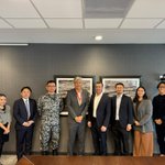
Vantor recently welcomed Consul-General Hiroyuki Okajima of the Consulate General of Japan in Denver and Colonel Yukihiko Hayakawa of the @JASDF_PAO_ENG to our headquarters.
The discussions highlighted opportunities for commercial spatial intelligence to strengthen Japan’s sovereign capabilities and support its evolving defense and security needs.
We demonstrated Vantor’s AI-powered analytics, satellite imagery capabilities, and Tensorglobe, and discussed our next-generation satellites Pulse and Vantage, which will help organizations monitor activity, detect change, and make more informed decisions.
Thank you to our guests for the engaging exchange. We look forward to continued collaboration with our partners in the Indo-Pacific region, including Japan Space Imaging.

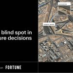
Construction activity can reveal risk, readiness, and market movement before traditional data catches up. Leaders need a trusted way to see it.
@FortuneMagazine explores why physical signals matter for technology and finance organizations making infrastructure and investment decisions:
🏗️ See how projects are progressing and whether supporting infrastructure is keeping pace
📊 Evaluate investment timing, risk, and market exposure
🌐 Spot where construction activity may signal shifts in local capacity or demand
More details in the article: fortune.com/brandstudio/vant…

Understanding what’s happening across the physical world takes accurate information and the ability to put it into context.
Vantor’s spatial intelligence capabilities help reveal activity on the ground and in orbit, providing insights that support situational awareness and more informed decisions.
This October, Vantor’s News Bureau team contributed to reporting on China’s expanding military presence, Russia’s new drone attack base, activity near North Korea’s coastline, and a close approach between satellites in space.
Take a look at these stories 👇

Attack aircraft and military vehicles are visible at a new China–Laos base, satellite images show.
@Reuters: reuters.com/world/asia-pacif…

2
9
762
Your drone’s camera can do more than see. With Vantor Raptor, it can help the drone navigate without GPS.
Raptor pairs existing video with accurate 3D terrain data for absolute positioning, autonomous navigation, and a live 3D view for operators—all without specialized camera hardware.
@BreakingDefense explores Raptor in real-world UAS operations: breakingdefense.com/2026/04/…

The @DefenseIntel latest Challenges to Security in Space report makes clear that competition in space is accelerating as China and Russia advance their capabilities.
The report documents China’s expanding presence in space, including reusable space systems, and features Vantor’s WorldView Space imagery of a Chinese spaceplane in orbit in 2024. Our analysts provide additional context on the image in the graphic below.
Commercial space is now a critical part of the national security toolkit. Commercial imagery and analysis give the U.S. and its allies greater visibility into activity in orbit and help decision-makers understand emerging capabilities. Continued investment in these capabilities is essential as the space domain becomes increasingly contested.
Read the full DIA assessment and view the Vantor image on page 53: dia.mil/Portals/110/Images/N…

How can energy teams sift through thousands of miles of infrastructure to spot changes that warrant a closer look?
In our webinar with @OGJOnline, Vantor’s Bill Tinney demonstrates how Site Sentry uses AI-powered change detection to automatically flag locations for further analysis. Spatial intelligence can help teams move from broad monitoring to identifying where action may be needed.
Watch the webinar: go.vantor.com/webinar-energy…
Vantor has been named one of @Forbes' America’s Dream Employers 2027! The recognition highlights organizations where college students and employees aspire to work and build their careers.
At Vantor, we’re forging the new frontier of spatial intelligence, combining AI, advanced technology and human expertise to help customers solve complex challenges and make better decisions.
👉 See the full list: forbes.com/lists/americas-dr…
🔍 Explore careers: vantor.com/careers/


Rosie Riveters, @BGCMetroDenver and @ScienceBuddies are helping students experience hands-on STEM, build skills and explore future careers.
1
1
1,253
As the U.S. Army accelerates its modernization efforts, operating without reliable GPS or connectivity is becoming a critical consideration.
In a new @WashTimes article, Vantor’s Will Cocos discusses how Tensorglobe, our spatial intelligence platform, helps address this new reality by providing an accurate 3D representation of the physical world that supports navigation and operations in contested environments.
Vantor’s capabilities enable autonomous systems to navigate using on-board technology rather than depending on external positioning signals, helping maintain critical capabilities when traditional systems are unreliable.
Read the full coverage: washingtontimes.com/news/202…

A rare view of concerning activity in orbit.
From Oct. 16–18, a Russian satellite made several close approaches to a U.S. commercial satellite. This image, collected by Vantor’s WorldView Space capability on Oct. 17, shows Russian Cosmos 2612 at an estimated distance of about 1 km from ICEYE-X36.
“This image captures a reality long recognized by our national security leaders—space is becoming increasingly contested. Seeing one spacecraft repeatedly maneuver close to another raises serious concerns about capability and intent.”—Dan Smoot, Vantor CEO.
With WorldView Space, Vantor’s non-Earth imaging capability lets us collect images of other spacecraft in orbit, helping us better understand how they’re operating and spot activity that warrants a closer look.
Read @axios's exclusive coverage: axios.com/2026/10/22/space-w…
Explore WorldView Space: vantor.com/product/worldview…

Activity on a job site can tell you a lot about how a project is progressing: Where and when is equipment appearing? How is it changing over time? Where is work advancing or slowing down?
On-site visits provide a point-in-time view. Persistent monitoring with Vantor provides another perspective, helping teams track activity consistently across multiple projects without being physically present at each one.
By analyzing site signals over time, teams can identify patterns of activity and better understand how a project is progressing, leading to better decision-making.
Our Monitoring Construction Signals from Space eBook shows how these capabilities come together, with real-world examples from projects around the globe.
See what construction signals can reveal: go.vantor.com/monitoring-con…
Mine sites are constantly changing. Tracking those changes across pits, stockpiles and tailings facilities can require frequent surveys, especially when teams need accurate information to support engineering decisions.
@PhotoSat_Info combines their deep-learning workflows with Vantor’s high-resolution satellite imagery to create high-accuracy topographic surveys and measurements of site conditions over time.
The result is a clearer understanding of how operations are evolving, helping mining teams monitor development, assess changes, and plan with greater confidence while reducing the need for frequent site visits.
Explore how PhotoSat and Vantor are generating actionable mining intelligence: photosat.ca/blog/turning-sat…
This fall, Vantor’s Raptor team completed successful flight demonstrations for the Australian Defence Force and joined defense leaders, customers and partners at Land Forces in Australia and the Modern Warfare Conference in Romania.
Three themes stood out in conversations about the future of autonomous operations:
• Resilient navigation when GPS is unavailable or unreliable
• Spatial intelligence that turns observations into actionable insight
• Connected systems that help platforms, sensors and teams coordinate
At Land Forces, Vantor Chief Product Officer Peter Wilczynski explored these ideas in his keynote. Raptor was also one of nine solutions shortlisted from 230 submissions for the Australian Army’s Army Innovation Day 2026. Thanks to everyone who joined the conversations.
Learn more about autonomy that doesn’t rely on GPS: go.vantor.com/autonomy-witho…


A clear view of a data center site is useful. Understanding what changed—and what it means—is where the picture becomes more valuable, avoiding fragmented reporting, delayed updates, and reliance on site visits.
In this demo, see how Site Sentry™, Vantor’s site monitoring solution, automates recurring imagery collections based on the cadence a user needs, creating a consistent awareness of construction progress and activity over time.
From there, use AI-powered analysis to put those observations into context. Across a portfolio, that intelligence can help teams validate project milestones and capital deployment, identify potential slowdowns, and determine when future capacity may be moving toward completion.
Explore the data center monitoring solution: vantor.com/resources/data-ce…
Vantor welcomed @nttdata_inc Executive Vice President Satoru Yanagimachi and team to our Colorado headquarters to discuss opportunities to build on our relationship, along with the potential of our next-generation satellites, Vantor Vantage and Pulse.
The conversation centered on a shared ambition: building a digital twin that keeps pace with reality. Tensorglobe, Vantor’s end-to-end spatial intelligence platform, makes that possible by anchoring sensor data, customer and partner inputs, and mission workflows to trusted ground truth, creating a living operational picture that people and systems can act on with confidence.
Thank you to Satoru Yanagimachi and the NTT DATA team for the thoughtful exchange.

As a Vantor Purpose Partner, the Amazon Conservation Team (@AmazonTeamOrg) and its local partners use spatial intelligence to identify mining activity, track dredges and provide actionable information to relevant authorities and partner institutions.
That work helped document hundreds of illegal mining barges, which informed actions that contributed to the destruction of more than 115 barges—while reducing the need for potentially invasive overflights in sensitive areas.
See how ACT and its partners are turning insight into action to help protect the Amazon: vantor.com/blog/protecting-t…
Fresh off the satellite today! 🪐🛰️
This incredible image of Saturn was taken by WorldView Legion on October 7, 2026 —from nearly 1.5 billion kilometers away.
Even at that distance, WorldView Legion was still able to see the planet and surrounding stars clearly.
A remarkable view of Saturn. And a remarkable demonstration of our imaging capabilities.
Learn more about WorldView Space: vantor.com/product/worldview…

@NASA has awarded Vantor a $4.1 million task order through its Commercial Satellite Data Acquisition (CSDA) program to deliver high-resolution imagery mosaics.
By combining satellite images into seamless basemaps, these products offer a detailed view of the ground that can complement government observations and provide new perspectives for research, including agricultural insights.
We’re proud to continue supporting with NASA and the CSDA program.

Autonomous platforms need to keep navigating even when GPS doesn’t.
Raptor gives them another way to know where they are. It matches what a platform sees through its existing camera with Vantor’s global 3D terrain to determine its position and stay on course.
No specialized navigation hardware required. Just vision, trusted terrain, and software built to keep the mission moving.
See how it works: vantor.com/product/mission-s…