

One-stop shop for in-depth forecast discussions and case studies for upcoming and past severe weather events across the United States.
Joined April 2022
- Tweets7.6K
- Following935
- Followers13.2K
- Likes15.2K


Pinned Tweet
LINK: youtube.com/watch?v=A4amTqLZ…
This week, several short-range weather models, including the NAM, are going away for good, to be replaced by the RRFS and REFS. In this video, we break down why NOAA is making these changes, the timeline behind how we got here, the technical specifications of these new models, and how you can adapt your forecast process to the RRFS and REFS.

Beautifully structured supercell near Reva, SD, on June 20, 2025. #sdwx

Convective Chronicles retweeted

Turns out, more than a few people missed the NAM following its discontinuation.
@recast and @DeepGuessr replicated its configuration, ported it to GPU, and are disseminating its data for free in real time - and it is now live on PolarWx:
polarwx.com/models/?model=wo…


Turns out people really do love the NAM despite its flaws. We @recast have decided to continue to offer our WOOF-NAM 12km for free indefinitely (link below).
It’s also important to understand that we are cold starting from GFS Analysis which naturally does slightly change model outcomes compared to starting from a native NAM analysis.
Because of that, we will be running quite a few hindcasts of both popular and requested dates and model inits so people can compare. If anyone has any examples they’d like to see, I’ll run them and put it on the site.
woof-nam.recastsystems.com/i…

I've had some time to go over the data from our recent severe weather event in the Southern Plains on Monday (Nov. 2), and a few factors stand out to me as potential bugaboos that led to the underperformance (keep in mind that this is likely not an exhaustive list):
*EARLY CONVECTIVE INITIATION: Storms fired just before 19z (1 pm CST), a couple hours earlier than expected, along the dryline across far western Oklahoma into the eastern Texas Panhandle. At this time, the dryline was still quite slanted from northeast to southwest. As a result, deep-layer shear vectors were much more parallel to the dryline, aiding in rapid upscale growth. Had storms formed a couple hours later as initially forecast, the portion of the dryline across western Oklahoma would've been oriented a bit more north-south as the secondary surface low tightened in southwest Kansas, perhaps warranting a less linear storm mode.
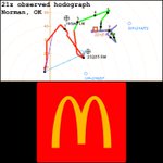
*VEER-BACK: There seemed to be a notable absence of mesocyclones, both with more cellular elements within the convective line and with open-warm-sector convection, and those that did develop were relatively short-lived. This may be a result of the significant veer-back signature exhibited by proximity hodographs. Satrio et al. (2026) found that supercells tended to be weaker and less organized when the backing/kink in the hodograph begins within or just above the effective inflow layer, as opposed to when the backing is much higher in the profile or doesn't exist. Our 21z observed hodograph from Norman, OK, shows a significant kink beginning just a hair above the upper bound of the effective inflow layer. I suspect this played a role in stifling mesocyclone development and maintenance.
*UNFAVORABLE LOW-LEVEL SHEAR VECTOR ORIENTATION: Line-embedded mesovortex tornadoes within a QLCS tend to be much more likely when low-level (generally 0-3km, per Gibbs (2021)) shear vectors are more perpendicular to the orientation of the QLCS itself. In this case, the line was oriented generally north-northeast to south-southwest, which was quite parallel to the low-level shear vectors, decreasing the chances for QLCS tornadoes despite strong low-level shear.
*MEAGER THERMODYNAMICS: While this was not the most prominent factor, thermodynamic profiles left a bit to be desired, with meager midlevel lapse rates and relatively skinny CAPE. Also, the initial dryline storms that quickly evolved into a line tracked into an area where horizontal convective rolls, indicative of low-level stability, failed to dissipate much through the afternoon. Central Oklahoma also saw ample elevated convection and stagnant cloud cover for much of the day, which likely kept thermodynamics at bay.


Satrio et al. (2026) paper on veer-back: repository.library.noaa.gov/…
Gibbs (2021) paper on QLCS tornadoes: repository.library.noaa.gov/…
Epic structure on a tornado-warned supercell near Anton, CO, on June 22, 2026. #COwx

Convective Chronicles retweeted

There is more good news today. I had seen this a day or two ago but now it's confirmed by a notice sent out to Nat'l Weather Service offices directing them to resume timely 2x/day balloon releases. NWS has been on a hiring spree after the ill-advised DOGE cuts. (H/T Alan Gerard).


Well-structured supercell near Frankfort, KS, back on June 13, 2026. #kswx

Today's the day. We salute you, NAM; thank you for your service. Rest in peace.
The RRFS now takes over as one of our main short-range forecast models. For more info on the RRFS and REFS, check out my recent video on them: youtube.com/watch?v=A4amTqLZ…
For storm chasers, it's usually not a great thing when your observed hodograph looks like the McDonald's Golden Arches...
Veer-back-veer was one of the many potential culprits of today's significant underperformance across the central/southern Plains. I'll have a more detailed report once I further analyze the data. Very glad that these flies in the ointment kept this event from reaching its high ceiling.
Still, a robust QLCS from Kansas to Texas continues to march east as of this post (10:55pm CST); damaging winds and embedded spin-up tornadoes will remain possible overnight.

Beautiful scene near Randlett, OK; feels good to be out chasing again.
Storms have remained relatively tame so far, but that could easily change in the coming hours. Do not let your guard down across the risk area!

LINK: youtube.com/watch?v=7aD5fOwv…
Forecast discussion on today's significant severe weather threat across the central/southern Plains. Strong to severe storms are expected to develop along and ahead of a dryline as a robust shortwave moves into the region. Initial supercells should evolve into an expansive QLCS with time, posing a risk for damaging winds and tornadoes, some strong.

Last night, a freak heavy rain event occurred between Bogalusa, LA and Poplarville, MS on the Louisiana-Mississippi state line northeast of New Orleans. Thunderstorms began during the early evening and completely parked themselves over the area for several hours, inundating the area with well over 10" of rain over this span. Radar estimates show an even more impressive total of over 15". Between last night and this morning, the West Hobolochitto Creek near McNeill, MS, rose from around 5.5 feet to 18 feet, and several homes were reported flooded.


SPC has upgraded to Slight Risk (level 2/5) from central New Mexico into the Texas Panhandle for the period stretching from this evening into Monday morning. Confidence has increased in a robust initial round of storms associated with the lead shortwave/jet streak we discussed in yesterday's forecast video. These storms should emanate from rain/storms across Arizona and New Mexico, intensifying after dark tonight as they move east into and across the Slight Risk area. Damaging winds (with gusts possibly over 74 mph) look to be the main threat, along with a risk for a couple embedded tornadic circulations within the line. Scattered severe storms with a damaging wind and brief tornado risk are possible with the daytime activity across Arizona/New Mexico.
The forecast for tomorrow (Monday) remains on track, but questions remain regarding the persistence of the clouds/convection associated with tonight's initial round of storms and how this will impact destabilization during the day tomorrow. The current expectation is for a narrow zone of stronger surface heating and destabilization near the dryline from southern Kansas to northwest Texas, initiating a mix of supercells and line segments late tomorrow afternoon. These initial storms should pose a risk for damaging winds and perhaps a couple tornadoes before storms morph into an expansive line moving east across the risk area after dark. Damaging winds and several embedded tornadic circulations are a good bet as the line marches east across Kansas, Oklahoma, and Texas. Should more of the warm sector destabilize adequately throughout the day, the possibility of open warm sector supercells with a damaging wind/tornado risk may evolve. Check out yesterday's forecast discussion video for more information on the overall setup.


Elevated chances for heavy rain and flash flooding exist across the Desert Southwest tomorrow (Sunday, Nov 1). WPC has outlined dual Moderate Risk (level 3/4) areas for excessive rainfall, one across Utah and Arizona and one in the Four Corners vicinity.

LINK: youtube.com/watch?v=cS-ZdGvU…
Forecast discussion on the severe weather threat taking aim at the central/southern Plains on Monday into Tuesday (Nov. 2-3). For now, damaging winds and tornadoes appear to be the most likely hazards; we'll compare and contrast a few different models to come up with a range of outcomes for this event.
