
Official Twitter account for the National Weather Service Seattle. Details: https://teapaw.org/t.co/yoQbjVwBSK
- Tweets47.4K
- Following428
- Followers258K
- Likes17.9K
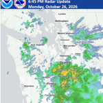






ALT Weather radar image showing rain south of Seattle as of 6:45 PM with heaviest rain near Belfair, Federal Way, Spanaway, and Graham.

ALT This graphic displays a special weather statement plotted on a map. The statement is in effect until 11:00 PM PST. The statement includes Aberdeen WA, Hoquiam WA and Ocean Shores WA. The threats associated with this storm are wind gusts up to 55 MPH and pea sized hail. Seek shelter in a sturdy structure until the storm passes.


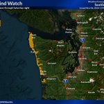
ALT Strong winds are forecast. Make sure to secure loose objects, stay clear of trees and downed power lines, and prepare for power outages.

ALT Strong winds are forecast. Make sure to secure loose objects, stay clear of trees and downed power lines, and prepare for power outages.

ALT Radar image depicting a strong cold front and associated rain aligned north to south over the Pacific coast and Olympic Peninsula as of 6:35 PM on November 7 2026.
ALT Strong winds are forecast. Make sure to secure loose objects, stay clear of trees and downed power lines, and prepare for power outages.


ALT Info graphic "Strong winds are forecast - secure loose outdoor objects - stay clear of trees and downed power lines - prepare for power outages"

ALT Image of fall leaves on ground. Rain returns! Rake leaves and clear gutters and storm drains to prevent street and yard flooding.

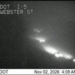
ALT Image of fog and cars on roadway.

ALT Image of foggy conditions and cars on roadway.


ALT Dense fog advisories issued from Everett down the I-5 corridor into the Willamette Valley.

ALT Este gráfico muestra la localización en el mapa de un Aviso Especial Marítimo. El aviso estará en efecto hasta las 8:30 AM PDT. El aviso incluye a Aguas Costeras Desde Point Grenville A Cabo Shoalwater 10 A 60 Mn. Las amenazas asociadas a este aviso son: ráfagas de vientos de mayor de 34 nudos yno se espera granizo. Las trombas marinas son posibles. Alto oleaje. Busque un puerto seguro y tome medidas de precaución.

ALT This graphic displays a special marine warning plotted on a map. The warning is in effect until 8:30 AM PDT. The warning includes coastal waters From Point Grenville To Cape Shoalwater 10 To 60 Nm. The threats associated with this warning are wind gusts less than 34kts and no hail expected.Waterspouts are possible. Steep waves can be expected. Seek safe harbor and take protective actions.

ALT Este gráfico muestra la localización en el mapa de un Aviso Especial Marítimo. El aviso estará en efecto hasta las 6:45 AM PDT. El aviso incluye a Aguas Costeras Desde Isla James A Point Grenville 10 A 60 Mn y Aguas Costeras Desde Point Grenville A Cabo Shoalwater 10 A 60 Mn. Las amenazas asociadas a este aviso son: ráfagas de vientos de mayor de 34 nudos yno se espera granizo. Las trombas marinas son posibles. Alto oleaje. Busque un puerto seguro y tome medidas de precaución.