

Official Twitter account for Windseeker Storm Chasing
Brandenburg, KY
Joined June 2023
- Tweets78
- Following127
- Followers92
- Likes21






Auroras are out and visible to the naked eye in short increments in Brandenburg, Kentucky!
@NWSLouisville @NWSSWPC

1
101


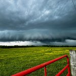
Check out the shelf cloud on this barely sub-severe storm over the Ohio River in Brandenburg, KY!
#kywx #inwx #lmkwx
@NWSLouisville


We captured this beautiful large tornado near Prairie Du Sac, Wisconsin a few minutes ago. #wiwx
@NWSMilwaukee

Even as a Kentucky resident I can say this… Screw chasing in Kentucky 😐
See you next setup tho ✌️
163
I am still in AWE over the storm structure on our storm earlier south of Caneyville, Kentucky! This is going in a frame!

1
4
182


Near whiteout conditions in Breckinridge County with multiple vehicle slide offs. That combined with roads still flooded is making for an intriguing morning.
Location: Hwy 333@US-60
@NWSLouisville

Rapidly flowing water up to 1 inch in some places has covered First Street in Irvington, KY. Drainage systems are maxed out and water is piling up in places I’ve never seen it pile up before 👀
@NWSLouisville
216
Here in Brandenburg, just the snow on top of the ice is so high that it’s past our fully grown Dachshunds legs into his chest. We’ve had a measured 2.5” additional accumulation with today’s system so far.
@NWSLouisville
6 inches of snow has accumulated so far on the square in Corydon, Indiana
@NWSLouisville #inwx

2
519
I-64 and SR-135 in Corydon, Indiana. Much of the bottom layer snow is turning to ice which is making travel much more dangerous.
@NWSLouisville #inwx

