

Arcfield Weather provides daily weather forecasts for the Mid-Atlantic and Southeast U.S. with detailed video discussions and in-depth climate info.
Washington, DC
Joined April 2012
- Tweets10.5K
- Following187
- Followers1.1K
- Likes715
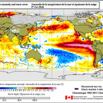




*Very strong El Niño continues in the tropical Pacific as it likely soon reaches its peak…an interesting development to its west and south with a growing area of colder-than-normal water…look for a return of La Niña later in 2027…but El Niño should last right through winter*

Morning video discussion:
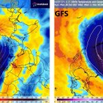
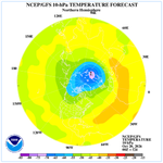
"Follow-up on the polar vortex disruption...an El Nino update and an interesting development in the Pacific"
arcfieldweather.com/videos
*Still stuck in a rut in the Mid-Atlantic region...chilly nights, comfortable afternoons, and rain-free conditions into the weekend*
*Signals for an early-to-mid November polar vortex disruption...quite a rare event for this early in the season*
arcfieldweather.com/blog/202…

Morning video discussion:
"Signals for a polar vortex disruption in early November...a rare occurrence"
arcfieldweather.com/videos

*Another week with high pressure in control across the Mid-Atlantic region resulting in day-after-day-after-day of rain-free weather...chilly nights and comfortable afternoons on the table right into the weekend*
*Frost/freeze possible late tonight in some suburbs along the DC-to-Philly-to-NYC corridor and again late Saturday night...rain-free conditions to continue well into next week*
*Pattern continues in the Mid-Atlantic region with chilly nights, cool days, and rain-free conditions...patchy frost will be possible in many areas late Friday night and again late Saturday night*
*Weather is likely to have minimal impact on the 2026 World Series between Milwaukee (retractable roof) and Tampa Bay (permanent roof), but it has played a critical role in many recent games*
arcfieldweather.com/blog/202…

Arcfield Weather retweeted

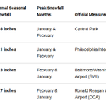
Will DC get buried in snow this winter — or barely see a flake?
We asked five winter weather experts for their predictions. Their answers range from just 3.3 inches to 25.5 inches!
All five weigh in on how a potentially historic El Niño could shape the winter ahead.
Here's what they predict — and why: 👇
capitalweather.com/boom-or-b…

*Super Typhoon "Champi" has become the strongest tropical system of the year with winds reaching 185 mph*

*Chilly nights, comfortably cool days, and rain-free conditions in the Mid-Atlantic region next several days with high pressure to the north in control...coastal impacts from ocean storm with possible flooding at times of high tide*
Morning video discussion:
"An unusual early season polar vortex disruption...El Nino update...latest on Arctic temps...western US snowfall"
youtube.com/watch?v=-GsIEion…

*High pressure stays in control across the Mid-Atlantic region...dry with chilly nights, comfortably cool days...coastal impacts from ocean storm...watch for flooding at times of high tide*
*An interesting graphic with NOAA's winter temperature outlook versus actual results...often times, there is an underestimate of the cold somewhere across the CONUS...this winter has lots of moving parts with El Nino a key player...our winter outlook...*
arcfieldweather.com/blog/202…

*After a chilly start to the day, copious amounts of sunshine will boost temperatures to the 60's in the Mid-Atlantic region for the afternoon hours...monitoring an ocean storm for some coastal impacts next few days*
*Big-time cold frontal passage tonight for the Mid-Atlantic region and an unseasonably chilly weekend... possible frost/freeze late Saturday night/early Sunday - even into the suburbs along the I-95 corridor...front can be preceded with a strong-to-severe thunderstorm late today*
Morning video discussion:
"Keep a close eye on the western Atlantic next ten days or so*
arcfieldweather.com/videos
