

California Highway Patrol traffic/incident information from the CHP CAD system. This information is for San Diego County. This account is not monitored.
San Diego, CA.
Joined April 2009
- Tweets2.3K
- Following23
- Followers2.5K
- Likes0
CHP Information Page retweeted

#ValleyFire [update] Please see below for an update with regards to all evacuation orders, evacuation warnings and road closures being lifted.

CHP Information Page retweeted
#ValleyFire [update] The fire remains 17,665 acres and is now 32% contained.

CHP Information Page retweeted

Due to unprecedented & historic fire conditions in CA, we are temporarily closing an additional 10 National Forests, meaning all 18 National Forests in California are now closed. The closure of the additional ten forests will be effective at 5 pm today. fs.usda.gov/detail/r5/news-e…
CHP Information Page retweeted

#ValleyFire Road Closures
Lawson Valley Rd/Skyline Truck Trl
Wisecarver Ln/Wisecarver Truck Trl
Japatul Rd/Japatul Valley Rd/Lyons Valley
Lyons Valley/Skyline Truck Trl/Honey Springs
Japatul Rd/Via Asoleado also @ Sequan Truck Trl
No access to Corrall Canyon from Buckman Springs


CHP Information Page retweeted
#ValleyFire [update] The fire remains 17,345 acres and 3% contained. @ClevelandNF @SDSheriff @ReadySanDiego

CHP Information Page retweeted
#ValleyFire [update] The fire is now 17,345 acres and is 3% contained.

CHP Information Page retweeted
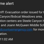
#ValleyFire [update] Please see attached map provided by sdcountyemergency.com for new evacuation orders in effect for the areas of Corral Canyon off-road area, Bob Cat Meadows, and Los Pinos. TEPs Temporary Evacuation Points remain open at Steele Canyon HS and Joan MacQueen MS


S10; MOVING THE CLOSURE AT DEHESA / JAPATUL OVER TO JAPATUL RD AT VIA ASOLEADO
10:36 AM VALLEY FIRE- PER 108-L2; ALL UNITS ON CLOSURES - THESE ARE SOFT CLOSURES - ACCESS GRANTED ONLY TO LE, FD and UTIL VEHS --- **NO RESIDENTS IN VEHS OR ON FOOT **/// BC ELE [Shared]


7:46PM[Incident] VALLEY FIRE 108-095 START A TOW FOR IMPOUND, PARTY RAN ROAD CLOSURE [Shared]
THIS WAS AN INCIDENT FROM LAST NIGHT. IF YOU SEE A ROADBLOCK, DO NOT TRY TO GO AROUND IT. IT'S THERE FOR YOUR SAFETY AND THE SAFETY OF OUR FIRST RESPONDERS.

CHP Information Page retweeted
#ValleyFire Road Closures @CHP_San_Diego @SDSheriff
Japatul Rd/Sequan Truck Trl
Japatul Rd/Carveacre Rd
Japatul Rd/Hidden Glen
Wisecarver Ln/Wisecarver Truck Trl
Skyline Truck Trl/Lawson Valley
Montiel Truck Trl/ W Boundary Truck Trl
Montiel Truck Trl/Lawson Valley Rd

CHP Information Page retweeted
#ValleyFire Update
Please be informed the temporary evacuation point at Joan MacQueen Middle School has been closed.
If you're under an evacuation order, you can still go to Steele Canyon High School 12440 Campo Road, Spring Valley. Pets are welcome. @SoCal_RedCross is assisting

9:12 AMVALLEY FIRE[6] HARD CLOSURES IN PLACE JAPATUL / CARVEACRE JAPATUL / SEQUAN TRUCK TRAIL JAPATUL / HIDDEN GLEN CLOSED TO ALL RESIDENTS - ANYBODY NEEDING FURTHER WILL NEED TO CHECK WITH SHERIFF / OR FIRE DEPT
CHP Information Page retweeted
#ValleyFire [update] The fire is now 4,000 acres and is 0% contained, 10 structures has been destroyed. @CALFIRESANDIEGO remains in Unified Command with @ClevelandNF

CHP Information Page retweeted

Our Emergency Response Team is preparing for day 2 of assisting with animal evacuations in the #ValleyFire.
If you need help evacuating: call @sdhumane at 619-299-7012 (press 1). Remember to evacuate early, take your pets with you, bring food & water. #SDHSEmergencyResponseTeam
