

CalTopo provides next generation topographic maps with a number of helpful and unique layers. Used by search and rescue and emergency management orgs.
USA
Joined July 2019
- Tweets156
- Following33
- Followers988
- Likes64


CalTopo retweeted

Today's 8/3/22 Morning #McKinneyFire and #YetiComplex virtual tour situation and analysis includes:
How to read a wildfire operations map.
Firing tactics.
Incident Command concepts.
Web resources for wildfire intelligence.
youtu.be/J-Ve8JOz9zU

CalTopo retweeted

This week is 3rd Thursday: "Best Practices for Data Management & Search Mapping in SAR Topo"
Download the @CalTopoMaps app in advance!
1/21/2021, 6:00 pm PST
us02web.zoom.us/j/8315211203…
Meeting ID: 831 5211 2031
@Garmin


CalTopo retweeted

Nice example of leveraging open #lidar data for winter backcountry travel: @CalTopoMaps refreshes the slope angle layer w/ @USGSTNM 3DEP lidar data caltopo.com/about/2019/12/20… Slope angle layer is a really helpful tool for terrain recon, route planning, & avalanche hazard evaluation
CalTopo retweeted

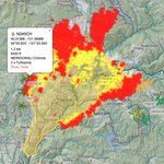
Here’s an interactive map that shows the fires and evacuation areas. We’ve evacuated 180,000 people from #SonomaCounty. That’s nearly 40% of the population! Only 31 homes lost so far thanks to @CALFIRE_PIO.
#SonomaFire
caltopo.com/map.html?fbclid=… – at Petaluma, CA
CalTopo retweeted

CalTopo is one of the tools that we use to route plan in the winter. Here's an article that highlights some of the features of the program. Check it out!
buff.ly/2MFYhhJ

CalTopo retweeted

I love that Caltopo really pays attention to their customers! This is a great move by Caltopo in an ever-growing and crowding space of maps. Check out my thoughts on their Beta App here: seekadventure.net/d/105-calt…
#optoutside #maps #mapping #navigation #android #iPhone #caltopo

This week we're optimizing subscriptions! We've shifted away from quota's among other improvements! Based on your feedback we wanted to make our subscription model easier to use and to understand. Lots more here: bit.ly/2NAq5WM