

AMS Board Certified Consulting Forensic Maritime Meteorologist —-Hurricane Preparedness Specialist —-Emmy winning former TV Meteorologist —-CCM #794
Miami, FL
Joined May 2011
- Tweets20K
- Following1.1K
- Followers20.2K
- Likes75.8K
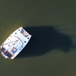





At the Annapolis Sailboat show this week. Thankful my cat is smaller than this BalanceCat getting through the draw bridge. “Everyone suck in!”


We are at the part of a hurricane event I call "baked in the cake". Very little will change between now and landfall, and only little wobbles will determine who gets the worst of the winds and surge. It's not going to suddenly weaken or turn, what we see will likely be what we get.
The prep stage is wrapping up, and the hunker down time for those in the path of Isaias is nearing. Later today and tonight your goal is to get through the storm's fury so that you can get to the often endless-feeling recovery stage. The two parts of your preps should reflect that as well. Make your home ready to get through the storm as best as possible, then the hurricane kit should have what you need to get into the beginning of the recovery.
Some tips, freeze bottles of water to extend refrigeration if power goes out. Preposition flashlights so you can find them in the dark. Make sure electric stoves/ranges are off during the storm. Use a carbon monoxide detector when running a generator. Don't rush to clean up after the storm, many injuries/fatalities come after the storm has passed.
Because hurricane impacts can be infrequent events for specific areas (thankfully), we can look to previous storms to help form an idea of expectations with a current one. Opal comes to mind and likely shows the upper end of what is possible from Isaias. It was over 30 years ago but some still remember how it devastated the panhandle beaches and dunes, not to mention resulted in loss of life in the dozens.
Opal was weakening when it came ashore but had enough inertia so to speak, it was still a very destructive hurricane.


Isaias has taken advantage of the very warm waters of the loop current and strengthened overnight. And as many mentioned when Isaias first started coming together, this seems very similar to the evolution of 1995 Opal (that track here). That hurricane took advantage of similar atmospheric and oceanic conditions and strengthened until right before landfall, then weakened as it reached the coast, but not enough to avoid causing extensive damage. weather.gov/mob/opal


Thursday's 5PM NHC advisory sets the intensity of Isaias at 100mph (cat 2). Is this intensification or has the hurricane had these winds and they just weren't sampled earlier as there was no Doppler radar aircraft in the storm? I say this because pressure and flight level winds have remained steady during the day.
Regardless, it doesn't change the outcome. The hurricane continues nearly on track while the intensity forecast remains a challenge. Dry air shear is increasing while water temps also increase for a bit, and NHC is thinking the water will win before the shear takes its toll.
Bottom line, no changes to the overall thinking, outdoor preps in the hurricane warning should be completed by early tomorrow, and if you live well inland along the storm's path, I would prepare for power outages due to excessively high wind gusts. The dry air working into the system will account for that.
Craig Setzer, CCM retweeted

#Hurricane #Isaias is now a Category 2 hurricane with max winds of 100 mph. The last Atlantic hurricane season with no Category 2+ hurricanes was 2013.
Isaias has managed to get a lot of convection wrapped upshear (storms forming into and against the wind shear on its west side) which is often a precursor to an intensifying trend. Also, a dimple of an eye is appearing in visible imagery also signaling potential strengthening. That being said, there has been little change in the pressure (978mb) over the past six hours.
There is less than 18 hours left for any meaningful strengthening before wind shear overwhelms the hurricane, likely before making landfall. Regardless of weakening before landfall or after it, a portion of the Florida Panhandle, Alabama, & potentially Mississippi coasts-inland will see hurricane conditions Friday night. Much of this nuanced meteorological discussion doesn't matter much to the folks in its direct path. They are busy getting ready hopefully.

Isaias showing the classic signs of dry air impacts as bands of outflow driven low level clouds race away from the center on the western side. Dry air will likely continue eroding the west half keeping the hurricane lopsided through landfall.
Recon is also finding this with strongest winds on eastern half of storm. The hurricane center is also tilted with the surface winds swirling around a point many miles west of the upper level center. You can see this in the latest drop sonde from the recon plane. They thought they were near the center flying around 9000 feet but the center was much farther west near the ocean surface.
We are near the very fine line between shear and dry air being detrimental verses warm water and an established tropical cyclone trying to intensify. The small size also makes the core sometimes more resilient to fighting against shear. This fine line is also where intensity forecasts can be most challenging.


Thursday morning thoughts on Isaias. The satellite presentation is less than spectacular (thankfully) following diurnal expansion, and while the upper cloud shield has expanded, the core continues to struggle against dry air and shear.
This is a good sign in that the environment does not support a monster, rapidly intensifying storm right up to landfall tomorrow. But this does not take slow strengthening and the hurricane impacts threat off the table for a portion of the Gulf coast in the hurricane warning areas. Preps there should still be taken for all hurricane related hazards in these areas. Why? Because we never want to be surprised when a hurricane is approaching, expecting it to weaken or miss, we always plan like it will hit us, and hope it's just a minor blow.
The diurnal clock is the natural timed increase in a tropical cyclone. And while it happened with Isaias overnight, it only expanded the upper cloud shield but now we see individual convective towers rotating around an not complete circle. So the cyclone is strengthening but thankfully struggling, and this is likely limiting rapid intensification.

The Wednesday evening water vapor paints a pretty hostile picture for Isaias with plenty of shear (all of the cloud/water vapor elements moving left to right toward it) and dry air sweeping east toward and north of the storm. The center appears to still be tucked in a moist environment but if we're going to have a hurricane in the Gulf, you like seeing less than ideal conditions for strengthening.
We are confident Isaias will not directly impact the Florida Peninsula because a blocking high will build in the rest of this week. But the details on exactly where the center and its impacts reach the northern Gulf are less clear as a weak disturbance (not shown) is also trying to nudge Isaias east, then north.
While the exact location the storm reaches the coast are not known yet, preps from Louisiana through Florida Panhandle need to be made because, by the time we know precisely where the storm will have greatest impacts, there won't be enough time to make substantial preps.
It's the age old dilemma about over-prep because the costs of under-prep and getting hit directly are significant. Hopefully in the coming years, AI (machine learning) will improve our landfall forecasts and reduce uncertainty and unnecessary preps. There's already glimpses of that future in the forecasts.
With the first NHC advisory (5PM Tue) on what is expected to become Hurricane Isaias, we now have a timeline for when along the northern Gulf, our preps should be completed.
We have two days to take care of what is needed before the weather deteriorates on Friday. Securing boats/homes, topping off hurricane kits can be done Wednesday & Thursday, Friday would be last minute indoor preps. Coastal storm surge prone folks should already be thinking about where they would evacuate to, if needed.

After a very quiet season, it's sometimes more difficult to ramp up tropical storm/hurricane preps, but unfortunately that is required for the northern Gulf Coast.
We typically prepare along a timeline, we never want to play catch up, but the clock has already started and we are a ways into our potential tropical impacts countdown.
Google Deep Mind experimental ensemble shown here.cept the fact you may be dealing with tropical storm/hurricane conditions by week's end (Fri/Sat) and begin moving into the action phase of your storm preps. Topping off supplies and personal preps should be taken care of today. Home & boat preps would take place Wednesday.
Should things change with the forecast we can always pause preps, but it's very difficult to rush preps once you're behind the curve.
Google Deep Mind exp ensemble shown here.
