

Experimental cyclone forecast. Un-official sub-tropical/ tropical development forecast in Mediterranean Sea using standard classification.
Joined June 2023
- Tweets60
- Following32
- Followers30
- Likes15
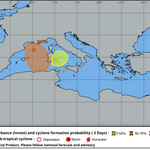
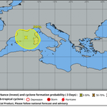

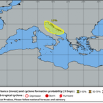


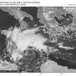
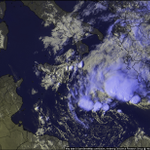
Yesterday MCV is still alive with first sign of low-level propagation and ground circulation. A medium (60%) probability is been issued for the next 3 days. During nightime new convective burst is started on the east side of the suppose center of circulation.

50% probability is in the mid-way between the global model guidance and LAM's. If the mid-level circulation will increase convective activity tomorrow in the morning first advisory would be possible.
A tropical development is rulled out, but a shallow sub-tropical depression is potentially forecast in 12-24h. @MedicaneTrack @TropensturmDE @ScienceSrg @cyclonicwx @eumetsat_users @metofficestorms @NHC_Atlantic @JointCyclone @severeweatherEU @hurricane_chase #medicane #cyclone
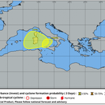
A low-medium probability (50%) is been issued for the area discussed this morning. A well defined mid level circulation is emerged from the parent MCS with an evident swirl of low-level cloud and some new convective burst.

Global models guidance continue to remain uncertain and are not able to resolve the circulation. LAM's and High res start to forecast moderate convective activity with well defined low-level vortex.
A shallow cold air advection is forecast to enhanced thermal/orographic E-NE flow from Liguria and France increasing baroclinicity on the north side of the MCV and eventually forcing new convection during the night.
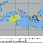
Recent scatterometer passages are not able to resolve the circulation at the ground but 12z high-res model are in good agreement to show a modest mid-level (850-700hPa) vorticity center. The MCV is forecast to stall between Sardinia and France coastline in the next 12-24h.
2 very low probabilities are been issued for central mediterranean. A very low to near 0% probability is been issued for a small low level convective ciculation NW of Sicily. This is forecast to dissipate rapidly in an poor conducive environment with numerous outflow boundaries.
