

Weather Blogger, Storm Chaser❄️⛈️ | Stay Tuned for Weather Around the world, and the Pacific Northwest⛈️💨Follower of Christ✝️
Joined November 2021
- Tweets13.5K
- Following1K
- Followers3.4K
- Likes41.7K





As someone who makes forecasts for Washington State AND BC, this is going to take time to get used to. Also BC, get ready for 9am Sunrises this winter!


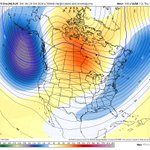
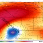
The pacific jet stream is about to go ham next week, and what does the gfs model make out of that? A major atmospheric river followed by a major mid latitude cyclone, reaching a ridiculous 948mb. *THIS IS BY KNOW MEANS A FORECAST AND THERE IS NO LOCKED IN STORM SYSTEM TO TRACK YET* so come back for more insight later. But during November larger storms are much more likely especially when the jet stream is looking this strong. This is a fantasy fun run, and not meant to be taken seriously yet. But it does look more active in the extended. #BCStorm #WAWX #PNW


A pacific Jet extension in the early November is likely to occur. This will create a large Gulf of Alaska Trough which can bring increased risk of #AtmosphericRivers and frontal systems in the #PNW and maybe even into California, in the 2nd week of November and on. It may also increase the windstorm chances *depending on many factors. Come back later for details. #BCStorm #WAWX #ORWX #CAEX


WestCoastWX22 retweeted
Now that's a Fall capture! Haven't seen Asperitas Clouds this dramatic around here in a little while. Winds reacting with the topography of the Mountains and the height of the Clouds. Like waves in the sky! Coquitlam, BC. #shareyourweather @spann @foxweather @MurphTWN


Dramatic Asperitas Clouds in the Northern sky above Coquitlam, BC this afternoon. Looks like the back of a large Bird flapping it's wings. #bcstorm #shareyourweather


WestCoastWX22 retweeted

We're still 4-6wks away from ENSO peak, first distant signs of the Super El Niño's demise is here! Cooling, deep in the Indo-Pacific, has begun migrating eastward while the cooling has intensified, it'll still take several months to chew away the 2026-27 Super El Niño event.
On Tuesday, a Polar Trough will make its way to the Region. ❄️Mountain snowfall and widespread rainfall is likely out of this system. Snow levels could temporarily hit 500 meters in some cases later this coming week. But accumulations on our ski hills are likely. 10-20cm could be a good ballpark around 1000 metres, and 6-8 inches in the cascades, more above 7000 feet. Wish this was December, we would be talking about sea level chances. #BCStorm #WAWX #BCSNOW


WestCoastWX22 retweeted

With NWS discontinuing the availability of observation maps outside the US, a reminder that the @westernuNMP is available at weather.cssl.ca — I just hope they can fix the outlined font as it’s hard to read!
@ConnellMiller


Not an amazing sunset tonight as there are so many clouds buts definitely not bad! Leaving Gibsons now where I have worked for a while. Might go back there in the spring we’ll see, but it was fun to spend a while over there, do some hikes, meet new people and explore my faith in Jesus there. Onto Langley again! #BCStorm #Gibsons


WestCoastWX22 retweeted

A critical reminder to be careful who you get weather information from. There's some discussion of a Saturday windstorm floating around. That is currently NOT the case. My rationale in the replies.👇#wawx


