

Editor of Geo Week News, a monthly newsletter covering all things geospatial, remote sensing, and lidar mapping. Come see us in DC March 23-25!
Portland, Maine
Joined February 2020
- Tweets47
- Following57
- Followers50
- Likes8

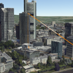

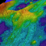



One of my favorite little things that make me smile in geospatial are all the people that post heart-shaped geographic features for valentines' day. Happy valentine's day, all! #geoweek
Geo Week Editor retweeted

“To me, true solid state lidar is like Bigfoot – something that everyone is talking about, but no one has ever seen. And now – it’s for sale – you can buy it now, not somewhere in the future.” -Filip Guens, @XenomatiX
spar3d.com/sponsored/sponsor…

Geo Week Editor retweeted
Honored and excited to be moderating a panel for #GEOBIM2020 this morning! Join us for a discussion on Unlocking Opportunities with Reality Capture at 11:30 CET geo-bim.org

Geo Week Editor retweeted
"Unless it flies or floats, every infrastructure product in the world exists in the context of existing ground conditions." -@bob_mankowski at #YII2020
“It’s not just a matter of having LIDAR data and having images that go with it but you can actually create more accurate models of the terrain below when you have both technologies operating together.”
spar3d.com/news/lidar/leica-…

Geo Week Editor retweeted
The iPhone #lidar sensor is here – the only question left to be answered… is what we will do with them.
spar3d.com/news/hardware/no-…

Attention surveyors - join our 30 minute workshop presented by @SBG_Systems today at 11:00am -
Dive in to Qinerta PPK Software and its brand new tools designed to ease surveyors' lives
Register here>> geo-week.com/webinars/dive-i…
From the #CaseStudy of the Month from @TrimbleNews
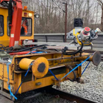
How could a survey firm perform a survey 1) without significantly impacting rail traffic 2) while keeping the survey crew out of harm’s way, and 3) deliver 1cm precision on all observed points?
geo-week.com/breaking-the-ce…

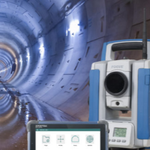
"For example, it may take a surveyor several minutes to manually measure a tunnel profile; however, with an automated solution, several profiles can be collected at the same time, which saves several seconds for each profile."
geo-week.com/spectra-geospat…

Congratulations to all the winners of the 2020 Lidar Leader Awards! Read more here: geo-week.com/winners-announc…


Geo Week Editor retweeted

Don't miss our upcoming virtual panel: COVID-19 and The Lidar Industry followed by the presentation of the 2020 Lidar Leader Awards. Register here geo-week.com/webinars/covid-…

Interesting that @facebook has acquired the road mapping / crowdsourced road imagery company @mapillary - do they have more #geospatial #mapping ambitions planned? spar3d.com/news/related-new-…
Use cases for the GeoCue 410 sensor include assessing #earthquake damage. spar3d.com/news/lidar/new-us…
“Geospatial information can be used to provide information that power machine learning applications”
geo-week.com/how-geospatial-…
How Geospatial Platforms are Providing Context to Enable a New Digital Economy geo-week.com/how-geospatial-…

04.13.2020
Geo Week Round-up:
*Accuracy w/o Base Stations *MapDash for COVID
*New EU Geospatial Directive
*Air Pollution Reduction
geo-week.com/geo-week-round-…
