

Alberta's independent and community-driven weather organization. Providing context to severe weather since 2013. Download our app: https://teapaw.org/t.co/8ppLT5AR75
Alberta, Canada
Joined July 2013
- Tweets19.4K
- Following173
- Followers4.9K
- Likes274


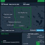


#abstorm 4:29a SNOWFALL WARNING (YELLOW LEVEL) ENDED by Environment Canada
(Locations listed below description)
Significant snowfall is no longer expected.
ENDED:
- Crowsnest Pass including Coleman and Frank
- M.D. of Pincher Creek near Beauvais Lake Prov. Park
- M.D. of Pincher Creek near Cowley Burmis and Maycroft
- M.D. of Pincher Creek near Pincher Creek and Twin Butte
- M.D. of Ranchland
- Municipality of Crowsnest Pass including Coleman and Frank
- Piikani Reserve
- Waterton Lakes Nat. Park and Blood Res. 148A

#abstorm 12:04a SPECIAL WEATHER STATEMENT ENDED by Environment Canada
ENDED:
- Beaver Co. near Holden and Ryley
- Beaver Co. near Tofield
- Brazeau Co. near Drayton Valley and Breton
- Camrose Co. near Bawlf and Rosalind
- Camrose Co. near Camrose and Bittern Lake
- Camrose Co. near Hay Lakes and Miquelon Lake Prov. Park
- Camrose Co. near New Norway Edberg and Ferintosh
- City of Edmonton
- Co. of Minburn near Vegreville Inland and Warwick
- Co. of Two Hills near Willingdon and Hairy Hill
- Co. of Wetaskiwin near Alder Flats and Winfield
- Co. of Wetaskiwin near Pigeon Lake
- Co. of Wetaskiwin near Wetaskiwin Millet and Hwy 2
- Edmonton
- Elk Island Nat. Park
- Flagstaff Co. near Daysland Heisler and Strome
- Fort Saskatchewan and Nrn Strathcona Co.
- Lac Ste. Anne Co. near Cherhill and Glenevis
- Lac Ste. Anne Co. near Mayerthorpe and Sangudo
- Lac Ste. Anne Co. near Onoway and Lac Ste. Anne
- Lamont Co. near Andrew and Wostok
- Lamont Co. near Bruderheim Lamont and Peno Creek
- Lamont Co. near Mundare Chipman and Ukrainian Village
- Leduc Co. near Calmar and Devon
- Leduc Co. near Leduc Beaumont and Kavanagh
- Leduc Co. near New Sarepta and Rolly View
- Leduc Co. near Warburg Thorsby and Pigeon Lake
- Parkland Co. near Entwistle Fallis and Tomahawk
- Parkland Co. near Spruce Grove and Stony Plain
- Parkland Co. near Wabamun Carvel and Keephills
- Ponoka Co. near Crestomere
- Ponoka Co. near Rimbey Bluffton and Hoadley
- Sherwood Park
- Smoky Lake Co. near Smoky Lake and Waskatenau
- St. Albert
- Strathcona Co. near Ardrossan and Cooking Lake
- Sturgeon Co. near Bon Accord Gibbons and Namao
- Sturgeon Co. near Legal and Mearns
- Sturgeon Co. near Morinville Volmer and Big Lake
- Sturgeon Co. near Redwater
- Sturgeon Co. near Rivière Qui Barre and Villeneuve
- Thorhild Co. near Thorhild Opal and Radway
- Yellowhead Co. near MacKay Wildwood and Evansburg

#abstorm 3:14p SNOWFALL WARNING (YELLOW LEVEL) UPDATED by Environment Canada
(Locations listed below description)
Heavy snow, with total amounts of 10 to 20 cm, is expected over southwestern Alberta.
Snow will continue tonight into Thursday.
Upwards of 20 cm is expected, particularly near Crowsnest Pass and Waterton Lakes National Park. Communities at lower elevations, such as Pincher Creek, will see total amounts closer to 10 cm.
Snow will taper off Thursday morning.
Roads and walkways will likely be difficult to navigate due to accumulating snow. Visibility will likely be reduced at times.
Allow extra time for travel.
Please continue to monitor alerts and forecasts issued by Environment Canada. To report severe weather, send an email to [email protected], call 1-800-239-0484 or post reports on social media using #ABStorm.
UPDATED:
- Crowsnest Pass including Coleman and Frank
- M.D. of Pincher Creek near Beauvais Lake Prov. Park
- M.D. of Pincher Creek near Cowley Burmis and Maycroft
- M.D. of Pincher Creek near Pincher Creek and Twin Butte
- M.D. of Ranchland
- Municipality of Crowsnest Pass including Coleman and Frank
- Piikani Reserve
- Waterton Lakes Nat. Park and Blood Res. 148A

#abstorm 3:09p SPECIAL WEATHER STATEMENT UPDATED by Environment Canada
(Locations listed below description)
The first significant snowfall of the season continues.
A long duration snowfall event will continue through parts of central Alberta until Thursday morning.
Total snowfall amounts will vary significantly. Some localities may see upwards of 15 cm on colder surfaces.
Allow extra time for travel.
Prepare for quickly changing and deteriorating road conditions.
There may be a significant impact on rush hour traffic.
Please continue to monitor alerts and forecasts issued by Environment Canada. To report severe weather, send an email to [email protected], call 1-800-239-0484 or post reports on social media using #ABStorm.
UPDATED:
- Beaver Co. near Holden and Ryley
- Beaver Co. near Tofield
- Brazeau Co. near Drayton Valley and Breton
- Camrose Co. near Bawlf and Rosalind
- Camrose Co. near Camrose and Bittern Lake
- Camrose Co. near Hay Lakes and Miquelon Lake Prov. Park
- Camrose Co. near New Norway Edberg and Ferintosh
- City of Edmonton
- Co. of Minburn near Vegreville Inland and Warwick
- Co. of Two Hills near Willingdon and Hairy Hill
- Co. of Wetaskiwin near Alder Flats and Winfield
- Co. of Wetaskiwin near Pigeon Lake
- Co. of Wetaskiwin near Wetaskiwin Millet and Hwy 2
- Edmonton
- Elk Island Nat. Park
- Flagstaff Co. near Daysland Heisler and Strome
- Fort Saskatchewan and Nrn Strathcona Co.
- Lac Ste. Anne Co. near Cherhill and Glenevis
- Lac Ste. Anne Co. near Mayerthorpe and Sangudo
- Lac Ste. Anne Co. near Onoway and Lac Ste. Anne
- Lamont Co. near Andrew and Wostok
- Lamont Co. near Bruderheim Lamont and Peno Creek
- Lamont Co. near Mundare Chipman and Ukrainian Village
- Leduc Co. near Calmar and Devon
- Leduc Co. near Leduc Beaumont and Kavanagh
- Leduc Co. near New Sarepta and Rolly View
- Leduc Co. near Warburg Thorsby and Pigeon Lake
- Parkland Co. near Entwistle Fallis and Tomahawk
- Parkland Co. near Spruce Grove and Stony Plain
- Parkland Co. near Wabamun Carvel and Keephills
- Ponoka Co. near Crestomere
- Ponoka Co. near Rimbey Bluffton and Hoadley
- Sherwood Park
- Smoky Lake Co. near Smoky Lake and Waskatenau
- St. Albert
- Strathcona Co. near Ardrossan and Cooking Lake
- Sturgeon Co. near Bon Accord Gibbons and Namao
- Sturgeon Co. near Legal and Mearns
- Sturgeon Co. near Morinville Volmer and Big Lake
- Sturgeon Co. near Redwater
- Sturgeon Co. near Rivière Qui Barre and Villeneuve
- Thorhild Co. near Thorhild Opal and Radway
- Yellowhead Co. near MacKay Wildwood and Evansburg

#abstorm 3:07p SNOWFALL WARNING (YELLOW LEVEL) ENDED by Environment Canada
(Locations listed below description)
Significant snowfall is no longer expected.
ENDED:
- Lac La Biche Co. near Crow Lake Prov. Park
- Lac La Biche Co. near Wiau Winefred and Grist Lakes
- R.M. of Wood Buffalo near Fort MacKay and Wallace Creek
- R.M. of Wood Buffalo near Fort McMurray and Anzac
- R.M. of Wood Buffalo near Gipsy Lake and Whitemud Falls
- R.M. of Wood Buffalo near Grand Rapids Wildland Prov. Park
- R.M. of Wood Buffalo near Janvier South and Conklin
- R.M. of Wood Buffalo near Mariana Lake
- R.M. of Wood Buffalo near Stony Mtn Prov. Park and Engstrom Lake

#abstorm 10:26a SNOWFALL WARNING (YELLOW LEVEL) UPDATED by Environment Canada
Snowfall with total amounts of 15 to 20 cm continues.
Roughly 10 cm of snow fell overnight, and another 5 to 10 cm is expected today.
Snow will ease tonight and then end on Thursday morning.
Roads and walkways will likely be difficult to navigate due to accumulating snow. Visibility will likely be reduced at times.
Allow extra time for travel.
Please continue to monitor alerts and forecasts issued by Environment Canada. To report severe weather, send an email to , call 1-800-239-0484 or post reports on social media using #ABStorm.
R.M. of Wood Buffalo near Fort McMurray and Anzac
R.M. of Wood Buffalo near Fort MacKay and Wallace Creek
Lac La Biche Co. near Wiau Winefred and Grist Lakes
R.M. of Wood Buffalo near Mariana Lake
Lac La Biche Co. near Crow Lake Prov. Park
R.M. of Wood Buffalo near Stony Mtn Prov. Park and Engstrom Lake
R.M. of Wood Buffalo near Janvier South and Conklin
R.M. of Wood Buffalo near Grand Rapids Wildland Prov. Park
R.M. of Wood Buffalo near Gipsy Lake and Whitemud Falls

#abstorm 10:25a SNOWFALL WARNING (YELLOW LEVEL) UPDATED by Environment Canada
(Locations listed below description)
Snowfall with total amounts of 10 to 20 cm is expected in southwestern Alberta.
Snow began early this morning and continue through the day.
Up to 20 cm is expected, particularly near Crowsnest Pass and Waterton Lakes National Park. Communities at lower elevations, such as Pincher Creek, will see total amounts closer to 10 cm.
Snow will taper off Thursday morning.
Roads and walkways will likely be difficult to navigate due to accumulating snow. Visibility will likely be reduced at times.
Allow extra time for travel.
Please continue to monitor alerts and forecasts issued by Environment Canada. To report severe weather, send an email to [email protected], call 1-800-239-0484 or post reports on social media using #ABStorm.
UPDATED:
- Crowsnest Pass including Coleman and Frank
- M.D. of Pincher Creek near Beauvais Lake Prov. Park
- M.D. of Pincher Creek near Cowley Burmis and Maycroft
- M.D. of Pincher Creek near Pincher Creek and Twin Butte
- M.D. of Ranchland
- Municipality of Crowsnest Pass including Coleman and Frank
- Piikani Reserve
- Waterton Lakes Nat. Park and Blood Res. 148A

#abstorm 10:24a SPECIAL WEATHER STATEMENT UPDATED by Environment Canada
(Locations listed below description)
The first significant snowfall of the season continues.
A long duration snowfall event is underway and will continue through parts of central Alberta until Thursday morning. Total snowfall amounts may reach up to 15 cm on colder surfaces in a few localities.
Allow extra time for travel.
Prepare for quickly changing and deteriorating road conditions.
There may be a significant impact on rush hour traffic.
Please continue to monitor alerts and forecasts issued by Environment Canada. To report severe weather, send an email to [email protected], call 1-800-239-0484 or post reports on social media using #ABStorm.
UPDATED:
- Beaver Co. near Holden and Ryley
- Beaver Co. near Tofield
- Brazeau Co. near Drayton Valley and Breton
- Camrose Co. near Bawlf and Rosalind
- Camrose Co. near Camrose and Bittern Lake
- Camrose Co. near Hay Lakes and Miquelon Lake Prov. Park
- Camrose Co. near New Norway Edberg and Ferintosh
- City of Edmonton
- Co. of Minburn near Vegreville Inland and Warwick
- Co. of Two Hills near Willingdon and Hairy Hill
- Co. of Wetaskiwin near Alder Flats and Winfield
- Co. of Wetaskiwin near Pigeon Lake
- Co. of Wetaskiwin near Wetaskiwin Millet and Hwy 2
- Edmonton
- Elk Island Nat. Park
- Flagstaff Co. near Daysland Heisler and Strome
- Fort Saskatchewan and Nrn Strathcona Co.
- Lac Ste. Anne Co. near Cherhill and Glenevis
- Lac Ste. Anne Co. near Mayerthorpe and Sangudo
- Lac Ste. Anne Co. near Onoway and Lac Ste. Anne
- Lamont Co. near Andrew and Wostok
- Lamont Co. near Bruderheim Lamont and Peno Creek
- Lamont Co. near Mundare Chipman and Ukrainian Village
- Leduc Co. near Calmar and Devon
- Leduc Co. near Leduc Beaumont and Kavanagh
- Leduc Co. near New Sarepta and Rolly View
- Leduc Co. near Warburg Thorsby and Pigeon Lake
- Parkland Co. near Entwistle Fallis and Tomahawk
- Parkland Co. near Spruce Grove and Stony Plain
- Parkland Co. near Wabamun Carvel and Keephills
- Ponoka Co. near Crestomere
- Ponoka Co. near Rimbey Bluffton and Hoadley
- Sherwood Park
- Smoky Lake Co. near Smoky Lake and Waskatenau
- St. Albert
- Strathcona Co. near Ardrossan and Cooking Lake
- Sturgeon Co. near Bon Accord Gibbons and Namao
- Sturgeon Co. near Legal and Mearns
- Sturgeon Co. near Morinville Volmer and Big Lake
- Sturgeon Co. near Redwater
- Sturgeon Co. near Rivière Qui Barre and Villeneuve
- Thorhild Co. near Thorhild Opal and Radway
- Yellowhead Co. near MacKay Wildwood and Evansburg

#abstorm 4:35a SNOWFALL WARNING (YELLOW LEVEL) UPDATED by Environment Canada
(Locations listed below description)
Snowfall with total amounts of 15 to 20 cm will continue.
Roughly 10 cm of snow fell overnight, and another 5 to 10 cm is expected today.
Snow will ease tonight and then end on Thursday morning.
Roads and walkways will likely be difficult to navigate due to accumulating snow. Visibility will likely be reduced at times.
Allow extra time for travel.
Please continue to monitor alerts and forecasts issued by Environment Canada. To report severe weather, send an email to [email protected], call 1-800-239-0484 or post reports on social media using #ABStorm.
UPDATED:
- Lac La Biche Co. near Crow Lake Prov. Park
- Lac La Biche Co. near Wiau Winefred and Grist Lakes
- R.M. of Wood Buffalo near Fort MacKay and Wallace Creek
- R.M. of Wood Buffalo near Fort McMurray and Anzac
- R.M. of Wood Buffalo near Gipsy Lake and Whitemud Falls
- R.M. of Wood Buffalo near Grand Rapids Wildland Prov. Park
- R.M. of Wood Buffalo near Janvier South and Conklin
- R.M. of Wood Buffalo near Mariana Lake
- R.M. of Wood Buffalo near Stony Mtn Prov. Park and Engstrom Lake

#abstorm 4:30a SNOWFALL WARNING (YELLOW LEVEL) ISSUED by Environment Canada
Snowfall with total amounts of 10 to 20 cm is expected in southwestern Alberta.
Snow will begin early this morning and continue through the day. Up to 20 cm is expected, particularly near Crowsnest Pass and Waterton Lakes National Park. Communities at lower elevations, such as Pincher Creek, will see total amounts closer to 10 cm.
Snow will taper off Thursday morning.
Roads and walkways will likely be difficult to navigate due to accumulating snow. Visibility will likely be reduced at times.
Allow extra time for travel.
Please continue to monitor alerts and forecasts issued by Environment Canada. To report severe weather, send an email to , call 1-800-239-0484 or post reports on social media using #ABStorm.
M.D. of Pincher Creek near Cowley Burmis and Maycroft
Waterton Lakes Nat. Park and Blood Res. 148A
Piikani Reserve
Municipality of Crowsnest Pass including Coleman and Frank
M.D. of Ranchland
M.D. of Pincher Creek near Beauvais Lake Prov. Park
M.D. of Pincher Creek near Pincher Creek and Twin Butte

#abstorm 3:33a SNOWFALL WARNING (YELLOW LEVEL) ENDED by Environment Canada
(Locations listed below description)
Significant snowfall is no longer expected.
ENDED:
- M.D. of Greenview near Grande Cache Botten and Amundson
- M.D. of Greenview near Kakwa Wildland Prov. Park and Nose Lake
- Willmore Wilderness Park
- Yellowhead Co. near Big Berland and the Wildhay River
- Yellowhead Co. near Hinton and Obed Lake Prov. Park
- Yellowhead Co. near William A. Switzer Prov. Park

#abstorm 3:00a SPECIAL WEATHER STATEMENT UPDATED by Environment Canada
(Locations listed below description)
The first significant snowfall of the season is expected.
A long duration snowfall event is expected to continue through parts of central Alberta until Thursday morning. Total snowfall amounts may reach 15 cm.
Allow extra time for travel.
Prepare for quickly changing and deteriorating road conditions.
There may be a significant impact on rush hour traffic.
Please continue to monitor alerts and forecasts issued by Environment Canada. To report severe weather, send an email to [email protected], call 1-800-239-0484 or post reports on social media using #ABStorm.
UPDATED:
- Beaver Co. near Holden and Ryley
- Beaver Co. near Tofield
- Brazeau Co. near Drayton Valley and Breton
- Camrose Co. near Bawlf and Rosalind
- Camrose Co. near Camrose and Bittern Lake
- Camrose Co. near Hay Lakes and Miquelon Lake Prov. Park
- Camrose Co. near New Norway Edberg and Ferintosh
- City of Edmonton
- Co. of Minburn near Vegreville Inland and Warwick
- Co. of Two Hills near Willingdon and Hairy Hill
- Co. of Wetaskiwin near Alder Flats and Winfield
- Co. of Wetaskiwin near Pigeon Lake
- Co. of Wetaskiwin near Wetaskiwin Millet and Hwy 2
- Edmonton
- Elk Island Nat. Park
- Flagstaff Co. near Daysland Heisler and Strome
- Fort Saskatchewan and Nrn Strathcona Co.
- Lac Ste. Anne Co. near Cherhill and Glenevis
- Lac Ste. Anne Co. near Mayerthorpe and Sangudo
- Lac Ste. Anne Co. near Onoway and Lac Ste. Anne
- Lamont Co. near Andrew and Wostok
- Lamont Co. near Bruderheim Lamont and Peno Creek
- Lamont Co. near Mundare Chipman and Ukrainian Village
- Leduc Co. near Calmar and Devon
- Leduc Co. near Leduc Beaumont and Kavanagh
- Leduc Co. near New Sarepta and Rolly View
- Leduc Co. near Warburg Thorsby and Pigeon Lake
- Parkland Co. near Entwistle Fallis and Tomahawk
- Parkland Co. near Spruce Grove and Stony Plain
- Parkland Co. near Wabamun Carvel and Keephills
- Ponoka Co. near Crestomere
- Ponoka Co. near Rimbey Bluffton and Hoadley
- Sherwood Park
- Smoky Lake Co. near Smoky Lake and Waskatenau
- St. Albert
- Strathcona Co. near Ardrossan and Cooking Lake
- Sturgeon Co. near Bon Accord Gibbons and Namao
- Sturgeon Co. near Legal and Mearns
- Sturgeon Co. near Morinville Volmer and Big Lake
- Sturgeon Co. near Redwater
- Sturgeon Co. near Rivière Qui Barre and Villeneuve
- Thorhild Co. near Thorhild Opal and Radway
- Yellowhead Co. near MacKay Wildwood and Evansburg

#abstorm 11:21p SNOWFALL WARNING (YELLOW LEVEL) ISSUED by Environment Canada
(Locations listed below description)
Snowfall with total amounts of 10 to 15 cm is expected.
Snow will continue tonight and through the day on Wednesday.
Snow will ease Wednesday night and then end on Thursday morning.
Roads and walkways will likely be difficult to navigate due to accumulating snow. Visibility will likely be reduced at times.
Allow extra time for travel.
Please continue to monitor alerts and forecasts issued by Environment Canada. To report severe weather, send an email to [email protected], call 1-800-239-0484 or post reports on social media using #ABStorm.
NEW:
- Lac La Biche Co. near Crow Lake Prov. Park
- Lac La Biche Co. near Wiau Winefred and Grist Lakes
- R.M. of Wood Buffalo near Fort MacKay and Wallace Creek
- R.M. of Wood Buffalo near Fort McMurray and Anzac
- R.M. of Wood Buffalo near Gipsy Lake and Whitemud Falls
- R.M. of Wood Buffalo near Grand Rapids Wildland Prov. Park
- R.M. of Wood Buffalo near Janvier South and Conklin
- R.M. of Wood Buffalo near Mariana Lake
- R.M. of Wood Buffalo near Stony Mtn Prov. Park and Engstrom Lake

#abstorm 8:30p SNOWFALL WARNING (YELLOW LEVEL) ISSUED by Environment Canada
Snowfall with total amounts of 10 to 15 cm is expected by Thursday morning.
Snow will intensify tonight and continue through Wednesday.
Snowfall will ease Wednesday night and end late Thursday morning.
Roads and walkways will likely be difficult to navigate due to accumulating snow. Visibility will likely be reduced at times.
Allow extra time for travel.
Please continue to monitor alerts and forecasts issued by Environment Canada. To report severe weather, send an email to , call 1-800-239-0484 or post reports on social media using #ABStorm.
Yellowhead Co. near Big Berland and the Wildhay River
Yellowhead Co. near William A. Switzer Prov. Park
Yellowhead Co. near Hinton and Obed Lake Prov. Park
Willmore Wilderness Park
M.D. of Greenview near Kakwa Wildland Prov. Park and Nose Lake
M.D. of Greenview near Grande Cache Botten and Amundson

#abstorm 1:23p SPECIAL WEATHER STATEMENT ISSUED by Environment Canada
(Locations listed below description)
The first significant snowfall of the year is expected.
A long duration snowfall event is expected through parts of central Alberta beginning this evening and persisting until Thursday morning. Total snowfall amounts may reach 15 cm.
Allow extra time for travel.
Prepare for quickly changing and deteriorating road conditions.
There may be a significant impact on rush hour traffic.
Please continue to monitor alerts and forecasts issued by Environment Canada. To report severe weather, send an email to [email protected], call 1-800-239-0484 or post reports on social media using #ABStorm.
NEW:
- Beaver Co. near Holden and Ryley
- Beaver Co. near Tofield
- Brazeau Co. near Drayton Valley and Breton
- Camrose Co. near Bawlf and Rosalind
- Camrose Co. near Camrose and Bittern Lake
- Camrose Co. near Hay Lakes and Miquelon Lake Prov. Park
- Camrose Co. near New Norway Edberg and Ferintosh
- City of Edmonton
- Co. of Minburn near Vegreville Inland and Warwick
- Co. of Two Hills near Willingdon and Hairy Hill
- Co. of Wetaskiwin near Alder Flats and Winfield
- Co. of Wetaskiwin near Pigeon Lake
- Co. of Wetaskiwin near Wetaskiwin Millet and Hwy 2
- Edmonton
- Elk Island Nat. Park
- Flagstaff Co. near Daysland Heisler and Strome
- Fort Saskatchewan and Nrn Strathcona Co.
- Lac Ste. Anne Co. near Cherhill and Glenevis
- Lac Ste. Anne Co. near Mayerthorpe and Sangudo
- Lac Ste. Anne Co. near Onoway and Lac Ste. Anne
- Lamont Co. near Andrew and Wostok
- Lamont Co. near Bruderheim Lamont and Peno Creek
- Lamont Co. near Mundare Chipman and Ukrainian Village
- Leduc Co. near Calmar and Devon
- Leduc Co. near Leduc Beaumont and Kavanagh
- Leduc Co. near New Sarepta and Rolly View
- Leduc Co. near Warburg Thorsby and Pigeon Lake
- Parkland Co. near Entwistle Fallis and Tomahawk
- Parkland Co. near Spruce Grove and Stony Plain
- Parkland Co. near Wabamun Carvel and Keephills
- Ponoka Co. near Crestomere
- Ponoka Co. near Rimbey Bluffton and Hoadley
- Sherwood Park
- Smoky Lake Co. near Smoky Lake and Waskatenau
- St. Albert
- Strathcona Co. near Ardrossan and Cooking Lake
- Sturgeon Co. near Bon Accord Gibbons and Namao
- Sturgeon Co. near Legal and Mearns
- Sturgeon Co. near Morinville Volmer and Big Lake
- Sturgeon Co. near Redwater
- Sturgeon Co. near Rivière Qui Barre and Villeneuve
- Thorhild Co. near Thorhild Opal and Radway
- Yellowhead Co. near MacKay Wildwood and Evansburg

#abstorm 8:21p SNOWFALL WARNING (YELLOW LEVEL) ENDED by Environment Canada
(Locations listed below description)
Significant snowfall is no longer expected.
ENDED:
- Lac La Biche Co. near Crow Lake Prov. Park
- Lac La Biche Co. near Wiau Winefred and Grist Lakes
- R.M. of Wood Buffalo near Clausen's Landing and Chipewyan 201FG
- R.M. of Wood Buffalo near Fort MacKay and Wallace Creek
- R.M. of Wood Buffalo near Fort McMurray and Anzac
- R.M. of Wood Buffalo near Gipsy Lake and Whitemud Falls
- R.M. of Wood Buffalo near Grand Rapids Wildland Prov. Park
- R.M. of Wood Buffalo near Janvier South and Conklin
- R.M. of Wood Buffalo near Mariana Lake
- R.M. of Wood Buffalo near Old Fort Chipewyan 201 and 201ABCDE
- R.M. of Wood Buffalo near Stony Mtn Prov. Park and Engstrom Lake

#abstorm 4:27p SNOWFALL WARNING (YELLOW LEVEL) UPDATED by Environment Canada
DATE: Saturday, October 24, 2026
(Locations listed below description)
Impact level: Moderate
Forecast confidence: High
Snowfall, with total amounts of 20 to 30 cm continues.
An additional 2 to 4 cm of snow will fall before snow tapers off this evening.
Blowing snow may also occur in some exposed locations early this evening.
Travel will likely be challenging. Roads and walkways will likely be difficult to navigate due to accumulating snow. Road closures are possible. Prepare for quickly changing and deteriorating travel conditions. Allow extra time for travel.
Please continue to monitor alerts and forecasts issued by Environment Canada. To report severe weather, send an email to [email protected], call 1-800-239-0484 or post reports on social media using #ABStorm.
UPDATED:
- Lac La Biche Co. near Crow Lake Prov. Park
- Lac La Biche Co. near Wiau Winefred and Grist Lakes
- R.M. of Wood Buffalo near Clausen's Landing and Chipewyan 201FG
- R.M. of Wood Buffalo near Fort MacKay and Wallace Creek
- R.M. of Wood Buffalo near Fort McMurray and Anzac
- R.M. of Wood Buffalo near Gipsy Lake and Whitemud Falls
- R.M. of Wood Buffalo near Grand Rapids Wildland Prov. Park
- R.M. of Wood Buffalo near Janvier South and Conklin
- R.M. of Wood Buffalo near Mariana Lake
- R.M. of Wood Buffalo near Old Fort Chipewyan 201 and 201ABCDE
- R.M. of Wood Buffalo near Stony Mtn Prov. Park and Engstrom Lake

#abstorm 3:47p SNOWFALL WARNING (YELLOW LEVEL) ENDED by Environment Canada
(Locations listed below description)
Significant snowfall is no longer expected.
ENDED:
- R.M. of Wood Buffalo near Colin-Cornwall Lakes Prov. Park
- R.M. of Wood Buffalo near Fitzgerald and La Butte Creek
- R.M. of Wood Buffalo near Fort Chipewyan and Sand Point
- R.M. of Wood Buffalo near Namur River and Namur Lake Reserves
- Wood Buffalo Nat. Park near Garden River and Thebacha Trail
- Wood Buffalo Nat. Park near Hay Camp and Ninishith Hills
- Wood Buffalo Nat. Park near Peace Point and Lake Claire
- Wood Buffalo Nat. Park west of the Fifth Meridian

#abstorm 3:37p SNOWFALL WARNING (YELLOW LEVEL) UPDATED by Environment Canada
DATE: Saturday, October 24, 2026
(Locations listed below description)
Impact level: Moderate
Forecast confidence: High
Snowfall, with total amounts of 20 to 30 cm continues.
An additional 2 to 4 cm of snow will fall before snow tapers off this evening.
Travel will likely be challenging. Roads and walkways will likely be difficult to navigate due to accumulating snow. Road closures are possible. Prepare for quickly changing and deteriorating travel conditions. Allow extra time for travel.
Please continue to monitor alerts and forecasts issued by Environment Canada. To report severe weather, send an email to [email protected], call 1-800-239-0484 or post reports on social media using #ABStorm.
UPDATED:
- Lac La Biche Co. near Crow Lake Prov. Park
- Lac La Biche Co. near Wiau Winefred and Grist Lakes
- R.M. of Wood Buffalo near Clausen's Landing and Chipewyan 201FG
- R.M. of Wood Buffalo near Fort MacKay and Wallace Creek
- R.M. of Wood Buffalo near Fort McMurray and Anzac
- R.M. of Wood Buffalo near Gipsy Lake and Whitemud Falls
- R.M. of Wood Buffalo near Grand Rapids Wildland Prov. Park
- R.M. of Wood Buffalo near Janvier South and Conklin
- R.M. of Wood Buffalo near Mariana Lake
- R.M. of Wood Buffalo near Old Fort Chipewyan 201 and 201ABCDE
- R.M. of Wood Buffalo near Stony Mtn Prov. Park and Engstrom Lake

#abstorm 10:50a SNOWFALL WARNING (YELLOW LEVEL) UPDATED by Environment Canada
DATE: Saturday, October 24, 2026
(Locations listed below description)
Impact level: Moderate
Forecast confidence: High
Snowfall, with total amounts of 20 to 30 cm continues.
An additional to 5 to 10 cm of snow will fall today.
Snow will taper off this evening.
Travel will likely be challenging. Roads and walkways will likely be difficult to navigate due to accumulating snow. Road closures are possible. Prepare for quickly changing and deteriorating travel conditions. Allow extra time for travel.
Please continue to monitor alerts and forecasts issued by Environment Canada. To report severe weather, send an email to [email protected], call 1-800-239-0484 or post reports on social media using #ABStorm.
UPDATED:
- Lac La Biche Co. near Crow Lake Prov. Park
- Lac La Biche Co. near Wiau Winefred and Grist Lakes
- R.M. of Wood Buffalo near Fort MacKay and Wallace Creek
- R.M. of Wood Buffalo near Fort McMurray and Anzac
- R.M. of Wood Buffalo near Gipsy Lake and Whitemud Falls
- R.M. of Wood Buffalo near Grand Rapids Wildland Prov. Park
- R.M. of Wood Buffalo near Janvier South and Conklin
- R.M. of Wood Buffalo near Mariana Lake
- R.M. of Wood Buffalo near Stony Mtn Prov. Park and Engstrom Lake
