




Lightbulb Noob retweeted

Atualização da classificação de intensidade do tornado que atingiu os municípios de Senador Salgado Filho, Giruá e Sete de Setembro (RS) em 28 de julho de 2026.
Uma análise adicional, conduzida por nossos colaboradores da Universidade Federal de Santa Maria (UFSM), foi realizada sobre os danos causados à vegetação. Ao longo do trajeto percorrido pelo tornado, foram observados trechos em que cerca de 60% ou mais das árvores nativas de tronco rígido apresentaram descascamento acentuado dos troncos.
Não obstante, imagens aéreas georreferenciadas foram utilizadas para a aplicação do modelo desenvolvido pelo Canadian Severe Storms Laboratory (CSSL), o qual utiliza modelos analíticos do perfil de ventos em um vórtice tornádico para estimar a velocidade do vento a partir do padrão de queda de árvores (tree-fall pattern analysis). Em um dos trechos analisados, o padrão de quedas de árvores provocadas pelo tornado apontou para ventos que superaram o limiar inferior de um tornado de intensidade EF/F4.
A estimativa dos ventos nos demais trechos, em particular os estragos observados nas construções civis permanece inalterada em F3, assim como a largura da faixa de destruição e a extensão total percorrida pelo tornado.
Em suma, este tornado terá sua intensidade máxima estimada elevada de F3 para F4.
Todo este trabalho foi apresentado no primeiro Simpósio Sul-Americano de Tempestades Severas (I SSTS) que ocorreu esta semana em São José dos Campos.


Lightbulb Noob retweeted

New unreleased footage of the Union City, Michigan EF3 tornado back on March 6, 2026, capturing the moments before the tornado hits.
📸: Unknown, taken from Discovery Channel doc
(if anyone can help me find the og person of this footage, I will be greatly appreciated)
Lightbulb Noob retweeted

The Akçamezra tornado has officially been upgraded to IF4 intensity! This upgrade comes following analysis of extreme tree damage in the Çaybeyi area. This truly anomalous event marks the first violent tornado recorded in the Middle East, thankfully with no fatalities.


Lightbulb Noob retweeted
A hail stone measuring 6.6 inches in diameter that was collected in Kankakee, Illinois, on March 10 has officially become the new state of Illinois record for diameter, volume, and weight.
For more information on this severe weather event, see: weather.gov/lot/2026_03_10_s…

Illinois officially has a new state hail record! ⛈️ A colossal hailstone, measuring 6.603 inches in diameter, was confirmed by the SCEC following a storm on March 10, 2026, near Kankakee, IL. It reached historic size, weight, and volume! Learn more: bit.ly/ILHailRecord

Lightbulb Noob retweeted

Massive wedge tornado intercepted by my storm-chaser friends @claros_rafael @gabriel_zapa right now in Campo Erê, Santa Catarina, Brazil.


Lightbulb Noob retweeted

– Damage Survey Update –
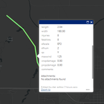
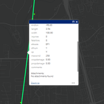
The tornado that struck El Reno, Oklahoma, on June 22 has been upgraded to EF2, with estimated winds of 125 mph, according to the National Weather Service in Norman, OK. The tornado tracked for 2 miles and reached a maximum width of 180 yds.
The EF2 rating was based on significant roof removal from a residential structure.


Lightbulb Noob retweeted
| Levantamento dos Registros de Tempo Severo - 28 a 29 de julho de 2026 |
A primeira imagem mostra o mapa com os registros de tempo severo durante o período de previsão de 28 a 29 de julho de 2026. Além das dezenas de registros de granizo e ventos intensos lineares, ao menos um tornado foi confirmado no noroeste do Rio Grande do Sul. Contudo, alguns dos registros de danos atribuídos a ventos lineares podem, na realidade, tambem corresponder a ocorrências tornádicas adicionais que serao averiguadas.
A segunda imagem mostra o rastro do tornado ocorreu nos municípios de Senador Salgado Filho, Giruá e Sete de Setembro, sendo amplamente registrado pela mídia e por moradores locais. Este percorreu ao menos 14,5 km e atingiu uma largura máxima de aproximadamente 900 m. Até o momento, 86 indicadores de danos foram catalogados com base no material disponível na mídia, incluindo imagens aéreas obtidas por drones. Desses, ao menos quatro pontos foram avaliados como apresentando danos compatíveis com uma intensidade de pelo menos F3 na escala Fujita, com ventos superiores a 300 km/h.
Tanto a terceira imagem quanto o vídeo mostram alguns desses indicadores de danos, como vegetação nativa de madeira rígida que foi desfoliada e/ou reduzida apenas aos troncos, seguida, em alguns casos, de descascamento parcial. Além disso, uma residência de alvenaria apresentou o colapso de aproximadamente 70% de suas paredes. A estrutura era composta por paredes de tijolos rebocados, reforçadas por colunas de concreto armadas com vergalhões de aço. Finalmente, uma residência adjacente de estrutura mista foi completamente destruída com destroços lançados por uma longa distância.
Além disso, a classificação do tornado de Senador Salgado Filho/Giruá/Sete de Setembro é preliminar e baseia-se no material disponível à nossa equipe até o momento. Uma análise in loco da trilha de danos também deverá ser realizada nos próximos dias.
Agradecemos a Leandro Rodrigo Beltrame e ao Portal Plural (instagram.com/portalpluralof…) pelo material fornecido.


Another update on the Huanggang survey. I have completed the polygons for the entire track, though they will still most likely be adjusted in the future. In addition, I determined a more accurate touchdown point. This survey has nearly 500 DIs so far.


Quick path of the San Antonio, Texas tornado from this morning, made from radar and one instance of likely EF2 damage.


Lightbulb Noob retweeted

Foshan Tornado Center just released survey results from the tornado sequence spawned by Typhoon #Maysak.A pair of EF3 were confirmed in Daye&Huanggang, Hubei Province, casuing 12 fatalities, >500 injuries. rating of another sig tor near Hefei, Anhui Province is still pending.

Major update on the Huanggang survey, I have upgraded to to EF4/170, added polygons for the main portion of the damage, and revised many of the concrete home DIs thanks to some people who are much more versed with masonry/concrete structures.


My survey so far of the very photogenic (Toty) Tulliby Lake, Alberta tornado. Some of the tree damage is incredibly intense. As new information comes, I will update it accordingly.


Toty

No words. Here is a peak at one of our most incredible drone flights around a #tornado to date near Tulliby Lake, AB.
The odds were completely stacked against us on this one, but thanks to some determination to make the 18 hour drive up here pulling an all-nighter, and brilliant forecasting by Nelson Tucker we were able to see this beauty.
This will likely be one of our last intercepts of the season, thank you so much to everyone for following along as we press on to properly measure tornadoes to push weather science forward!
#stormchasing #nature #weather

2
185
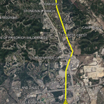
Update on the survey, I have upgraded it to EF3, though I am still determining the exact windspeed. Here's the survey so far, quite the intense tornado. Note the wind rowing of the warehouse near the end of the industrial area.


