

Proud daddy, Ostomate, bodybuilder, scientist and all things surveying
Joined July 2014
- Tweets1K
- Following539
- Followers425
- Likes1.1K



Mark White retweeted

Involved or interested in #utilities + subsurface mapping? Make sure these events are on your calendar - thanks to CICES USMP for compiling. 🗓
#surveying #geospatial #events

Mark White retweeted

We are delighted to announce that we have been approved for the CICES, Approved Development Scheme (ADS). We are excited to lead, develop & assist our surveyors in becoming professionally registered members of the CICES. Let the training commence! #CICES #Surveyor #Development

Mark White retweeted

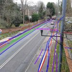
Our specialist Mark White recently shared some screenshots from IDS GeoRadar's AI Maps plugin for GPR post-processing. AI is used to automatically catch suspected anomalies and display the data in point cloud format.
#Utilities #GPR #AI

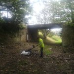
Lots of poles needed for some check measurements today! Bed levels required to add confidence to water velocity modelling of sonar data @LandScopeUK

Mark White retweeted
A shot of our mobile systems completing an integrated #topographical and #PAS128 #UtilityMapping survey in Leeds city centre 📷 find out more: bit.ly/3eAiX8n #Leica #Pegasus #P2U #MobileMapping #3DRadar #MobileGPR #GPR #Engineering #Highways #Surveying #Data


Mark White retweeted
We have been working hard behind the scenes to create a brand new website -coming soon! 💻 #NewWebsite #WebsiteLaunch
Mark White retweeted

3⃣ train stations🚉 2⃣bridges 🌉 1⃣city centre redevelopment🌆 - Looks like @LandScopeUK are working their #new #X7 hard!

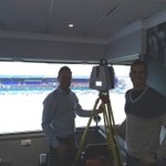
This month has seen the addition of a #Trimble #X7 to our equipment pool. The X7 has had a busy start scanning three railway stations, two bridges and a city centre development. Find out more on our latest blog post: bit.ly/352oHn6 #LaserScanning #BIM #Surveying

Mark White retweeted
GCP installation underway for a #MobileMapping project on behalf of @HighwaysEngland #Leica #Pegasus #MobileSolutions #Highways #Topographical #Surveying

Mark White retweeted
Through a combination of #multibeam and #LaserScanning we were able to capture this high resolution above and below water data set of a sluice gate, providing our client with a safe tool for the inspection and condition assessment of this difficult to access asset #Surveying

Mark White retweeted
Working alongside software vendors such as @BentleyUKI we have developed user-friendly data delivery platforms. Whether for visualisation, #AssetManagement or design, our systems cater for secure data access from the office and site #GIS #OrbitGT #BentleySystems #ChannelPartner

Mark White retweeted
A shot of our #highways survey vehicle in between rain showers on a #UtilityMapping project earlier this week 🌧️ data was captured with our #3DRadar #MobileGPR system to reduce project cost and time on site. Find out more about the value of mobile #GPR bit.ly/3hFdRZH

Mark White retweeted
Our hydrographic survey team out enjoying the sunshine whilst completing a #Bathymetric survey from our dedicated #SurveyVessel Investigator. Investigator is road-transportable so we can rapidly mobilise for UK #Hydrographic #Oceanographic and #Marine #AssetInspection surveys⚓

Mark White retweeted
A short clip of our #highways survey vehicle in action on a university campus mapping project simultaneously collecting above and below ground data #MobileMapping #Leica #Pegasus #P2U #MobileGPR #3DRadar #PAS128 #UtilityMapping #Surveying #MobileSolutions
Mark White retweeted
Our #MobileGPR and #MobileMapping systems have had a busy few weeks including a project in the sunny New Forest and mapping of a university campus. Case studies coming soon! bit.ly/37uBlfv #MobileSolutions #UtiltyMapping #Surveying #Leica #Pegasus

Mark White retweeted

We would like to invite organisations and authorities who own and operate buried assets, as well as those who excavate on their behalf to give us feedback on our plans for a National Underground Asset Register. Register for our information seminar here: tinyurl.com/y96w4y48
Mark White retweeted
Did you know that LandScope offer a variety of non-destructive testing and structural investigation services? bit.ly/3efHY7P #Structural #Investigation #NDT #GPR #Survey
Mark White retweeted
Our combined surveys produce a high resolution visualisation of structures above and below the water and are a valuable tool for both #AssetInspection and condition assessment. Pictured, a snapshot from a recent #survey of a sluice gate. Find out more: bit.ly/2Vgz2aS


Mark White retweeted
We are grateful for the trees providing some shelter from the sun at today's site in the New Forest! ☀️ #Topographical #Surveying #Trimble #SX10

Mark White retweeted
What benefits can Mobile #GPR offer for your project? Mobile GPR is a vehicle towed system capable of capturing the sub-surface environment whilst travelling at highways speed. Reducing project costs, time required on site and risk. Learn more: bit.ly/3hFdRZH

Mark White retweeted
Are you a facilities manager looking for a single #GIS environment to house all your survey data? Whether above ground, below ground or underwater, we have the solution. Get in touch to book a free virtual demo: bit.ly/30IqA7J #OrbitGT #BentleySystems #AssetManagement
