
TV meteorologist at WLS in Chicago
Joined September 2011
- Tweets1.9K
- Following51
- Followers2.2K
- Likes1

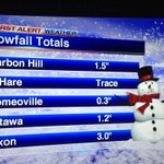


Straight from my work terminal--the latest on snowfall amounts for Sunday--based on the GFS computer model.

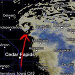
For weather geeks--look at the "hook" echo indicating a tight circulation in E IA within the broader trough.


Drizzle. Spotty freezing drizzle. Some fog. That's now. As for much snow later? Looking like 1" will be hard to reach.

New NAM computer model bullish for a prolonged period of light snow Tues-Wed.Minor accum. of 1" or so likely. I'll have the latest at 4.
36 already at O'Hare and 37 at Midway. I'm liking our forecast of 40s today that we've been advertising all week. Enjoy!