

Retired public servant (US National Park Service). Love making maps!
Virginia, USA
Joined January 2018
- Tweets2.3K
- Following20
- Followers15K
- Likes3.7K




Pinned Tweet
A gallery of my free-for-the-taking maps. You are invited to stop by and scroll around. shadedrelief.com/map-gallery…

Chiricahua National Monument, Arizona, is now Chiricahua National Park. It is an amazing place deserving of the elevated status. I made this 3D map of the park some years ago.

I am pleased to announce that the Equal Earth world map is now available in Bulgarian thanks to O.C. Stoyanov. This latest translation brings the language count to 24. equal-earth.com


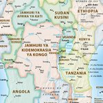
The Swahili version of Equal Earth, translated by Rohit Sonawane, is now available. A big thanks to the many people who reviewed the draft map—it is much better because of you. equal-earth.com

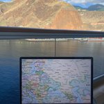
Doing a little early morning work on the Ukrainian version of Equal Earth before setting off to explore La Palma, Canary Islands.

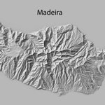
The terrain of where I am today rendered with @EduardShading software and 28-meter elevation data. (The actual island also looks very nice.)

Tom Patterson retweeted

Eduard 1.4.18 released: cast shadow layer, Mapterhorn DEM download, support for macOS 27, and various bug fixes and improvements
eduard.earth

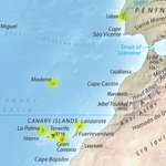
I like islands, especially those with pretty mountains. My whereabouts for the next couple of weeks :)

Help needed. I posted a draft Swahili Equal Earth map for review. If you are a native speaker, please report any problems that you find. Thanks!
The map: equal-earth.com/Equal-Earth-… My email: equal-earth.com/#contact

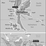
A little map I made this morning for a friend writing a book. It uses the Mercator projection—a valid choice for this region straddling the equator.

I am pleased to announce that Equal Earth is now available in Northern Sámi thanks to Lemet Máhtte Eira Sara. You can download it for free here: equal-earth.com

The Equal Earth world map is now available in Marathi—thank you Rohit Sonawane! With this latest translation, the language tally now stands at 21. All Equal Earth maps are available for free: equal-earth.com


Tom Patterson retweeted

I had a virtual meeting with my colleagues the creators of the Equal Earth Map projection
-Mr. Tom Patterson, Cartographer, U.S. National Park Service
• Prof. Bernhard Jenny, Monash University (Australia)
• Dr. Bojan Šavrič, Esri (USA)
My sincere gratitude to the three visionary geographers who developed the Equal Earth projection and helped open the way for the Correct the Map movement.
Your scientific work has contributed to a more accurate and equitable representation of our world—and helped inspire a global conversation about how Africa and another region in the world are portrayed on the map.
Thank you for helping make Correct the Map possible. The journey continues.@MtnMapper @ProjectionWizz @mappingbernie
#CorrectTheMap #EqualEarth
#MapAfricaRight #AfricaTrueSize
#FairMapFairWorld
#CartographyForEquality
#GeographyForEquality
#OneWorldFairMap
#AfricaOnTheMap


The latest update to Natural Earth v. 6 (a free geo-spatial dataset) includes US National Parks and US National Trails. Available here: shadedrelief.com/ne-draft/


Tom Patterson retweeted

1/3 #EqualEarth for web maps! The @UN is adopting the Equal Earth map to reflect Africa’s true size. MapTiler is developing a quick, easy way to switch your #webmaps to Equal Earth. Try the demo: buff.ly/amXJGTk
Tom Patterson retweeted

Following the UN vote on #EqualEarth I built a light #D3 app with sliders for central meridian/reference parallel. I like using 45° instead of the equator; balances distortion, brings the Arctic Circle into view, shows northern landmasses clearly. Try it:
codepen.io/editor/staridas-g…
Wow. When we (@ProjectionWizz
@mappingbernie) created the Equal Earth projection in 2018, we never imagined this: theguardian.com/world/2026/s…


Need something to do while flying? I suggest reading this story in the Hawaiian Airlines inflight magazine. hawaiianairlines.com/content…

Tom Patterson retweeted
Bavaria's official maps now use shadings created with Eduard.
German: ldbv.bayern.de/aktuell/archi…
English: www-ldbv-bayern-de.translate…
#shadedWithEduard

The latest update to Natural Earth v. 6.0 includes disputed areas, maritime indicator lines, Antarctic claims, China 9-dash line, and Pacific island groupings. shadedrelief.com/ne-draft/

Natural Earth v. 6.0 now includes preliminary US counties. The polygons are fitted to state shapes, coasts, lakes, and rivers.
shadedrelief.com/ne-draft/
