

Official X Account for National Weather Service Cleveland, Ohio. Details: https://xitter.cf/t.co/OiJC4bi5HZ
- Tweets28.7K
- Following535
- Followers52.1K
- Likes20.2K






ALT Chart on left showing highs in the mid 60s to low 70s through the week and lows in the upper 30s to low 40s. Dry weather continues through next week.

ALT Graphic showing the probability of fog tonight.

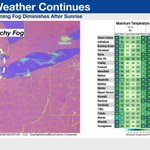
ALT Satellite image on left showing an area of fog across Lower Michigan into portions of Northwest Ohio. Table image of right showing temperature forecast across the region with highs today and Saturday in the mid 60s and lows tonight in the upper 30s to low 40s.

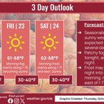
ALT graphic showing 3 day weather outlook from thursday to saturday, including weather icons and forecast temperatures

ALT Map of lows for Thursday morning and also areas of fog mainly across Northwest and North Central Ohio.

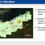
ALT graphic showing high temperatures with sun icons across northeast ohio and northwest pennsylvania and a fog icon across northwest ohio


ALT graphic showing today's highs with a sunny weather icon

ALT Seven-day high temperature forecast for October 2-26, 2026. High temperatures across northern Ohio and northwestern Pennsylvania will generally remain in the 60s throughout the week. A few locations could reach 70 degrees Tuesday. Friday is expected to be the coolest day, with highs ranging from 59 degrees in Erie to the middle 60s elsewhere. Temperatures moderate over the weekend, returning to the middle and upper 60s.

ALT graphic showing high temperatures and sunny weather icon today


ALT On the left, forecast highs for today, generally ranging from 59 to 63 degrees across the area. On the right, forecast lows tonight, ranging form the lower 40s along the Lake Erie to the 30s inland. The coldest temperatures and greatest frost potential tonight are found east of the I-71 corridor and away from Lake Erie.

ALT On the left, frost advisories and freeze warnings for Saturday night. There is a freeze warning for the entire area, except for locations along the eastern lakeshore where there is a frost advisory. Forecast details and impacts are shown on the right.

ALT Forecast highs today on the left, ranging from the upper 40s across the higher terrain of Northwest Pennsylvania to the low to mid 50s across Ohio. On the right is the chance for rain this morning, 30 to 60 percent across North Central Ohio, 20 to 30 percent across parts of Northwest Pennsylvania, and 10 percent or less elsewhere.

ALT On the left, frost advisories and freeze warnings for Saturday night. There is a freeze warning for the entire area, except for locations along the eastern lakeshore where there is a frost advisory. On the right is the forecast lows for tonight, in the upper 20s and lower 30s away from the lake and in the mid to upper 30s along the lakeshore.

ALT This graphic displays a special weather statement plotted on a map. The statement is in effect until 6:45 PM EDT. The statement includes Parma OH, Lakewood OH and Cleveland-Hopkins Airport OH. A STRONG THUNDERSTORM WILL IMPACT CUYAHOGA AND NORTHEASTERN LORAIN COUNTIES THROUGH 645 PM EDT. The threats associated with this storm are wind gusts up to 40 MPH and pea sized hail. Seek shelter in a sturdy structure until the storm passes.

ALT This graphic displays a special marine warning plotted on a map. The warning is in effect until 6:30 PM EDT. The warning includes Avon Point to Willowick OH beyond 5 nm off shoreline to US-Canadian border, Vermilion to Avon Point OH beyond 5 nm off shoreline to US-Canadian border, Reno Beach to The Islands OH and The Islands to Vermilion OH. The threats associated with this warning are wind gusts greater than 34kts and no hail expected.Waterspouts are observed. Steep waves can be expected. Seek safe harbor and take protective actions.