

Official X Account for National Weather Service Greenville-Spartanburg, SC. Details: https://xitter.cf/t.co/2JyXqeajGw.
- Tweets55.9K
- Following461
- Followers37K
- Likes16.6K







ALT Table showing the first, average, and last freeze date for Asheville.

ALT Table showing the first, average, and last freeze date for Charlotte.

ALT Table showing the first, average, and last freeze date for GSP.

ALT NWS Greenville-Spartanburg weather history graphic for October 23, 2017. Severe thunderstorms produced at least 11 tornadoes across Upstate South Carolina and portions of western North Carolina. At least three tornadoes caused EF2-rated damage, including one northwest of Spartanburg that injured one person. The right side shows extensive tornado damage at an airport, with a collapsed hangar, twisted metal roofing, scattered debris, and several damaged small aircraft.

ALT Map showing preliminary storm reports across the western Carolinas, northeast Georgia, and surrounding areas from the October 23, 2017 severe weather outbreak. Numerous blue wind damage reports are concentrated across western North Carolina, including the mountains, foothills, and Piedmont. Red tornado reports appear across Upstate South Carolina, particularly near Spartanburg and Simpsonville, highlighting the widespread severe weather associated with the outbreak.

ALT Four-panel NWS Greenville-Spartanburg radar display showing severe thunderstorms associated with the October 23, 2017 tornado outbreak. The panels depict radar reflectivity, storm-relative velocity, and additional radar products. Intense precipitation and contrasting inbound and outbound velocities highlight a rotating thunderstorm capable of producing tornadoes across Upstate South Carolina.

ALT Composite graphic documenting the October 23, 2017 EF2 tornado near Spartanburg, South Carolina. The top panel shows a detailed map of the tornado's path and surveyed damage indicators northwest of downtown Spartanburg. The bottom left shows the tornado track across the region, while the bottom right features a photograph of extensive structural damage, including a collapsed industrial building, scattered debris, and damaged equipment.

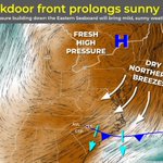
ALT Graphic title: "Backdoor front prolongs sunny skies." Subtitle: "High pressure building down the Eastern Seaboard will bring mild, sunny weather and a dry weekend." The main portion of the graphic is a map of the eastern United States. On the map, dry air is represented by shades of brown, and moist air in shades of green or teal. White areas represent where these air masses come together. Black streaks signify wind direction, and where there are more streaks, that suggests the wind is stronger. Arrows annotate an area of the East Coast where dry northerly breezes are occurring in association with high pressure.

ALT Weather graphic titled "Dry Weather Continues..." from the National Weather Service Greenville-Spartanburg SC, showing no rainfall expected in the 7-day forecast and an accompanying U.S. Drought Monitor map displaying abnormally dry and moderate drought conditions across the region as of October 20, 2026.

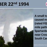
ALT NWS Greenville-Spartanburg weather history graphic for October 22, 1994. A small F0 tornado caused minor damage along a 2-mile path near Cross Anchor in Spartanburg County, South Carolina. The left side features a photograph of a tornado funnel extending from dark storm clouds toward the ground, partially obscured by trees. The date appears prominently across the top.
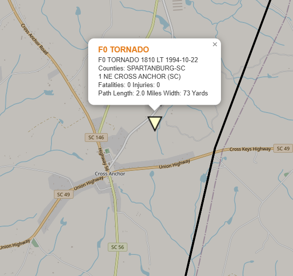
ALT Map showing the location of an F0 tornado that touched down approximately 1 mile north of Cross Anchor in Spartanburg County, South Carolina, on October 22, 1994, at 2:10 PM local time. The tornado traveled 2 miles, had a maximum width of 73 yards, and caused no injuries or fatalities. A triangular marker indicates the tornado's location northeast of Cross Anchor, near SC Highway 146 and Cross Keys Highway.

ALT Infographic from the National Weather Service in Greenville-Spartanburg titled "A Brief Cooldown This Weekend," highlighting dry weather, slightly cooler weekend temperatures with potential mountain frost, and a table of 7-day temperature forecasts for regional cities.

ALT National Weather Service Greenville-Spartanburg forecast for tonight detailing below normal temperatures, clear skies, light winds, and lingering dry conditions. A map showing the low temperature forecast for the NWS GSP forecast area.

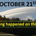
ALT NWS Greenville-Spartanburg weather history graphic for October 21. Large yellow text reads "Nothing happened on this day." The background photograph features a striking, smooth, layered lenticular cloud above a tree-covered hillside displaying early fall colors. The cloud has a curved, lens-like appearance against a blue sky.

ALT National Weather Service graphic titled "Another Nice Day" featuring a main key point: "Temperatures similar to yesterday's highs. Sunny skies, light winds, and low humidity." Below the header on the left is a regional temperature map for the Weather Forecast Office Greenville-Spartanburg area, issued October 21, 2026: High Temperature Wednesday. Highs ranging from 63 degrees in Newland, NC, to 75 degrees in Toccoa, GA. Most locations between 68 and 73 degrees.

ALT Title: Increased Fire Danger Across Northeast Georgia Key Bullet Points: Increased Fire Danger across northeast Georgia today through 7 PM. Similar conditions to yesterday, with low relative humidity and dry vegetation combining to produce increased fire danger in Northeast Georgia again today. Please refer to your local burn permitting authority on whether you can burn today. Map: A regional map highlighting northeast Georgia counties in orange under a "Fire Danger Statement."

ALT Smokey Bear has 5 don'ts to help prevent wildfire. Don't leave a campfire unattended. Don't leave coals until they're doused and stirred until cold. Don't burn dangerous things like aerosol cans, pressurized containers, glass or aluminum cans. Don't let your tow chains drag. Don't park over tall, dry grass. Learn even more ways at smokeybear.com.

ALT Slide showing a National Weather Service update for Greenville-Spartanburg, SC, issued on October 20, 2026, stating that dry weather continues with no rainfall forecast for the next seven days, maintaining drought conditions in parts of the area.

ALT NWS Greenville-Spartanburg weather history graphic for October 20, 1826. The graphic highlights the earliest recorded tornado in the GSP County Warning Area, reported in Rowan County, North Carolina, 200 years ago. The background features a historic black-and-white photograph of a narrow tornado funnel extending from dark storm clouds to the ground over a flat landscape. Large yellow text displays the date, October 20, 1826.

ALT Header: Increased Fire Danger Across Northeast Georgia Today Key Bullet Points: Increased Fire Danger across northeast Georgia from noon to 7 PM. Slightly warmer temperatures will combine with low relative humidity and dry vegetation to produce increased fire danger in Northeast Georgia again today. Please refer to local burn permitting authorities on whether you can burn today. Map: A regional map highlighting northeast Georgia counties in orange under a "Fire Danger Statement." Cities in or near the highlighted zone include Toccoa, Seneca, Anderson, and Elberton. Surrounding regions in Western North Carolina and Upstate South Carolina are shown in white.

ALT National Weather Service graphic titled "Pleasant Weather Continues..." featuring a main key point: "Temperatures will be slightly warmer than yesterday. Not as cool tonight. Continued clear skies and light winds." Below the header are two regional temperature maps for the Weather Forecast Office Greenville-Spartanburg area, issued October 20, 2026: High Temperature Tuesday (8 AM – 9 PM EDT, Oct 20): Shows widespread high temperatures in the mid-to-upper 70s across the region (e.g., Greenville 75°F, Spartanburg 75°F, Charlotte 75°F, Franklin 76°F), with slightly cooler temperatures in higher elevation areas like Asheville (73°F) and Newland (68°F). Low Temperature Tuesday Night (8 PM Oct 20 – 10 AM Oct 21): Shows overnight low temperatures mostly in the mid-to-upper 40s to around 50°F across lower elevations (e.g., Greenville 50°F, Spartanburg 48°F, Charlotte 48°F, Anderson 49°F), with colder lows in mountain areas like Asheville (42°F) and Newland (42°F).

ALT A map shows forecast low temperatures in the 40s (except upper 30s in mountain valleys) for the night of October 19-20, 2026, in the western Carolinas and northeast Georgia. Icons on the map represent clear skies as a full moon. Text above and beside the map reads: "Forecast for Tonight... Nothing exciting. Nothing significant happened in GSP Weather History on October 19, and nothing significant is expected tonight either. Generally clear skies and calm winds. Temps will run a little below normal. Mountain valley fog is possible."


ALT NWS Greenville-Spartanburg weather history graphic for October 19. Large white text reading "Nothing happened on this day" appears inside a yellow dashed rectangular border. The background features a scenic view of the Blue Ridge Mountains, with layers of distant mountain ridges beneath a pale sky and forested slopes in the foreground.

ALT Header: Increased Fire Danger Today Key Bullet Points: Increased Fire Danger across northeast Georgia from noon to 7 PM this evening. Critical relative humidity values less than 25% are expected. Refer to local burn permitting authorities on whether you can burn today. Map: A regional map highlighting northeast Georgia counties in yellow under a "Fire Danger Statement." Cities in or near the highlighted zone include Toccoa, Seneca, Anderson, and Elberton. Surrounding regions in Western North Carolina and Upstate South Carolina are shown in dark gray.

ALT Header: Warmer Today (with NOAA and National Weather Service logos). Bullet Points: Temperatures rebound a few degrees from yesterday’s highs. Sunny skies and light winds, with a few low-end gusts possible across the Piedmont this afternoon. Map Details: A regional map titled "High Temperature Monday (8 AM Through 9 PM EDT on Oct 19)" issued by Weather Forecast Office Greenville-Spartanburg at 2:21 AM EDT. High temperatures across Western North Carolina, Upstate South Carolina, and Northeast Georgia range mostly from 64°F in higher elevations (e.g., Newland at 64°F) to 73°F (e.g., Franklin at 73°F), with major areas like Asheville at 70°F, Greenville at 70°F, Spartanburg at 70°F, and Charlotte at 68°F.