

A Team of Forecasters covering news & weather across Ohio. Keeping you ahead of the storm since 2011! A proud member of @BelparkWx, a 501(c)3 organization!
Columbus, OH
Joined February 2012
- Tweets18.4K
- Following1.4K
- Followers2K
- Likes2.3K
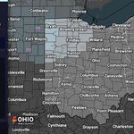


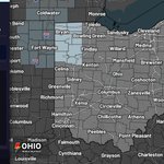


9:47 AM ET 10/24/26: Dense Fog Advisory has been extended for Williams, Defiance, Paulding, and Van Wert until 11 AM EDT 10/24/26. Visibility 1/4 mi or less in dense fog may make driving hazardous—use extra caution.

96
2:00 AM ET 10/24/26: Dense Fog Advisory issued for Hancock, Lucas, Ottawa, Sandusky, Seneca, Wood & Wyandot Counties until 10 AM EDT. Visibility 1/4 mi or less in dense fog may make driving hazardous.

76
1:48 AM ET 10/24/26: Dense Fog Advisory issued for Hardin, Mercer & Auglaize Counties until 10:00 AM EDT. Visibility may drop to 1/4 mile or less in dense fog, making driving hazardous—use extra caution.

76
1:44 AM ET 10/24/26: Dense Fog Advisory is in effect for Williams, Fulton, Defiance, Henry, Paulding, Putnam, Van Wert, and Allen until 10 AM EDT today. Visibility may drop to 1/4 mile or less in dense fog, making driving hazardous.

72
9:51 AM ET 10/21/26: Dense Fog Advisory has been extended for Williams, Fulton, Defiance, Henry, Paulding, Putnam, Van Wert, and Allen until noon EDT today. Visibility drops to 1/4–1/2 mi; fog should dissipate 10 AM–noon, making driving hazardous.

85
3:31 AM ET 10/21/26: Dense Fog Advisory has been extended for Delaware County until 10 AM EDT. Visibility less than 1 mile in dense fog may make driving hazardous with low-visibility conditions.

77
1:10 AM ET 10/21/26: Dense Fog Advisory has been issued for Hardin, Mercer, Auglaize, Shelby, Logan, and Union Counties until 10 AM EDT 10/21/26. Visibility may drop to 1/4 mile or less in dense fog, making driving hazardous.

63
1:07 AM ET 10/21/26: Dense Fog Advisory now begins at 1:07 AM EDT today for Allen, Defiance, Fulton, Henry, Paulding, Putnam, Van Wert, and Williams Counties, OH and Hillsdale County, MI, until 10 AM EDT. Visibility 1/4 mi or less; hazardous driving.

66
1:06 AM ET 10/21/26: Dense Fog Advisory is in effect for Allen, Defiance, Fulton, Henry, Paulding, Putnam, Van Wert, and Williams Counties, OH and Hillsdale County, MI until 10 AM EDT. Visibility 1/4 mi or less; hazardous driving—use extra caution.

59
12:34 AM ET 10/21/26: Dense Fog Advisory has been extended for Marion County until 10 AM EDT. Visibility may drop to 1/4 mile or less in dense fog, making driving hazardous with low visibility.

60
10:59 PM ET 10/20/26: Dense Fog Advisory is in effect for Crawford, Hancock, Lucas, Ottawa, Sandusky, Seneca, Wood, and Wyandot Counties until 10 AM EDT Wed. Visibility may drop to 1/4 mile or less, making driving hazardous.

77
6:29 PM ET 10/14/26: Flash Flood Warning continues for Athens, OH, Morgan, OH, and Perry, OH until 8:30 PM EDT. 1-2" rain has fallen with flash flooding already in McConnelsville. Turn around, don’t drown on flooded roads.

83
6:22 PM ET 10/14/26: Flash Flood Warning for Athens County, OH and Doddridge County, WV until 9:15 PM EDT. Heavy rain is causing flash flooding with 1-2" possible. Turn around, don’t drown—avoid flooded roads.

80
5:26 PM ET 10/14/26: Severe Thunderstorm Warning for Gallia, OH & Others until 6:00 PM 10/14/26. 60 mph wind gusts and 0.75 in hail are possible. A storm is moving east near Oak Hill. Move to an interior room on the lowest floor.

73
4:54 PM ET 10/14/26: Severe Thunderstorm Warning for Greenup, KY and Gallia, OH until 5:30 PM 10/14/26. 60 mph wind gusts and 0.75 in hail possible. Radar indicated. Move to an interior room on the lowest floor.
1
110
4:52 PM ET 10/14/26: Severe Thunderstorm Warning for Scioto, OH until 5:30 PM 10/14/26. 60 mph wind gusts are possible. A storm was over Rosemount moving E at 30 mph. Seek shelter in a well-built structure and stay away from windows.

74
4:24 PM ET 10/14/26: Flash Flood Warning for Athens, OH and Morgan, OH until 7:30 PM 10/14/26. Flash flooding is already occurring with 1-2" of rain. Turn around, don’t drown—do not drive on flooded roads.

71
4:02 PM ET 10/14/26: Severe Thunderstorm Warning for Monroe, OH and Noble, OH until 4:45 PM 10/14/26. 60 mph wind gusts and 1.0 in hail are possible. Seek shelter inside a well-built structure and stay away from windows.

66
3:48 PM ET 10/14/26: Storms are intensifying across the Ohio Valley and will spread east-southeast through afternoon into early evening across southern Ohio, northern Kentucky, and western West Virginia. Damaging winds up to 60 mph are possible.

