

Bringing your Precision Ag together online & in field. Satellite crop monitoring with http://t.co/3Aq68vaGFY. Historical analysis with http://t.co/v35cAnHNrs.
Melbourne, Victoria
Joined August 2011
- Tweets80
- Following1.3K
- Followers739
- Likes101
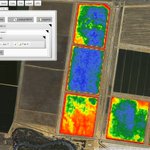

Watch.farm now has new #Sentinel2 imagery - 10m every 10 days. S NSW Summer crop imagery from Feb 6:

PASource retweeted

@GrainGrowersLimited #ProductionWise + @PASource = digital farming game changer for #ausag bit.ly/1Uvvmu7

We are joining forces with @GrainGrowersLtd. Exciting times ahead for us! teapaw.org/davejmck/status/738116…


@Bisso80 better chance 4 cloud-free capture. #Sentinel2 also has intrsting 'red edge' = new uses? @jimandlara @RobinMSchaefer @rick_rundell
@jimandlara New European satellite: 10m pixels every 10 days, second sat late 2016 = passes every 5 days @RobinMSchaefer @rick_rundell
@RobinMSchaefer added #Sentinel2 frm mid Dec to Watch.farm on Aust day, cloud+ in Jan, Feb OK. Great imagry src @rick_rundell
Drones Supporting Icebreakers and Aerial Mapping in Antarctica - great story from @AUAV_Chapman lnkd.in/b9FpyF2

@GribbleRC was thinking truckload basis eg. starting at north, first truck x rows tests y, then in middle, a rows/truck, quality b @agrobaz
@GribbleRC could do a simple validation by comparing yield & quality of northmost section with the central, high NDVI section @agrobaz
@GribbleRC This is one of the new #Sentinel2 images. On the 20ha block the 10m pixels look a lot better. @agrobaz
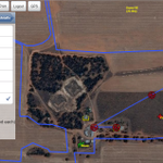
If you're planning a fence post- #harvest15, check out fence.farm. Visual fence design and costing: teapaw.org/fencefarm/status/66818…

fence.farm now available on your Ipad with Safari. Map & cost your fences with a touch of the screen.

@SatamapAU have also toyed with idea of modeling. Like that in urs modelled areas are obvious by blurring = low data quality @USGSLandsat
@SatamapAU #Landsat7 a great resource, esp at path center (watch.farm default) Thermal too @USGSLandsat


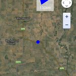
New ways of looking over the horizon: himawari8.nict.go.jp/ images Australia every 10 minutes with 1km pixels. Great for cloud watching.
Great to see this happening. Excellent scale of data for use in research. teapaw.org/richardaheath/status/6…


The wireless, invisible, 10m selfie stick. @AustralianUAV take a #selfie. @AUAV_Chapman at the controls.

PASource retweeted

Temps from Landsat 8:Useful 4 PA decision-making? Find out as @PASource @malleefocus present topic at #PASymposium15 tinyurl.com/pvca5ex – at Wagga Wagga, New South Wales
@LavisPaul Will do Paul. Should have good idea of how it relates to screen & canopy temps by then. Mix of soil & canopy temp in sparse crop.
Interested in #temperature variation across ur farm? Try thermal (land surface temp) option in watch.farm/watch.html
