
PhD student at @CtuGeomatics. #cartography, #GIS, #mapdesign, #spatialhistory, #historicalmaps, #historicalatlases.
Pilsen
Joined August 2019
- Tweets24
- Following182
- Followers19
- Likes366



PetraJ retweeted

Part of our cartographic group participated in the ICA Spring Olomouc symposium on "Atlases: Their Design and Use".
Thanks @ICAMapDesign (and other Commissions) and @gis_upol for organizing such a great event in Czechia!
#cartography #atlases #mapdesign #icaspring

PetraJ retweeted
📆 15. března 1939 ukončila nacistická okupace českých zemí existenci pomnichovského Česko-Slovenska. O den později byl na okupovaném území zřízen Protektorát Čechy a Morava.
🗺️ bit.ly/41zG6Qg
© @CtuGeomatics, @HiuAV2017

ALT Územní vývoj bývalého Československa od 14. března 1939. Mapa z tištěného atlasu Česky historický atlas.
PetraJ retweeted
📆🌳 1. března 1955 byla vyhlášena CHKO Český ráj - nejstarší CHKO v Česku. Vědomá ochrana přírody a krajiny se však na našem území objevuje již od poloviny 19. století.
🗺️ bit.ly/3ZK53aj
© @CtuGeomatics, @HiuAV2017, @PrirodovedaUK

PetraJ retweeted
📆25. února 1948 komunisté uchopením vlády na více než 40 let pohřbili československou parlamentní demokracii. Zásadní podíl na této události měly útvary Sboru národní bezpečnosti (SNB).
🗺️ bit.ly/41pKBNo
© @CtuGeomatics, @HiuAV2017

PetraJ retweeted
⚔️ Na konci roku 1805 zasáhly napoleonské války poprvé i do českých zemí.
📆 2. prosince 1805 proběhlo u Slavkova u Brna rozhodující střetnutí třetí koaliční války.
🇨🇿 bit.ly/3VtmSZl
© @CtuGeomatics, @HiuAV2017
#bitvauslavkova #ČeskýHistorickýAtlas
PetraJ retweeted
#30DayMapChallenge
#Day19: Golden #Globe Awards for Best Foreign Language Film, winners from Europe in 1949–2021.
Made by @PetuleJ, PhD student at @CtuGeomatics, just for fun. Made in #ArcGISPro. Data: Wikipedia (bit.ly/3tGpzdK)

PetraJ retweeted
#30DayMapChallenge
#Day18: Meanders of the Ohře River (the Eger River) in #blue
Made by @PetuleJ, PhD student at @CtuGeomatics, just for fun, inspired by the amazing work of @geo_coe. Made in #ArcGISPro (thanks @LittleMissEsri for the tutorial!)
#REM #Czechia

PetraJ retweeted
#30DayMapChallenge
#Day12: Regions in Czechia scaled by total population. #noncontiguous #cartogram
Made by @PetuleJ, PhD student at @CtuGeomatics, using Judy Olson’s (1976) projector method algorithm. Made in #ArcGISPro with #scale effect. Data: #SLDB2021 (@statistickyurad)

PetraJ retweeted
#30DayMapChallenge
#Day9: @ESA Member States’ Contributions Per Capita
Made by @PetuleJ, PhD student at @CtuGeomatics, just for fun, using customized #firefly symbology from @John_M_Nelson, thanks for that and all your tutorials! Made in #ArcGISPro
#space #cartography

PetraJ retweeted
#30DayMapChallenge
#Day3: Simplified geometric #polygons of #Prague city in #Mondrian style
Made by @PetuleJ, PhD student at @CtuGeomatics, just for fun. Inspired by “Rivet Pop Art Print of New York City Map” (amzn.to/3TRcwBJ). Made in #ArcGISPro

PetraJ retweeted
Po 28. říjnu 1918 vyhlásili představitelé sudetských Němců v pohraničních oblastech ČSR postupně čtyři separatistické provincie...
🇨🇿 bit.ly/3U4OQcF
🇬🇧 bit.ly/3Nkgn7N
© @CtuGeomatics, @HiuAV2017
#Československo #Sudety #kartografie #historie

PetraJ retweeted
Jak probíhal územní vývoj Československa po roce 1918? To zachycuje mapa na webovém portálu #ČeskýHistorickýAtlas:
🇨🇿 bit.ly/3DpgudY
🇬🇧 bit.ly/3zNg8wL
©@CtuGeomatics, @HiuAV2017
#28rijen #Československo #kartografie


Česká kartografická společnost pořádá 10. listopadu seminář "Kartovýročí 2022 & Mezníky digitální kartografie", tentokrát v prostorech Fakulty stavební @CVUTPraha (@CtuGeomatics).
#ČKS #kartografie #mapy

PetraJ retweeted

Are you interested in a seminar on semantic web and spatial humanities❓ It is the last chance to register for a second #WarSHum seminar: forms.gle/TBvfLe9c67YfHkd1A @ih_pan @UniWarszawski @Leibniz_IfL

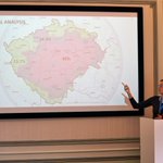
Talking about mapping ethnicity in Central Europe and giving examples of manipulative techniques in ethnic maps at #dach2022. For more info see the project website (bit.ly/3BC8GWg). Many thanks to @ica_heritage for organizing the conference at @UnivBabesBolyai


1
Three best students from our Project Map Creation course at @CtuGeomatics presented their map posters at #EuroCarto2022. Many thanks to @cartogroup for organizing such a great conference!

Pre-order completed! Looking forward to expanding our #AtlasOfDesign collection from #NACIS at @CtuGeomatics

We are excited to announce that pre-orders for the Atlas of Design Volume 6 are available now! Visit atlasofdesign.org/order to reserve your copy today.

1