

Nature (weather)
Noorwegen
Joined February 2017
- Tweets60.4K
- Following242
- Followers17.8K
- Likes49.1K




Pinned Tweet
Hi everyone
a nice to sunday to all
For the coming #winter make a mark to your favortites to this
#denniswinterindex
it starts from 1 dec 2026


AllNature retweeted

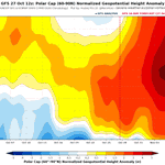
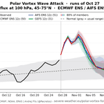
The latest stratospheric forecasts continue to show an interesting evolution as we approach November, with several indicators pointing to a substantial weakening of the stratospheric polar vortex (sPV).
Enhanced poleward heat transport (chart 1, orange diagonal area, and chart 2, long upwards vectors) signals increased activity that propagates upwards from the troposphere into the stratosphere.
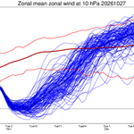
This is particularly interesting because broader model guidance has indicated below-average stratospheric winds at the examined levels (10, 30, and 50 hPa) for quite some time now. Although, while the models broadly support a weaker-than-normal vortex, they don't (yet) agree on how far this weakening will progress.
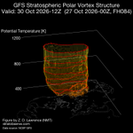
By early November, a pronounced, split-like configuration (Wave2 in chart 3) should take place, with high-pressure ridging increasingly distorting the vortex. The zonal wind at 10 hPa/60°N falls from ~22 m/s in the earlier forecast to ~5 m/s by this stage.
By around 8-10 November, the vortex appears more elongated and displaced again (Wave1 pattern in chart 4), suggesting the weakening could persist longer than previous forecasts.
Some model guidance suggests a possible zonal wind reversal, but this factor is still changing rapidly run-by-run, so it remains a scenario to monitor.
What could this mean for surface weather?
A significant stratospheric disruption can sometimes (emphasis on sometimes) influence the tropospheric circulation over the following weeks, increasing the potential for persistent blocking patterns and changes to the usual westerly flow.
However, downward propagation is not guaranteed, and even a major SSW does not automatically mean colder weather is coming. The eventual impacts would depend on how the tropospheric circulation responds and where blocking patterns establish themselves.
As always, longer-range forecasts carry considerable uncertainty, so monitor this rather than treat it as a definitive prediction for later in November.


AllNature retweeted

Fascinating to see a major stratospheric polar vortex breakdown so early in the season - when radiative spin-up is usually much stronger than planetary wave forcing.
Even the November SSW of 1968 was a vortex displacement, but we're looking at a real vortex split next week.


more monster #polarvortex disruption
#SSW chance, next 2 weeks68% · High
ECMWF 96% · AIFS 37% · GEFS 71%


AllNature retweeted

Sudden Stratospheric Warming Event
What is it? And why are cold weather enthusiasts getting excited about a warming event?
The image below (from Today’s GFS)
shows the result of a sudden stratospheric warming event on Nov 8th in the stratosphere.
Notice the red blob directly over the North Pole… that is a ridge of warmth that evolves rather suddenly, although as I have shown you it can be seen coming from a long way ahead, if you know what to look for…
A sudden stratospheric warming event is defined in either, or both, of the following 2 ways:
1) temperatures in the polar stratosphere rise >25°C in less than 1 week.
2) the normally westerly band of winds located at 60°N reverses to Easterly.
The first condition qualifies it as a sudden stratospheric warming event, but if it also meets the 2nd criteria then it qualifies as a major SSWE.
The result of the warming over the pole is that the cold air that is normally locked up there by the polar vortex is forced outward and into the mid-latitudes. (See the areas of blue).
The important thing to note here is that the effects seen at the surface do not happen immediately.
Depending on the exact dynamics involved, you could have a lag time as short as a week or as long as a month.
To make a long story short, the sooner the troposphere “couples” to the stratosphere, the sooner we will see the impacts at the surface.
What are those impacts?
Well, this time of year the cold air pool is not yet mature so the cold air that comes will be November cold, not January or February style cold.
However, November cold can still be cold enough for snow, especially at elevation.
Once the SSWE occurs and the troposphere starts to couple, we will see a much wavier (north-south) jet stream develop. From there, we watch where each wave will have an opportunity to amplify and that’s where we’ll start looking for a storm.
So, even though it’s called a “warming event” it can lead to some exciting winter weather. 🥳
~Meteorologist Mark Margavage


AllNature retweeted

عيّنات من أحداث احترار الستراتوسفير القطبية الشمالية شتاء 1982-1983 منهجية SCORPION النظام التحليلي CORe reanalysis
أختبر هنا مدى أهمية تحليل Continuous Wavelet Transform في وصف أحداث SSW
بالطبع شتاء وربيع 1982-1983 شهد انهيارا للدوامة القطبية الشمالية عدة مرات. #برمجة_أرصادية


