

Weather + Climate | Look Up 🚀 | Florida State PhD + Michigan Go Blue! | Cat 6 🐈 | SI @weathertrader | Maps at @ForecastEagle + https://xitter.cf/t.co/RZoMToAx1q
Atlanta, GA
Joined September 2008
- Tweets30.8K
- Following5.9K
- Followers154K
- Likes74.1K



Pinned Tweet
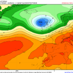
Great Britain and mainland Europe to be hit by "3 bomb cyclones" in a row each with hurricane force winds, heavy rain, and potential for disruption.
The North Atlantic storm track + jet stream is configured for storms to form every 2-days, rapidly intensify, and landfall.
Ryan Maue retweeted
Great Britain and mainland Europe to be hit by "3 bomb cyclones" in a row each with hurricane force winds, heavy rain, and potential for disruption.
The North Atlantic storm track + jet stream is configured for storms to form every 2-days, rapidly intensify, and landfall.
The first "bomb cyclone" for early Friday will bottom out around 977 mb but be a mobile "diabatic Rossby wave" driven system, so compact and potential for "sting jet" when bent-back warm front superposes with upper-level jet stream beneath/around tropopause fold.
The next 2 bombs are more typical "Icelandic Lows" in the 940s or 950s mb ... fairly intense but more typical/frequent heading into winter.


I don't think we should name purely Subtropical Storms, and NHC didn't until 2002 instead giving them a number designation. However, many subtropical systems eventually turn tropical, so it's often a moot point. Except with Josephine is going to transition into an extratropical system soon (at hurricane intensity).
All these definitions can cause confusion!


Super Typhoon Champi now up to 160-knots maximum sustained winds. That's almost 185 mph
Category 5 intensity for tropical cyclones
Nearly EF5 on tornado scale except Champi's eye is 35 miles wide.
Moving at 15-knots -- so vacuuming up boatloads of climate fuel from ocean


Reuters "heat storm" analysis has beautiful graphics and sound data analysis, but everything after that is fatally flawed including the interpretation. It's entirely wrong.
There is no new class of "heat storms" swarming the planet. Indeed, after performing the correct analysis (removing the long-term warming trend), it's found that the shift of the mean of the distribution entirely explains the massive 100x increase reported by Reuters.
A narrow bell curve moves past its own tail especially over the oceans where one standard deviation is small.
This is a well known issue in climate science extreme events literature, and is foundational to attribution science, too.
Explanation and further data analysis at Celsius Earth:
celsius.earth/heat-storms


Supersized heat waves used to be rare. No longer. A Reuters data-driven examination of global temperatures reveals the emergence of what we call heat storms. They now swarm the planet, upending life around the world. reut.rs/4zBUXtM
Moreover, the swing from La Niña to El Niño explains the observed frequency change in "heat storms" if properly defined with detrended temperature data over the past 80-years.
None of this is "new weather."
ENSO has been measured for more than a century, it is forecast months ahead, and its global warmth is well understood.
Counting an El Niño as a “heat storm” relabels a known ocean–atmosphere oscillation, riding on the warming trend, as a new kind of event. It's not.
celsius.earth/heat-storms

The same analysis repeated for the oceans and "marine heat waves" yields the same answer: the shift in the mean entirely explains the upward increase in the defined "heat storms"
celsius.earth/heat-storms/br…

Imagine you're a teenager on social media for the first time seeing Super Typhoons.
Going into high school and college, for the next decade, you'll be learning everything for the first time, and how can't you be amazed, astounded, and excited?
Golden age of meteorology underway!

Super Typhoon Champi completed an eyewall replacement cycle and immediately tapped enormously high ocean heat content (fuel)
🔴The eye is huge ... intensity is 155-170 knots or Category 5 (pressure under 900 mb)
East of the Philippines is home of the monster Typhoons.
Each pressure level file for Ensembles (EPS) is 14 GB.
That's hilariously large, and quite a challenge to ingest that much data in real-time.
Definitely need to take advantage of byte-range sub-setting to only collect certain parameters.
However, that does not help with only selecting a subset of the globe. That might be great value added product that would streamline operations.
ECMWF did just now update their open-data server to 2,000 simultaneous connections, which is an enormous data bucket firehose!
I'm a kid in a candy store right now. 🍬
data.ecmwf.int/ecpds/home/op…