Today we honor all of the men and women who have served in the United States Armed Forces with honor, integrity, and bravery. Thank you!
5
20
It's that time of year when the bucks and does are chasing, or running from, each other rather "blindly". Use extra caution when traveling during dusk, dawn, and the overnight. Check your speed, use high beam headlights when possible, and don't swerve at higher speeds.
34
Scott Co EM retweeted
Another area of patchy fog will be possible tomorrow morning across portions of south-central and western Kansas. The fog should not be overly dense, but cannot rule out dense fog in spots. Be sure to use caution if you are traveling through fog tomorrow morning. #kswx
Good news for those trying to get fall crops out of the field...
Dry weather is predicted over the next week. #KSWX
43
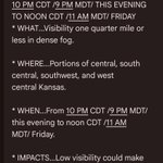
A Dense Fog Advisory has been issued from 5am until noon on Thursday.
- Give yourself extra time to reach your destination
- Increase following distance behind other vehicles
- Use your low beam headlights
Safe travels!
38
Fog will be possible early Thursday morning, so plan on a little extra time if you have travel plans outside of town.
Fog is expected to develop across portions of west central and southwest Kansas early in the morning, especially between 3 AM and 10 AM CDT. Please allow extra time to reach your destination. #kswx
45
These cooler temperatures are a reminder it's time to update, or create, the emergency supply kit for your vehicle(s)!
34
Scott Co EM retweeted
Dry weather is expected through Monday. There are chances for t-storms from next Monday night through Wednesday. #KSWX
There is potential for a significant rainfall event this week, so this evening and tomorrow will good opportunities to make sure your rain gutters and nearby storm drains are clear of debris.
These are the possible rainfall range amounts for the storm next week. Please note that these amounts are likely to change as the exact storm track becomes more clear. #kswx
72
When the fire meeting turns into a fire call you get the fastest response out of the station possible...
1
1,197
Scott Co EM retweeted
A severe thunderstorm watch has been issued for parts of Kansas and Nebraska until 10 PM CDT

ALT This graphic displays Severe Thunderstorm watch number 668 plotted on a map. The watch is in effect until 10:00 PM CDT. The watch includes parts of Kansas and Nebraska. The threats associated with this watch are no tornadoes expected, isolated hail up to ping pong size possible and scattered gusts up to 80 mph possible. There are 249,995 people in the watch along with 266 schools and 43 hospitals.
A Severe Thunderstorm Warning has been issued until 4:15pm for portions of Scott County. Wind gusts up to 60mph and penny size hail will be possible.
55
The latest update from the Storm Prediction Center paints a similar picture as this graphic. Severe thunderstorms will be possible later today with strong winds and hail being the main hazards.
54
Scott Co EM retweeted
Parts of western Kansas could see the opportunity for rain and storms very late this evening into Saturday morning. #kswx
A Severe Thunderstorm Warning has been issued for portions of northeast Scott County until 11:15pm, with 60mph wind gusts and quarter size hail possible.
52