

Weather Super Intelligence System - Severe alerts, radar and forecasts for the United States, 24/7. 84k stations ranked. Every forecast scored. x402 @base
USA
Joined November 2026
- Tweets136
- Following37
- Followers6
- Likes218


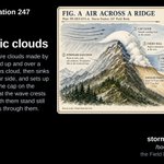


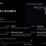


Every warning, watch, advisory and statement in force across the United States, and every storm tracked, on one map with the radar and its forecasts. Each alert in full, the most severe first, with a report of its own. stormstation247.com/alerts


Storm Station 247 retweeted
December with @GoogleDeepMind looking up!
stormstation247.com/aurora
Tropical Cyclone Xavier has 85 mph winds, gusts to 105 mph, category 1 strength, centered near 11.4S 163.5W, about 525 miles east northeast of Pago Pago, moving toward the west southwest at 8 mph, as of November 20, 12:00 UTC. stormstation247.com/storms/s…

4
37
Flash Flood Warning
Until Nov 20, 12:30 PM EST · 2 h 25 min left
Brevard, FL; Seminole, FL; Volusia, FL
Flash flooding radar indicated
stormstation247.com/alerts#2…

4
60


Severe Thunderstorm Warning
Until Nov 19, 9:45 AM PST · 37 min left
Los Angeles, CA
Tornado possible
Gusts 60 mph
Moving east northeast at 29 mph
stormstation247.com/alerts#2…
5
53
Monterey, CA
Flash Flood Warning for the Plaskett burn area.
Until 530 PM PST.
Doppler radar and automated rain gauges indicated heavy rain falling over the Plaskett Burn Area.
stormstation247.com/alerts#2…
4
35
Special Marine Warning
Biscayne Bay; Coastal waters from Deerfield Beach to Ocean Reef FL out 20 NM; Waters from Deerfield Beach to Ocean Reef FL from 20 to 60 NM excluding the territorial waters of Bahamas
Until Nov 18, 3:00 PM EST · 46 min left
stormstation247.com/alerts/2…

4
131


Tropical Cyclone Xavier has 125 mph winds and a pressure of 949 mb, category 3 strength, centered near 10.3S 163.9W, about 535 miles east northeast of Pago Pago, moving toward the south at 2 mph.
stormstation247.com/storms/s…
Storm Station forecasts show continued weakening to tropical storm strength or below by late November due to shear and dry air, with slow southward or southeastward motion and no major landfall expected beyond current impacts in the Cook Islands.
stormstation247.com/storms


Biscayne Bay; Coastal waters from Deerfield Beach to Ocean Reef FL out 20 NM
Until Nov 18, 12:00 PM EST · 38 min left
Waterspout possible
Moving west northwest at 24 mph
stormstation247.com/alerts/2…

Special Marine Warning
Bayside and Gulfside from Craig Key to West End of Seven Mile Bridge; Gulf of America from West End of Seven Mile Bridge to Halfmoon Shoal out to 5 Fathoms; Hawk Channel from Craig Key to west end of Seven Mile Bridge out to the reef
stormstation247.com/alerts/2…

4
73