

Sends latest info-Tweets on existing Tropical Cyclones affecting the Philippines. Data analyzed from Global Typhoon Models. Managed by: David Michael V. Padua.
Naga City, Philippines
Joined May 2011
- Tweets16.5K
- Following146
- Followers6.7K
- Likes118


🌏 MJO Outlook #17 | Nov 7, 2026
🇵🇭 Nov 8–21: Suppressed cloud development early; easing later. Models differ on MJO progression. Amihan/shear lines can still bring heavy rain.
T2k analysis; general reference only. Follow DOST-PAGASA.
#MJO #Amihan #Typhoon2000

🛰️ T2k/NCF 48-hr Outlook | Nov 4–6, 2026
🌬️ Amihan: Extreme N Luzon; winds 30–60 km/h, rough seas.
🌦️ Northeasterlies/easterlies: passing showers & localized storms.
🌀 IN-FA forecast to stay outside PAR, recurving toward waters south of Japan.
#Typhoon2000 #PHWeather

PILIPINAS, MANANATILING TUYO! May Pulu-pulong Pag-ulan Pa Rin! youtu.be/hCXUrK4ixRA?si=xOsp… via @YouTube #WeatherTV #StormAlert #Infa #SuperElNiño #Amihan
PHILIPPINES STAYS DRY! Only Isolated Showers! youtu.be/ICwrZB_WbtY?si=aN-x… via @YouTube #WeatherTV #StormAlert #Infa #SuperElNiño #Amihan
T2k/NCF 48-hr GraphSat | Oct 30–Nov 1
Amihan over extreme N Luzon; northeasterlies bring showers to parts of Luzon.
IN-FA: 220 km/h, outside PAR. Entry less likely.
For reference only; consult DOST-PAGASA for official updates.
#Typhoon2000 #Undas2026

Balik na ang Amihan at Shear Line! | Super Typhoon In-fa Update youtu.be/ucwBGF1Nm0g?si=N9hH… via @YouTube #WeatherTV #StormAlert #Infa #SuperElNiño #Amihan #Shearline
Amihan & Shear Line Return! Super Typhoon In-fa Update youtu.be/qrCN7fmbZuI?si=zvhl… via @YouTube #WeatherTV #StormAlert #Infa #SuperElNiño #Amihan #Shearline
🌏 T2k/NCF GraphSat | Oct 28–29, 2026
Amihan affects N/E Luzon. Shear line brings rain to Bicol, Quezon, Marinduque & Aurora.
Typhoon IN-FA: 195 km/h, outside PAR. Entry uncertain.
For reference only. Follow DOST-PAGASA for official updates.
#Typhoon2000

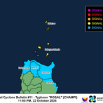
🌀 TYPHOON ROSAL (CHAMPI) WEAKENS!
Still packing 185 km/h winds, with a massive 1,300-km circulation!
⚠️ Batanes: Strong winds, heavy rain
🌊 Hazardous seas: 2–7m
📍 Taiwan threatened; PAR exit Saturday.
📡 FULL STORMWATCH #02:
typhoon2000.org/rosal26_02/


Update sa Super Bagyong “ROSAL” (Champi) - Huwebes, 10/22/26 (Tagalog Ve... youtu.be/rI8w75WNI2I?si=s_jc… via @YouTube #WeatherTV #StormAlert #RosalPH #Champi #SuperElNiño
STY “ROSAL” (Champi) Update - Thursday, 10/22/26 (English Version) youtu.be/C87isZ2IEag?si=G-FL… via @YouTube #WeatherTV #StormAlert #RosalPH #Champi #SuperElNiño
🌀🚨 SUPER TYPHOON ROSAL (CHAMPI) THREATENS TAIWAN!
Peaked at 295 km/h! Batanes & Northern Cagayan may experience gusts of 60–100 km/h. Dangerous seas (2–7m).
📡 FULL StormWatch analysis, tracks & graphics:
typhoon2000.org/rosal26_01/
#ROSAL #CHAMPI


🌀 Oct 20–21 | Super Typhoon CHAMPI (ROSAL): Category 5, 285 km/h, now inside PAR. Forecast recurvature lowers the Batanes threat; track may change. Trough affects Bicol/E Visayas; northeasterlies affect N/E Luzon. Waves/swells: 3–7 m along N/E Luzon coasts. #T2kNCF


Update sa Super Bagyong “CHAMPI” - Linggo ng Gabi, 10/18/26 (Tagalog Ver... youtu.be/a93Qcu0EzCI?si=Kokz… via @YouTube #WeatherTV #StormAlert #RosalPH #Champi #SuperElNiño #Amihan

STY “CHAMPI” Update - Late Sunday Evening, 10/18/26 (English Version) youtu.be/EAADmraJPw8?si=CGSf… via @YouTube #WeatherTV #StormAlert #RosalPH #Champi #SuperElNiño #Amihan


Bagyong “CHAMPI” Dadaanan Ang Guam Ngayong Linggo…Papasok ng PAR sa Martes. youtu.be/DIyXYuUvk5s?si=b6aQ… via @YouTube #WeatherTV #StormAlert #Champi #RosalPH #SuperElNiño #Amihan

Typhoon “CHAMPI” To Pass Over Guam On Sunday…Will Enter PAR On Tuesday. youtu.be/drgdm6W7oWw?si=-tcX… via @YouTube #WeatherTV #StormAlert #Champi #RosalPH #SuperElNiño #Amihan
