







Pinned Tweet
🌍 Do you study or teach Geography at KS4 - 5 and want to highlight the importance of location and maps?
💻 Geospatial UK has been created to broaden awareness and understanding of geospatial skills and technologies and its applications for the future
geospatialuk.org/

🤔 Considering a Summer placement?
Read about @UniofNewcastle's Geospatial Engineering student, Mohamed Al Hashmi's Summer placement experience with @bp_UK.
Read more 👇
geospatialuk.org/post/consid…

🎉 We are pleased to introduce our new #supporter @TrimbleNews!
🌎 We are looking forward to working with you to inspire the next generation of #geospatial experts!
@KORECGroup
🚗With over 11,000km of dual carriageway, find out how the Danish Road Directorate used #pointcloud data and #panoramicimagery to #map their roads 👇
geospatialuk.org/post/mainta…
@LeicaGeo_UKI • @RICSnews • @bp_UK • @THS_UKI

🤔 Considering an Industry Placement?
Jennifer, BSc #GeographicInformationScience student at Newcastle University, shared her experience of a Year in Industry.
👉geospatialuk.org/post/consid…
#GIS #Undergraduate #Degree #Student #Subject #YearInIndustry

🗨 "It’s quite rare that a degree has so many applications that you can take your #skill set and apply it to whatever subject area interests you."
@LeicaGeo_UKI • @RICSnews • @bp_UK • @THS_UKI
📚 Back to #school? 🏫
👀 Looking for #FREE workshops, resources or careers info?
Check out GeospatialUK.org for a range of geospatial topics including #Geography, #Maths and #Physics!
@LeicaGeo_UKI • @RICSnews • @bp_UK • @THS_UKI
#Teacher #Workshops #FreeResources
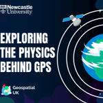
🤔 Ever wondered how #GPS knows where you are on Earth? 🌍
It's all about #physics! 🛰
Book our NEW #workshop for your class this term to explore the physics behind GPS!
👉 stem.ncl.ac.uk/?s=Exploring+…
#Teachers #Geography #Maths #Geospatial #NewTerm #FREEWorkshop

Think #3DLaserScanning can only be used for buildings? 🏢
❗Think again❗
Digital Dry Dock use 3D laser scanners to capture a 20-meter classic racing #yachts! ⛵
Find out how they did it 👇
geospatialuk.org/post/digita…
🎂 Here at Geospatial UK, we're celebrating #1Year of inspiring the next generation of geospatial experts!
🌍 We've been busy over this past year engaging with young people to raise awareness of the #geospatial sector and help them make the right decisions for their #future.
👏 A huge thanks to our outstanding network of supporters:
@HexagonSIG • @LeicaGeosystems • @RICSnews • @bp_plc • @HydSocUKI • @KORECGroup • @Plowman_Craven • @m_geospatial • @MalcolmHughesUK • @Survey_Solution • @fugro • @UniofNewcastle
3D laser scanning allows #GeospatialEngineers to survey their site even when certain areas are inaccessible!
🏥 Find out how BAM Ireland use #3DLaserScanning to construct the New Children's Hospital (NCH) in Dublin 👇
geospatialuk.org/post/using-…
For those that love #numbers, the new hospital will...
... Be 7️⃣ storeys high
... Include 3️⃣2️⃣0️⃣ individual inpatient rooms
... Support 2️⃣2️⃣ operating theatres
#Geospatial #GeospatialUK #Surveying
@LeicaGeosystems • @RICSnews • @bp • @HydSocUKI
🌊 #Flood risk and #CoastalErosion are serious issues for authorities in north west England.
The councils take these risks very seriously, having suffered severe coastal flooding a number of times in the early 2010s.
These factors, plus the coastal geomorphology, makes the north west area sensitive to the effects of climate change.
Find out how #surveying helps to protect the coastlines of the North West British Isles 👇geospatialuk.org/post/protec…
