

One stop shop for Radar, Satellite & Forecast Models inc. ECMWF & exclusive 1x1 km SwissHD. Apps: https://teapaw.org/t.co/fZZbkRWs6B Tweets by @es5nhc (TT)
United States
Joined December 2016
- Tweets9.1K
- Following700
- Followers18.8K
- Likes531




Pinned Tweet
We now offer a fully automated weather API service. For Adfree Plus users a hobby API Key is included and can be immediately used for smart-home automation, hobby or your own widget.
For more information check out: business.meteologix.com/en/a…
#weatherAPI

2
9
14,182
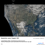
Here is a look at the imagery generated from the data of the GOES-19's 5-minute CONUS sector this noontime:
weather.us/satellite/usa/sat…
TT

2
601
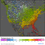
Here's a look at measured air temperature across the continental USA this forenoon:
weather.us/observations/usa/…
TT

1
569
Here's a look at the continental USA radar composite this noontime:
weather.us/radar-us/usa/
TT
3
709
Severe thunderstorms are possible this afternoon into tonight in the southern and central Plains, with the highest risk in parts of Oklahoma and Kansas, where the SPC has highlighted a level 3 out of 5 risk.
Radar from Wichita, KS:
weather.us/radar-us/kansas/r…
TT
636
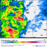
A heavy rain event is likely in the Four Corners region on Sunday. The region has already recently experienced a heavy rainfall event, which factors in to possible impacts during the new one.
GFS 24 hour rain scenario valid at 6 AM CST Monday: weather.us/model-charts/gfs-…
TT

525
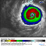
A typhoon warning is in effect for Alamagan, Pagan, and Agrihan in CNMI as Super Typhoon In-fa is expected to pass through far northern Marianas on Friday. Preparations should be rushed to completion by Friday morning local time.
Satellite imagery:
weather.us/satellite/1471-e-…
TT

2
582
The SPC has highlighted a level 2 out of 5 risk of severe weather today for parts of Minnesota and Wisconsin. Isolated tornadoes, damaging winds and large hail could be possible this afternoon. Scenario from CONUS Swiss HD 4x4:
weather.us/model-charts/swis…
TT

584
Shown here is a map of minimum temperatures across the continental USA in the preceding 12 hours as of 7 AM CDT this morning:
weather.us/observations/usa/…
TT

614
Here's a look at air temperature across the continental USA this forenoon:
weather.us/observations/usa/…
TT

1
1
604
Here is a look at observed temperature across the continental USA this morning:
weather.us/observations/usa/…
TT

530
Here's a look the visible satellite imagery of the continental USA this noontime based on data from GOES-19. Standing out on the right is a nor'easter, which is expected to cause hazardous coastal conditions along the Mid-Atlantic through mid-week.
weather.us/satellite/usa/sat…
TT

2
644
The eye of Typhoon Champi has made its closest approach to Guam. An Extreme Wind Warning that was issued for Southern Guam as the worst winds approached will be expiring later this hour.
weather.us/radar-us/1456-e-1…
TT

4
820
This is going to be a really close call for southern Guam as Typhoon Champi's eyewall with the worst conditions is about to make its closest approach in the coming hours after explosive intensification over the past day.
Local radar:
weather.us/radar-us/1456-e-1…
TT
Wind gusts as of 1:50 AM ChST. Even if the eyewall narrowly stays offshore, it is still dangerous out there with winds capable of causing damage. Any jog to the north by the eye would be bad news.
weather.us/observations/1471…
TT

414
Severe Tropical Storm Champi is intensifying and is headed toward Guam which it could hit as a typhoon this weekend. A typhoon warning is in effect for Guam and Rota.
weather.us/satellite/1469-e-…
TT
2
690
Here's a look at the radar composite of the continental USA this noontime. Severe weather risk continues today in the Southern Plains with a level 2/5 risk highlighted by the SPC. There is also a level 1/5 risk in parts of Ohio Valley and Mid-Atlantic
weather.us/radar-us/usa/
TT

556
The SPC has also highlighted a level 2 out of 5 risk of severe weather for parts of central and southern Plains into Lower Missouri Valley for this afternoon into tonight. One of GOES-19's meso sectors is currently watching the region:
weather.us/satellite/oklahom…
TT
2
652
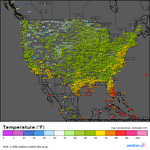
Here's a look at the air temperature across the continental USA this noontime:
weather.us/observations/usa/…
TT

600
Update: Isaias is now a major hurricane with maximum sustained winds to 120 mph according to the NHC.
TT

GOES-19 is currently scanning Hurricane Isaias at a 30-second interval as the hurricane is close to major hurricane strength with maximum sustained winds up to 110 mph. Isaias could still be a serious hurricane by the time it makes landfall tonight.
weather.us/satellite/848-w-2…
TT
1
652
GOES-19 is currently scanning Hurricane Isaias at a 30-second interval as the hurricane is close to major hurricane strength with maximum sustained winds up to 110 mph. Isaias could still be a serious hurricane by the time it makes landfall tonight.
weather.us/satellite/848-w-2…
TT