

Assistant professor @NcUofficial CSRSR, Taiwan. Remote sensing & data science of icy worlds 🛰🌏 + ❄🧊. Also loves 🏂🏕. Born at 351 ppm CO2. Views = own.
Zhongli, Taiwan
Joined December 2017
- Tweets476
- Following475
- Followers407
- Likes411




Whyjay Zheng retweeted

立正大学の永井先生が、ネパール・中国国境付近で発生した大規模土石流災害の衛星画像解析結果をまとめてくださっています。
典型的な氷河湖決壊洪水(GLOF)とは異なり、氷河末端部の大規模な崩落を起点として発生した土石流の可能性が高いとの見解だそうです。
mapg4d.jp/?p=314
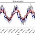
Sharing a study led by Dr. Francesca Baldacchino, which I contributed to! We resolved the seasonal variation in glacier speed and found that speed-ups and slowdowns in ice flow are associated with water trapped beneath the glaciers.
👉 doi.org/10.1016/j.srs.2025.1…

Whyjay Zheng retweeted

😬Almost 40% of glaciers in Central Europe were lost between 2000 and 2023.
A new study, using data from various satellite🛰️observations -including @esa_cryosat mission- reveals alarming insights about the declining rate of glaciers.
Read the full study🔗 esa.int/Applications/Observi…

ALT Glaciers in the Chugach Mountains of Alaska
RP @iamdonovan.bsky.social: 🚨dataset/paper alert!🚨 Our community effort to identify lake-terminating glaciers in the Randolph Glacier Inventory is published in ESSD! check out the associated dataset here: doi.org/10.5281/zenodo.15524…
doi.org/10.5194/essd-18-1665…
Whyjay Zheng retweeted
📊Access research-ready global climate data records!
ESA’s Climate Change Initiative provides python code examples and extensive documentation to navigate our Toolbox. Get fast access to about 500 robust, validated satellite records via our Jupyter Lab. Start using this pre-defined, free-of-charge environment and become a pro at accessing climate data.
Check out the new page here: climate.esa.int/en/data/tool…

Whyjay Zheng retweeted

Exciting news for #QGIS users! The "Google Earth Engine Plugin for QGIS" is now updated with new no-code tools that allow you to download and use #EarthEngine datasets in QGIS easily. Check out my newly contributed tutorials for the latest plugin (1/n) 👇

