

BSc(Hons) Geoinformatics Student🌍 TUKS📚
South Africa
Joined May 2020
- Tweets20
- Following61
- Followers25
- Likes374


Zelbé Boshoff retweeted

Contribute to this citizen science effort. Report your daily rainfall at uprain.co.za @geobach_za @Rehema1234

Zelbé Boshoff retweeted

Please help answer this short survey related to COVID-19 vaccine opinions.
pretoria.eu.qualtrics.com/jf…
#COVID19 #SouthAfrica #COVIDVACCINE #vaccine #VAXXED #coronavirus #antivaxxers

Zelbé Boshoff retweeted

I achieved an exciting milestone today as autoesda - a python library developed as part of my honours project is available for download from @pypi and @condaforge 👨💻👾 A special shout out goes to @giswqs for your extremely informative YouTube Playlist🙏


Zelbé Boshoff retweeted

@Zelbe04 is now presenting her daily rainfall map for South Africa. Check it out here, zelbe04.github.io/research_p…
Zelbé Boshoff retweeted

Day 30: Metamapping and the final day of #30DayMapChallenge 😅 Today's map, created by @Zelbe04 , shows an overview of the maps produced by our team, @GeotoZee , @geobach_za , @terisha_pillay1 , @DrNicNacks and @Zelbe04

Zelbé Boshoff retweeted
Day 25: An Interactive map for the #30DayMapChallenge @Zelbe04 created this map for her honours research project. The map visualizes rainfall🌧 data scraped from OpenWeatherMap and SAWS. The interactive map can be found here zelbe04.github.io/research_p…

Zelbé Boshoff retweeted
Day 20 of the #30DayMapChallenge and today's challenge is to map Movement. Commercial Airliners🛩 trasport millions of people each year between different locations, which is why @Zelbe04 mapped the 10 busiest air routes in Africa based on the number of passengers transported.

Zelbé Boshoff retweeted

My summary of last week's #gischat #mappymeme

ALT Oh you do GIS? is that like Google Maps? "You understand you just insulted my entire race of people? But yes.
Zelbé Boshoff retweeted
Day 5 of #30DayMapChallenge and the 1st data challenge 💪. The Challenge is OpenStreetMap.
Today's map was created by @Zelbe04 and shows the total kilometres of roads 🛣 mapped in OSM per country.


Zelbé Boshoff retweeted

Generate your own world map, choose the centering and your projection and much more, ...
worldmapgenerator.com/en/
#worldmapgenerator #maps #map #mapmaking #mapmaker #juliamia #world #mapping #projection
@MapPornTweet
Zelbé Boshoff retweeted
Calling ALL University of Pretoria students to participate in UPMappers 2021 Crossword Competition.
Complete the data visualization crossword and you will be placed in a raffle to win R500.
Crossword: drive.google.com/drive/folde…
Submit here: forms.gle/7f1DZgHPhXs7ahT87
Deadline: 31 March

For my #30DayMapChallenge comeback I decided to do a collaboration with @DrNicNacks .
Day 19: NULL Values

Day 19: NULL Values
#30DayMapChallenge
On holiday and collaborating with a number of good friends such as @Zelbe04

#30DayMapChallenge
Day 6: Red
In honor of the Queen👑, @taylorswift13 , I have mapped Countries where her Red album reached Top 10 in the country's charts.


For day 3 of the #30DayMapChallenge I took inspiration from one of my favorite shows, Gossip Girl. I've decided to map Manhatten, New York using colours that were used in Gossip Girls opening credits.
Day3: Polygons

#30DayMapChallenge
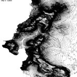
Day 2 : Lines
Contour Lines showing elevation in the Table Bay area of Cape Town, South Africa.

Zelbé Boshoff retweeted
@UPmappers is hosting a virtual geospatial tech event for school students interested in geoinformatics and geography on 10 October 09:00 (UTC+2). To participate, register here, forms.gle/eRj4eePFSCTnpmzt6

Zelbé Boshoff retweeted

New National Spatial Planning Data Repository (NSPDR) is available for testing👍🏾@FuthiGama @DRDLR_online. Export of data points in area of interest works nicely nspdr.splum.drdlr.gov.za/por…

