
An Atlas for Curious Minds. Order the book here: https://teapaw.org/t.co/t7QLqVHTr3 & Join our free newsletter: https://teapaw.org/t.co/WZmucogM64
London and around the world
Joined August 2014
- Tweets32.2K
- Following303
- Followers217K
- Likes1K




Pinned Tweet
Join our nesletter here and get the newest and best brilliant maps delivered to your inbox weekly --> brilliantmaps.beehiiv.com/su…

If The World Were 100 People…
More stats if there world were 100 people: brilliantmaps.com/if-the-wor…


5 Interesting Facts About the 1868 Election
1. Ulysses S. Grant, at 46, became the youngest president yet elected.
2. It was the first election in which Black men voted in large numbers, under Reconstruction governments in the South.
3. Texas, Virginia and Mississippi, not yet readmitted, cast no electoral votes.
4. Grant's entire platform fit in four words: 'Let us have peace'.
5. Horatio Seymour never wanted the nomination, the convention drafted him over his own protests.
More about the election: brilliantmaps.com/us-electio…

For the rest of your life, you can only eat food from one of these Asian regions. Which do you choose?

Best Presidential Results By Party In Texas Between 1900 & 2024
See all 49 other states: brilliantmaps.com/best-presi…

The Origin of Each US State’s Name: Exploring the Etymology Behind Every State
Note some of these are disputed, see the full list: brilliantmaps.com/state-name…

Number of Cities With A Tram System in Europe
brilliantmaps.com/tram-syste…

Biggest Sources of Electricity by US State & Canadian Province
Credit: Visual Capitalist Elements
See Europe & Asia: businessenergyuk.com/knowled…

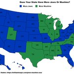
Does Your State Have More Jews or Muslims?
Full numbers by state: brilliantmaps.com/jews-musli…

Top UK Imports From European Countries
Which one surprises you the most?
Source: merchantmachine.co.uk/uk-imp…

Most Common Foreign Born Nationality in the USA & Canada
brilliantmaps.com/foreign-us…

What Each State Has The Largest Of In The World
Full List: brilliantmaps.com/largest-th…

Can You Name The 3 Countries That Border The UK (including BOT and Crown Dependencies)?
The answer: brilliantmaps.com/map-of-the…

All of Italy's various Mafia Groups On One Map
More Mafia Maps: brilliantmaps.com/where-the-…

Which Language Does Every Country Want to Learn In Europe
brilliantmaps.com/which-lang…

The Impact of World War One On Each Major Power's GDP
Credit: Geo Universe
Also see World War 1 Casualties As A Percentage of Pre-War Population: brilliantmaps.com/ww1-casual…

Declassified 1944 Detailed Topographic Map of China Created By The CIA
In 1944, China was heavily involved in Second Sino-Japanese War, which was part of World War II.
Japanese forces launched Operation Ichi-Go, the largest offensive of the war in China, capturing territory and important railways while trying to destroy American air bases.
Although China suffered enormous losses and hardship, Chinese forces continued resisting Japan with support from the United States and other Allies, helping tie down large numbers of Japanese troops.
More 1940s Declassified CIA Maps: brilliantmaps.com/cia-maps-1…

This bit of London with 21,725 people squeezed into 1 sq km has the highest population density of anywhere in the UK.
Yet it's less than half as dense as the densest European city: brilliantmaps.com/densest-ne…
credit: @undertheraedar

Declassified 2015 Colombia Coca Cultivation Map Created By The CIA
This 2015 CIA map visualizes the distribution of coca cultivation across Colombia in 2013, highlighting the geographic foundations of the global cocaine trade.
Shaded regions indicate coca-growing density, with the heaviest concentrations located in Colombia’s remote southern and western departments, particularly Nariño, Putumayo, Cauca, Guaviare, and parts of the Pacific coastal region.
The map reveals how coca cultivation was concentrated in isolated jungle, mountain, and border regions where weak state control, difficult terrain, and long-running insurgencies allowed illegal economies to flourish.
The historical context is tied directly to Colombia’s decades-long internal conflict involving groups such as FARC, right-wing paramilitaries, drug cartels, and the Colombian government.
By the early 2010s, Colombia had spent more than a decade implementing “Plan Colombia,” a massive US-backed anti-narcotics and counterinsurgency campaign involving aerial fumigation, military operations, and rural security programs.
Although cultivation declined from peak levels in the early 2000s, coca production remained deeply embedded in regions where armed groups taxed or protected growers and traffickers. The map captures the period just before peace negotiations with FARC culminated in the 2016 peace agreement.
The map remains important today because coca cultivation continues to shape politics, violence, migration, and organized crime across Latin America.
Many of the same regions shown here are still centers of narcotics production and armed group activity, even after FARC’s demobilization. The map also demonstrates a broader geopolitical reality: drug economies often emerge where state authority is weakest and economic alternatives are limited.
Visually, the map reflects the CIA’s focus on linking geography to security threats.
Rather than simply showing drug production totals, it emphasizes terrain, remoteness, and regional concentration, illustrating how mountains, jungles, and borderlands became critical infrastructure for one of the world’s most valuable illicit trades.
More Declassified 2010s CIA Maps: brilliantmaps.com/cia-maps-2…
