

Maps, data, stats - that kind of thing. Working on Atlas of Modern Britain, to be published by Penguin Random House in 2027. Also a bit of training/consulting.
Sheffield, England
Joined July 2011
- Tweets25.2K
- Following3.9K
- Followers42.8K
- Likes21.1K
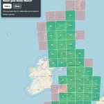
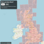




I've updated my 'have you been to this OS grid tile' map game - I've managed to get to 40 of them, but still need to plan an expedition to the tiny bit of land in OV - try it here automaticknowledge.org/os-10…


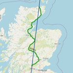
Back in 2018 me and a colleague used an algorithm to map an alternative set of Scottish councils (not a proposal and my views on the whole thing have changed) - this is what came out of it so it will be interesting to see what the current proposals lead to

am I back on here? who knows, but all the recent talk of local gov reorganisation has been making me look again
Alasdair Rae retweeted

In 1998 and 1999, four of Britain's regions and nations voted for devolution. Since then, all have overperformed the rest of the country economically. Even Wales.
.
Also a bit of a rant about how London isn't the only big city in Britain. tomforth.co.uk/agglomeration…


Alasdair Rae retweeted

The Perimeter is out today — my journey around the entire British coastline on foot, captured in photographs and words.
To celebrate release day, I'm giving away a free signed copy. To enter:
1. Follow me
2. RT this tweet
That's it!
Ends midnight Sunday 18th May. UK only.
Buy the book & events 👉 is.gd/P2BW67
#ThePerimeterBook #BookGiveaway #NewRelease #PhotobookLove #Photography


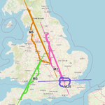
The new 'how much longer would this line look if it wasn't wiggly?' tool is coming along nicely and has so many real world applications I can't begin to list them


It's ALCS day again and the mystery continues - based on the trend I'm thinking 2027 might be another jackpot year but really who knows what the formula is


Alasdair Rae retweeted

Huge win! Government announces plans to open up the Land Registry.
If delivered, will finally reveal more about who owns land in England and Wales.
Read my blog post for more details & how you can write to the Minister to make sure this now happens:
whoownsengland.org/2025/03/0… 🧵

Alasdair Rae retweeted

MAP MEN BOOK!!! 🗺️📖
@markcooperjones and I are excited to announce we are releasing a MAP MEN BOOK this Autumn - all about maps that went wrong.
We haven’t designed the cover yet.
Pre-order your copy here
lnk.to/MapMen
@HarperCollinsUK

ALT Mark and Jay hold a copy of Paul Hollywood's Bread book. They've scribbled out the title and written "Map Men Book"
Alasdair Rae retweeted

Buses in the United Kingdom complete more than three billion journeys each year.
@CraigTaylorViz gives us a stunning look into some of these buses and their routes.
View the complete series: maps.com/a-day-in-the-life-o…
#maps #dataviz
Is this new gmail assistant telling me I need to polish my writing or is it suggesting I write in Polish instead? I can't quite figure it out

Alasdair Rae retweeted
Fantastic work by @LukeStrange22 at @OpenInnovates who's extended work on bus tracking I did (and still do) in the West Midlands to North West England and Yorkshire thanks to Liverpool City Region funding. Blog post here, and I'll show examples next. open-innovations.org/blog/20…
Alasdair Rae retweeted
I've had a few direct requests for my version of the Microsoft US building footprint data, which I chunked up state-by-state and added county name and FIPS codes to and put here for anyone to use (gpkg format, loads fast in QGIS, also fine in ArcGIS Pro)
automaticknowledge.co.uk/us-…

I've had a few direct requests for my version of the Microsoft US building footprint data, which I chunked up state-by-state and added county name and FIPS codes to and put here for anyone to use (gpkg format, loads fast in QGIS, also fine in ArcGIS Pro)
automaticknowledge.co.uk/us-…
the original format was geojson, often very slow loading and didn't have county names or FIPS codes so filtering was a bit more cumbersome - this is the 2022 update, a bit of processing info here
github.com/microsoft/USBuild…

it's been on the website for a few years and updated to the latest version for anyone to use - hopefully it's useful and saves people some time
automaticknowledge.co.uk/res…
