

Commodity Weather Group, LLC (CWG) helps its clients manage and mitigate the weather’s important impacts on agricultural and energy commodities.
Bethesda, MD, USA
Joined March 2014
- Tweets6.4K
- Following68
- Followers9.7K
- Likes557
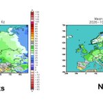



Colder push next two weeks not enough to push Europe/Black Sea wheat into dormancy. commoditywx.com/news/2026102…

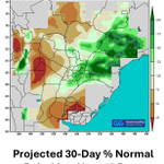
Paraná fieldwork has not shown severe impacts on the latest progress report, following another wet week. commoditywx.com/news/2026102…

Medium-range models reaching toward middle November with powerful northeast Pacific trough and stretched PNA ridge preventing cold air access to Canada and U.S.


Powerful Pacific jet stream offsets/outweighs any immediate influences from next week's Sudden Stratospheric Warming expectation (thanks to super Niño).

Models have been advertising weaker warmth or cooler variability in 11-15 day, but have struggled to advance that into more skillful 6-10 day, with warmer changes for Midwest, East, and South.

Parana to SE Minas Gerais corn/soy/sugar/wheat likely remain the focus for surplus moisture through early November. commoditywx.com/news/2026102…

IA remains 20% behind normal on corn harvest; KS wheat seeding advanced notably in this week's USDA crop progress report. commoditywx.com/news/2026102…

Unlike last year at this time, Euro weeklies keep Pacific split flow going into early December, keeping Canada very warm, and probably not warm enough for Lower 48. Powerful El Niño influences seen to continue.

Super El Niño, with a dash of strong -PDO, is deflecting stratospheric warming influences for North America. Strong Pacific jet stream flow undercuts blocking efforts in the North Pacific.

Earliest SSW in recorded history is forecast next week, with near real-time impacts for colder European trends, as Arctic and North Atlantic Oscillations veer negative.

Massive medium-range modeling demand losses this past weekend, as November kicks off momentum to potentially be warmest on record.

Watching unusually early first-of-season stratospheric warming in Northern Hemisphere. But this year's super El Niño could significantly outweigh anything else, such as this factor.

AI ensemble clusters show more support for continued warm to very warm pattern deep into 1st week of November for Midwest, East. and South.

Another late 11-15 day pattern battle between traditional (NWP) models, including the European, and the AI models. Pacific pattern looks warmer/bearish with troughing into the West Coast.

Record-breaking, super El Niño still on track to peak in Nov-Dec, but maintain its super-status through winter months.

End of 11-15 day is inside the first week of November, and all-ensemble mean/clusters in good agreement on continued strong Pacific jet influence for warm Lower 48 pattern.

Models lose U.S. heating demand over past 24 hours with warmer changes for East, South, and Midwest.

