

Colorado River Historian and Provocateur
Arriola, Colorado
Joined June 2009
- Tweets8.6K
- Following2.6K
- Followers891
- Likes1.1K


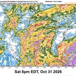


We are getting anither wave of small but pretty violent cells at Arriola.
Good remote reporting by @jfleck.
Farmington Flood.
“The gage at Bloomfield blew out late Thursday night, reading 13,100 cubic feet per second (cfs) before it failed. Downstream, the wave blew out the gage at the Bolack Ranch Bridge 7 hours later, running at 17,100 cfs. By the time the USGS gage on the San Juan at Farmington blew out Friday afternoon, the river had risen to ~32,600 cfs, the most water recorded there since the 1930s and more than double the biggest peak since Navajo Dam was completed in the early 1960s.”
inkstain.net/2026/10/farming…

Mr. Brightside Powell Tracker
Since low 9/15 Powell is up 470,000 AF
Versus Bureau SEP26_MIN projection up 553,000 AF
Add in Flaming Gorge DROA we've done the 1 MAF Lower Basin demanded :)
I technically need to measure FG against APR26 projection for it to be new "but for" water

All the old paintings on the tomb
They do the sand dance, don't you know?
If you move too quick (oh-way-oh)
They'll fall down like a domino
All the boys are men by the Nile
They got the money on a bet
All the crocodiles (oh-way-oh)
They snap their teeth on your cigarette
The foreign types with the hookah pipes say
(Way-oh, way-oh, way-oh, way-oh)
Walk like an Egyptian
The blonde waitresses take their trays
They spin around and they cross the floor
They've got the moves (oh-way-oh)
You drop your drink then they bring you more
All the school kids so sick of books
They like the punk and the metal band
When the buzzer rings (oh-way-oh)
They're walking like an Egyptian
All the kids in the marketplace say
(Way-oh, way-oh, way-oh, way-oh)
Walk like an Egyptian
Slide your feet up the street, bend your back
Shift your arm then you pull it back
Life's hard you know (oh-way-oh)
So strike a pose on a Cadillac
If you want to find all the cops
They're hanging out in the donut shop
They sing and dance (oh-way-oh)
They spin the club, cruise down the block
All the Japanese with their Yen
The party boys call the Gremlin
And the Chinese know (oh-way-oh)
They walk the line like Egyptian
All the cops in the donut shop say
(Way-oh, way-oh, way-oh, way-oh)
Walk like an Egyptian
Walk like an Egyptian
youtube.com/watch?v=JA0VfqtI…

Brenda Burman, @CAPArizona
GRAD592 10/19/26 - Colorado River Lower Basin Perspectives
@COWaterCenter
youtu.be/Eqo8T3uql5Q
Ed Millard retweeted

Animas River at 11,200 cfs this afternoon at the whitewater park in Durango. 400 cfs shy of the 1970 mark.
In the SNWA APA case (D. Nev.), one of the pro hac vice petitions was rejected. It looks like the Arizona attorney signed both as the applicant and on behalf of Arizona seeking her admission—someone else with authority needs to sign for the State of Arizona.
There was also a Motion to Extend/Shorten Time. Presumably the Interior defendants are seeking an extension, as the 60-day answer deadline after service is approaching. Haven’t reviewed it yet.

Animas still rising . San Juan in Pagosa may have topped. San Juan at Bluff going straight up again, nearing 20,000 CFS


“The San Juan River in Pagosa Springs hit “action stage” late Thursday. On Friday morning it reached 9,100 cfs and appeared to still be on the rise. That is the third highest recorded streamflow at that gage, following the flood of October 1911 (25,000 cfs) and the June 1927 flood (16,000 cfs).”
landdesk.org/p/rain-and-floo…

Worst of the Storm is moving to the plains. There may be another big storm after Halloween. Dolores thankfully peaked before flooding turned bad. Animas still rising, 8.1’ which is minor flooding. San Juan plateaued high, 15,000 CFS’ish


Ed Millard retweeted

‼️ Southwest Colorado ‼️
…is flooding, badly.
The rivers are running 20x as fast, the Animas river is currently at 5,980 cfs.
The San Juan River in Pagosa Springs is expected to crest at 15 feet at 5am.
Red Mountain & Wolf Creek Pass are both closed, along with many, many county roads.
Pray for the first responders, county commissioners, CDOT, it’s going to be a LONG night of evacuations.
Long.
Animals, horses, elderly, families, entire mobile home parks, mudslides, rock slides…it’s a scary night.
I expect the National Guard to be called in because it is so wide spread, so devastating.
The pictures at day break will tell the story.
Pray.


Powell tracker has instantaneous values for USGS gages, so spike going into Powell is current. 40 day deluge, biblical. USBR RISE reservoir storage is still lagging, its a daily API, Dolores river will move from minor flooding to moderate flooding at 7.3'.


San Juan gage at Bluff really popping, Mr Brightside as long as there isn't flooding on the res, my Powell tracker is a day behind this

Below is my new Mr Brightside Powell tracker, up 285,000 AF since it bottomed 9/15. Up 380,000 AF over the SEP26_MIN projection from before the pluvial. That would be nearly 8 years of contribution program for free. I need to add elevation delta.
I drove home from Copper Mountain 9/16 when it started. Wolf Creek nearly killed me, dark, pouring rain and fog.
There was just a huge spike in Powell mass balance inflow in bottom graph

Ed Millard retweeted
Below is my new Mr Brightside Powell tracker, up 285,000 AF since it bottomed 9/15. Up 380,000 AF over the SEP26_MIN projection from before the pluvial. That would be nearly 8 years of contribution program for free. I need to add elevation delta.
I drove home from Copper Mountain 9/16 when it started. Wolf Creek nearly killed me, dark, pouring rain and fog.
There was just a huge spike in Powell mass balance inflow in bottom graph