

Owner & Developer of Headcorn Weather, a Personal Weather Station located in the Village of Headcorn. Photographer, Weather enthusiast and member of Torro UK.
Headcorn, Kent , UK
Joined December 2010
- Tweets52.6K
- Following620
- Followers1.5K
- Likes27.9K






Nick Parnell retweeted

A change in the weather is on its way ⤵️
After a stormy period, the jet stream shifts northwards, allowing high pressure to build in from midweek onwards ⛅
This will bring largely settled conditions, but a risk of fog ☁️
Blustery showers, highs to 15⁰C in a fresh S'ly. Showers to start Tue, sunny later, 15⁰C.
Chilly o/night into Wed then sunny & 16⁰C.
Outlook: Cool nights, sunny spells by day with highs in the mid teens.
Data: Netweather
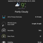
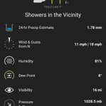
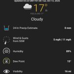
Live: Headcornweather via WeatherUnderground – at Busselton, Western Australia


Nick Parnell retweeted
Storm Boelo will bring wet and windy weather across the UK this weekend 🍃🌧️
Here are the details to help you make your plans 👇
Nick Parnell retweeted

Staff repositioning the Stones at #Stonehenge today ready for the the end of British Summer Time on Sunday ⏰⬅️ #BST #clocksgoback #thattimeofyear 😀
Lighter mornings, darker evenings and a WHOLE extra hour in bed! 🙏

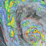
Current Satellite & Precip Radar. Image courtesy netweather.tv – at Esperance, Western Australia

Current Satellite & Precip Radar. Image courtesy netweather.tv – at Esperance, Western Australia

Nick Parnell retweeted
⚠️ Yellow weather warning issued ⚠️
Wind across parts of Wales and England
Friday 1000 – 2100
Latest info 👉 bit.ly/WxWarning
A wet & breezy start to Thursday, sunny later, highs to 15⁰C in a strong W'ly.
Wet with gales on Friday, highs to 15⁰C & winds gusting SE 40Mph at first, NW 50Mph later.
Sunny spells & showers thru the wkend, remaining windy with futher gales into the new wk.
Data: Netweather – at Esperance, Western Australia


Nick Parnell retweeted
The Met Office has named #StormAusten
The storm is forecast to bring strong winds and heavy rain across the UK on Thursday night and Friday
The strongest winds will be across the southwest of England and into southern Wales.
Stay #WeatherAware ⚠️
Variable cloud & bright spells today, highs to 13⁰C in a light SE'ly. Rain & 15⁰C Tue, showers & 13⁰C Wed.
Outlook: Sunny spells & showers, heavy with gales on Friday into the weekend.
Data: Netweather
Live: Headcornweather via WeatherUnderground – at Yanchep, Western Australia


Nick Parnell retweeted

Sunday Evening Video Discussion on the potential for a storm to develop later in the week. Video is about 14 mins and discusses the uncertainties, the synoptic background and the key things to watch on the models as we go through the week.
This video is not a forecast and does not go into immense detail of which locations are likely to see what strength winds. That detail will come later.
youtu.be/wgo4WSeQWv0

Nick Parnell retweeted
What’s this week got in store for you?
Increasingly unsettled with cloud, rain and some brighter spells, before turning wet and windy into Friday 🌧️💨
Nick Parnell retweeted
Potentially Likely to see the 1st named storm of the NW Europe Storm season later this week, either named by The UK Met Office / Met Eireann or Meteo France as we have the potential for a deep low to develop and move close to or near the UK.
There are currently significant uncertainties where this Low develops and how much it develops and there is plenty of Model Disagreement and there is ensemble disagreement too.
I will be recording a short video later today and will post this evening when i will run through the current uncertainties and go over the models and show why we have differences in the model evolutions.

Showers, heavy at times, highs to 12⁰C in a moderate N'ly. Sunny & 14⁰C Mon, showers & 14⁰C Tue.
Outlook: Sunny spells & showers, highs in the mid teens with some cold nights ahead.
Data: Netweather
Live: Headcornweather via WeatherUnderground – at Yanchep, Western Australia


Nick Parnell retweeted
Some lively showers across the southeast, with Kent and Essex likely to see the highest rainfall accumulations. Don’t rule out the odd rumble of thunder either! ⛈️
Early showers, sunny later, highs to 16⁰C in a fresh NW'ly. Cool o/night, sunny, windy & 14⁰C Sat, showers & 13⁰C Sun.
Outlook: Sunny spells, occasional showers, cool nights & daytime highs in the mid teens.
Data: Netweather
Live: Headcornweather via WeatherUnderground – at Yanchep, Western Australia


Nick Parnell retweeted
The Northern Hemisphere Jet Streams look set to intensify and become more zonal over the next 2 weeks according to the Global Models which are trending towards a very broad and intensifying Polar Jet of 180 Knt+ over Eastern Asia, and a strengthening Sub Tropical Jet emanating from the Eastern North Pacific and cutting east across The southern and SE united states. This is the Jet stream positions that i expect to be dominant through the much of the upcoming Winter
This over the Atlantic Space is likely to see an increasing risk of deepening depressions coming east across the Atlantic with the 00Z and 12 Z ECMWF both suggesting rapidly developing lows moving east towards the UK. The 00Z ECM was very developmental, the 12Z GFS has moved in that direction as well
In the shorter term, the high pressure block whilst impressive in the short term hardly looks likely to hang around long with the Jet likely to push it smartly eastwards, and part of the reason it will also get pushed east is the large upper vortex at 500mbs which will rotate west over Northern France and then merge and get absorbed into a 500mb trough coming in from the SW.
The PV will erode the edge edge of the high from both the South and SW and then West hence the intrusions will make significant inroads into the High and allow the Jet to punch east quite smartly next week.
Risk of some potentially very wet and windy weather coming in from the SW mid next week.


Nick Parnell retweeted
Ready for a taste of autumn? 🍂👇
After a warm day across the south today, temperatures will dip back towards seasonal averages tomorrow as a fresher airmass moves in 🌡️
Nick Parnell retweeted
High pressure is looking to build across the UK just in time for the weekend
But before that, there's rain and stronger winds to get through first ⤵️
After a mild night, variable cloud & showers to start the day, sunny & 21⁰C later in a strong W'ly. Cooler o/night into Wednesday then sunny & 19⁰C. Sunny spells & 21⁰C Thurs.
Outlook: Cooler nights, sunny spells & occasional showers, highs in the mid teens.
Data: Netweather – at Yanchep, Western Australia

