

Critical thinker. Spiritual scientist. Pureblood. @skywarn spotter for @NWSLouisville @0meterChasers
- Tweets7.4K
- Following1.4K
- Followers549
- Likes14.1K
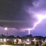





ALT This graphic displays a special weather statement plotted on a map. The statement is in effect until 9:00 PM CST. The statement includes Brownsville KY, Lindseyville KY and Bee Spring KY. A STRONG THUNDERSTORM WILL IMPACT NORTHERN WARREN and EAST CENTRAL BUTLER AND CENTRAL EDMONSON COUNTIES UNTIL 9 PM CST. The threats associated with this storm are wind gusts up to 40 MPH and penny sized hail. Seek shelter in a sturdy structure until the storm passes.

ALT This graphic displays a special weather statement plotted on a map. The statement is in effect until 8:30 PM CST. The statement includes Morgantown KY, Brownsville KY and Woodbury KY. A STRONG THUNDERSTORM WILL IMPACT NORTHERN WARREN and CENTRAL BUTLER AND WESTERN EDMONSON COUNTIES UNTIL 830 PM CST. The threats associated with this storm are wind gusts up to 40 MPH and half inch sized hail. Seek shelter in a sturdy structure until the storm passes.

ALT This graphic displays a special weather statement plotted on a map. The statement is in effect until 8:15 PM CST. The statement includes Beaver Dam KY, Hartford KY and Morgantown KY. The threats associated with this storm are wind gusts up to 40 MPH and half inch sized hail. Seek shelter in a sturdy structure until the storm passes.

ALT This graphic displays a special weather statement plotted on a map. The statement is in effect until 9:15 PM EST. The statement includes Elizabethtown KY, Radcliff KY and Bardstown KY. The threats associated with this storm are wind gusts up to 40 MPH and pea sized hail. Seek shelter in a sturdy structure until the storm passes.

ALT This graphic displays a special weather statement plotted on a map. The statement is in effect until 8:00 PM CST. The statement includes Morgantown KY, Rochester KY and Aberdeen KY. A STRONG THUNDERSTORM WILL IMPACT SOUTHWESTERN BUTLER COUNTY UNTIL 8 PM CST. The threats associated with this storm are wind gusts up to 40 MPH and half inch sized hail. Seek shelter in a sturdy structure until the storm passes.

ALT This graphic displays a special weather statement plotted on a map. The statement is in effect until 7:45 PM CST. The statement includes Beaver Dam KY, Hartford KY and Fordsville KY. A STRONG THUNDERSTORM WILL IMPACT OHIO AND NORTHWESTERN BUTLER COUNTIES UNTIL 745 PM CST. The threats associated with this storm are wind gusts up to 40 MPH and half inch sized hail. Seek shelter in a sturdy structure until the storm passes.

ALT This graphic displays a special weather statement plotted on a map. The statement is in effect until 7:45 PM CST. The statement includes Hardinsburg KY, Cloverport KY and McQuady KY. The threats associated with this storm are wind gusts up to 40 MPH and half inch sized hail. Seek shelter in a sturdy structure until the storm passes.

ALT This graphic displays a special weather statement plotted on a map. The statement is in effect until 7:45 PM CST. The statement includes Hardinsburg KY, Big Spring KY and Custer KY. The threats associated with this storm are wind gusts up to 40 MPH and penny sized hail. Seek shelter in a sturdy structure until the storm passes.

ALT This graphic displays a severe thunderstorm warning plotted on a map. The warning is in effect until 7:30 PM CST. The warning includes Hawesville KY, Patesville KY and Pellville KY. This warning is for Hancock County in central Kentucky and North Central Ohio County in central Kentucky. The threats associated with this warning are wind gusts up to 60 MPH and quarter sized hail. There are 5,763 people in the warning along with 4 schools and 0 hospitals.

ALT This graphic displays a severe thunderstorm warning plotted on a map. The warning is in effect until 7:15 PM CST. The warning includes Hardinsburg KY, Cloverport KY and Glen Dean KY. This warning is for South Central Perry County in south central Indiana, Southwestern Breckinridge County in central Kentucky and Southeastern Hancock County in central Kentucky. The threats associated with this warning are wind gusts up to 50 MPH and quarter sized hail. There are 8,386 people in the warning along with 4 schools and 1 hospital.

ALT This graphic displays a severe thunderstorm warning plotted on a map. The warning is in effect until 7:00 PM CST. The warning includes Lewisport KY, Cannelton IN and Cloverport KY. This warning is for Southwestern Perry County in south central Indiana, West Central Breckinridge County in central Kentucky and Hancock County in central Kentucky. The threats associated with this warning are wind gusts up to 60 MPH and pea sized hail. There are 11,619 people in the warning along with 8 schools and 1 hospital.

ALT This graphic highlights the risk for strong to severe storms across central Kentucky and southern Indiana this evening. The key messages and main impacts are shown on the left side of the graphic, while today's severe weather outlook from the Storm Prediction Center is shown on the right side of the image.


ALT This graphic displays Severe Thunderstorm watch number 704 plotted on a map. The watch is in effect until 11:00 PM EST. The watch includes parts of Indiana and Kentucky. The threats associated with this watch are a couple tornadoes possible, scattered hail up to ping pong size possible and scattered gusts up to 70 mph possible. There are 3,855,596 people in the watch along with 1092 schools and 91 hospitals.


