

N9MAN - Ham radio operator with a primary focus on Marion County Indiana Skywarn storm spotting. - Primary Twitter at @themann00
- Tweets124
- Following35
- Followers16
- Likes58





ALT This graphic displays a special weather statement plotted on a map. The statement is in effect until 4:00 PM EDT. The statement includes Plainfield IN, Mooresville IN and Monrovia IN. A strong thunderstorm will impact portions of north central Morgan and southeastern Hendricks and southwestern Marion Counties through 400 PM EDT. The threats associated with this storm are wind gusts up to 40 MPH and no hail is expected. Seek shelter in a sturdy structure until the storm passes.

ALT This graphic displays a tornado warning plotted on a map. The warning is in effect until 3:30 PM EDT. The warning includes Monrovia IN and Lake Hart IN. This warning is for North Central Morgan County. The threats associated with this warning are a radar indicated tornado and no hail is expected. There are 7,511 people in the warning along with 3 schools and 0 hospitals.


ALT An Extreme Heat Warning is in effect through Friday evening. Afternoon heat indices will peak from 105 to over 110 degrees over central Indiana with highs in the 90s through Thursday. Limit outdoor activities, wear lightweight, loose fit clothing and drink plenty of fluids.


ALT This graphic displays a special weather statement plotted on a map. The statement is in effect until 6:45 PM EDT. The statement includes Greenwood IN, Beech Grove IN and Mooresville IN. A strong thunderstorm will impact portions of northeastern Morgan, northern Johnson and southeastern Hendricks and southern Marion Counties through 645 PM EDT. The threats associated with this storm are wind gusts up to 50 MPH and pea sized hail. Seek shelter in a sturdy structure until the storm passes.

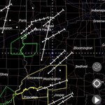
ALT This graphic displays a tornado warning plotted on a map. The warning is in effect until 5:15 PM EDT. The warning includes Terre Haute IN, Brazil IN and North Terre Haute IN. This warning is for Northeastern Vigo and Northern Clay Counties. The threats associated with this warning are a radar indicated tornado and ping pong sized hail. There are 107,254 people in the warning along with 31 schools and 4 hospitals.

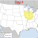
ALT Thunderstorms developing to the west are expected to strengthen over the next few hours. Damaging winds, large hail, and tornadoes are all possible. Storms expected through 10 PM but the greatest threat for severe storms will be from 5 to 8 PM


