Parchment (@parchmentmaps) header
Parchment (@parchmentmaps) profile picture

under construction: the world's best digital map

Joined June 2024
Photo by Parchment (@parchmentmaps)Photo by Parchment (@parchmentmaps)Photo by Parchment (@parchmentmaps)Photo by Parchment (@parchmentmaps)Photo by Parchment (@parchmentmaps)Photo by Parchment (@parchmentmaps)Photo by Parchment (@parchmentmaps)Photo by Parchment (@parchmentmaps)Photo by Parchment (@parchmentmaps)Photo by Parchment (@parchmentmaps)
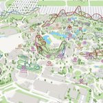
green spaces 🌳
3
1
71
2,336
Parchment retweeted
i hope you're not yet tired of the 3d cities :))
28
7
1
426
15,942
Parchment retweeted
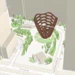
Lead us not in to penn station
77
4,104
156
38,664
791,595
work in progress
1
1
26
856
Parchment retweeted
Deleting Instagram did NOTHING to improve my productivity. I now doomscroll on Google Maps.
369
11,494
1,574
150,970
2,045,633
lit up the skyline
something about detailed city experiences
1
1
1
105
2,962
something about detailed city experiences
2
1
54
5,081
Parchment retweeted
Work-in-progress 3d Subway Builder
31
43
4
1,705
23,573
open data always beats closed
1
7
321
I'm building New York City, with Unreal Engine 5 and Blender and three.js as renderer options, open source! Ready for building games, visualization, simulations or reinforcement learning!
47
69
4
857
34,717
Parchment retweeted
Trying to improve the lighting of the whole scene, added soft shadow, fog, and adjusted the light from the sky.
4
4
43
1,475
GeoRetina Atlas is the most comprehensive digital twin of the entire planet ever built based on OpenStreetMaps (OSM). Any cities/place that has OSM data is available to explore for free without any limits. It's built using @threejs and a custom WebGL pipeline. It's not just built for visualizations, but also for physical simulations like flood scenario modeling. We already have our own high-resolution 5m flood maps for 139 cities and plan to expand it to 1000 cities across the world in the next few days. You can find the link in the comments 👇
2
2
1
4
3,709
it's pretty neat i guess
8
3
6
333
42,417
Parchment retweeted
oh yes let's build an open database of 3d landmarks, put those tokens to good use!
experimenting with 3d landmark models. could this work as a open, crowdsourced database? would ya'll be interested in something like that?
5
4
253
27,708
more
experimenting with 3d landmark models. could this work as a open, crowdsourced database? would ya'll be interested in something like that?
1
39
1,774
experimenting with 3d landmark models. could this work as a open, crowdsourced database? would ya'll be interested in something like that?
8
4
2
76
33,153
most mid-sized american cities are sprouting walkable, bikeable, and transit-oriented areas in their strategic investment zones. our goal is to make this lifestyle accessible with maps that elevate this information at a glance
You’re unable to view this Post because this account owner limits who can view their Posts. Learn more
3
2
1
120
6,848
this transit map updates in realtime based on live service alerts and detours, and each stop label shows currently active routes along with live vehicle tracking. here are all these features showcased by today's holiday schedule. happy labor day!
3
3
1
99
6,393
Parchment retweeted
Built an interactive 3D of Shibuya crossing Try it here: 3dscenes.qualityf2p.workers.…
35
89
11
973
73,297