SERCC (@SERCC) header
SERCC (@SERCC) profile picture

The Southeast Regional Climate Center (SERCC), is one of six Regional Climate Centers in the United States

Chapel Hill, NC
Joined June 2009
Photo by SERCC (@SERCC)Photo by SERCC (@SERCC)Photo by SERCC (@SERCC)Photo by SERCC (@SERCC)Photo by SERCC (@SERCC)Photo by SERCC (@SERCC)Photo by SERCC (@SERCC)Photo by SERCC (@SERCC)Photo by SERCC (@SERCC)Photo by SERCC (@SERCC)
So it turns out that southern Florida gets twice as many tornadoes during El Niño years, but northern Florida doesn't. When you average them out, it's only slightly higher, which leads people to think El Niño tornadoes aren't a big deal in Florida. accuweather.com/en/severe-we…
1
2
250
Our winter outlook is here, with a look at how the strong El Niño may affect North Carolina, and what we expect from our weather, including potential snow chances and drought relief. #ncwx 📰: climate.ncsu.edu/blog/2026/1…
5
24
6
120
16,058
Significant tornadoes have occurred across central FL during past strong El Niño events (1998 & 2007). The greatest threat of strong tornadoes (EF-2+) is typically between Feb-Apr. Does your family know where to shelter if a warning is issued? #FLwx #FloridaElNiñoAwarenessWeek
14
1
42
3,252
SERCC retweeted
October 2026 U.S. highlights are in! 🌡️ CONUS recorded its fourth-warmest October on record, with nighttime minimum temps setting a record for the fourth straight month. Meanwhile, drought coverage dropped to 44%! 🌧️ Learn more: bit.ly/USClimate202610
1
28
4
37
9,840
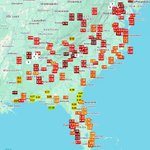
Love the value added map of our #CLIMPER data.. Here is the URL and a view of the U.S. extended region. sercc.oasis.unc.edu/Map.php?…
HOLY COW! 🔥🌡️ Here's a more aesthetically pleasing view of the same @SERCC data, courtesy of yours truly. Of 252 ThreadEx stations across the U.S., September 1–November 5, 2026 ranks: 🥇 57 — Warmest on record 🔥 124 — Top 5 warmest 🌡️ 169 — Top 10 warmest That's TWO-THIRDS of stations experiencing one of their warmest autumns to date! Just look at the extraordinary geographic extent of this warmth. Absolutely astonishing!
2
222
City of Copperhill, TN is now within 18 inches of the highest river level ever recorded back in 1990. Widespread and catastrophic flash flooding is ongoing, and heed all evacuation orders!
1
10
25
2,942
NEW RECORD 18.05' Highest since 1990. Downtown MaCaysville, GA and Copperhill, TN are underwater. 7-10' of catastrophic flooding. Water coming down slowly. We have had FLASH FLOOD EMERGENCIES since Saturday in seperate locations across the country.
2
10
1
29
8,492
A 5-inch plus rain swath about 20 miles long by 10 miles wide over mountainous terrain was enough to trigger major flash #flooding in Copperhill, TN and McCaysville, GA.
2
3
8
927
Here is the latest totals on the 3 Day Florida Heavy Rainfall
14
178
23
679
115,444
SERCC retweeted
Big Rain Bullseye - Florida's Central East Coast Over the past 48 hours torrential rain fell along Florida’s central east coast from Titusville in Brevard County south to Port St. Lucie. The hardest hit area was around Melbourne where 2-day measured totals exceeded 20 inches.
3
10
33
3,256
WPC has initiated Storm Summaries for heavy rainfall and flash flooding impacting the Florida Peninsula over the last few days. Top rainfall amount so far was reported near Malabar, FL... 24.1 inches. 🔗: wpc.ncep.noaa.gov/discussion…
2
28
2
51
11,923
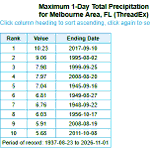
What a day for parts of #Florida #rain yesterday & MTD totals. The daily total at @iFLYMelbourne was the highest 1-day rain on record. @NWSMelbourne @FLClimateCenter @NWSSouthern @NOAANCEI @NWSMiami sercc.oasis.unc.edu/Map.php?…
1
151
As of the late afternoon CLI from @NWSMelbourne the daily total was 11.04 at @iFLYMelbourne mesonet.agron.iastate.edu/wx…
Looking at the #Rain totals as of 12:53pm today it looks like the 10.52 inches of rain so far @FlyMLB has recorded their wettest day on record(1937-Curr). That 2017 values was from #IRMA weather.gov/wrh/timeseries?s… @NWSMelbourne @NWSSouthern @FLClimateCenter @NOAANCEI
1
1
141
Looking at the #Rain totals as of 12:53pm today it looks like the 10.52 inches of rain so far @FlyMLB has recorded their wettest day on record(1937-Curr). That 2017 values was from #IRMA weather.gov/wrh/timeseries?s… @NWSMelbourne @NWSSouthern @FLClimateCenter @NOAANCEI
1
1
7
481
Great Info-graphic @TimBuckleyWX
If we look at other very strong El Niño winters, there’s a clear signal for wetter weather. Snow? As always, less clear. In these 4 very strong El Niño winters 3 saw snow, one didn’t, and none had above avg snowfall. I think we’ll have lots of systems to track, but we’ll have to try and line up the cold air just right.
141
Wednesday king tide flooding in Lantana. @NWSMiami #kingtides
2
7
26
1,374
Wow. Toasty #CONUS Here is the url to that map for your viewers to check out a location near them: sercc.oasis.unc.edu/Map.php?…
Replying to @wxjerdman
And unsurprisingly, many dozens more US cities will be on pace for their record warmest year through October, including Las Vegas, Phoenix, Salt Lake City, Denver, Houston and Nashville.
2
214
Thanks @wxjerdman here is the URL to that map for all your followers: sercc.oasis.unc.edu/Map.php?…
Based on the forecast through Saturday, dozens of cities from Texas to the Midwest will be on pace for their record warmest fall. Data kudos: @SERCC
227
‼️ 50 Year Record Broken in Ft Lauderdale! 🌊 Water levels reached 2.51 Ft above mean higher high water, breaking the record for highest water in Port Everglades. That beats #hurricane Dorian and Nicole. Palm Beach also set its highest level on record in 56+ years. (Palm Beach broke record too - graph in thread) This is due to persistently strong onshore winds, full moon, favorable lunar phase, and sea level rise due to a warming climate. The number of “Sunny day” floods are increasing each year recently. (Yes I know it wasn’t exactly sunny) 🧵 1/ #Florida #flood
3
41
1
105
4,383