The Land Desk (@Land_Desk) header
The Land Desk (@Land_Desk) profile picture

Jonathan P. Thompson: https://teapaw.org/t.co/ia5kqWjR7g; author of River of Lost Souls, Behind the Slickrock Curtain, Sagebrush Empire; contributing ed. @highcountrynews;

Western U.S. and beyond
Joined September 2008
Photo by The Land Desk (@Land_Desk)Photo by The Land Desk (@Land_Desk)Photo by The Land Desk (@Land_Desk)Photo by The Land Desk (@Land_Desk)Photo by The Land Desk (@Land_Desk)Photo by The Land Desk (@Land_Desk)Photo by The Land Desk (@Land_Desk)Photo by The Land Desk (@Land_Desk)Photo by The Land Desk (@Land_Desk)Photo by The Land Desk (@Land_Desk)
The Land Desk retweeted
I’ve been photographing the flood damage in and around Durango. It’s shocking to see what all that water and mud has done to our community. Here are some views from yesterday in the Trimble area, north of town. waterdesk.photos/Colorado/Du… #cowx
1
2
7
331
The Land Desk retweeted
Breaking News: Deb Haaland, the former congresswoman and interior secretary, will be the nation’s first female Native American governor after winning in New Mexico, according to The Associated Press. nyti.ms/4BFGoHo
126
3,187
182
17,631
482,327
The Land Desk retweeted
A few shots from our better camera of flood damage on the Piedra River just north of Navajo State Park today. 📷 John Livingston/CPW
1
8
47
1,914
The Land Desk retweeted
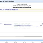
The Animas River in Durango rose from 1500 cfs yesterday to 13,000 cfs by 10:45 a.m. today. Just an insane amount of water.
1
14
61
2,952
DRONE video from in and around Pagosa Springs, Colorado Monday morning. Significant flooding ongoing! #COwx @granttosterudwx @BianchiWeather @CReppWx
26
258
17
1,124
87,997
The Land Desk retweeted
Don't be the person who blows through a CDOT roadblock and almost drives into the Piedra River where the bridge over US 160 no longer exists. Despite our patrols blocking roads, this still almost happened.
297
370
79
6,416
837,078
The Land Desk retweeted
Yet another extreme rainfall event is currently unfolding across Arizona and the Four Corners portion of AZ, NM, UT, and CO--and very serious major to locally catastrophic/record-breaking flooding is unfolding. Some areas will see *even worse* flooding than last week by tomorrow.
3
45
5
234
35,517
The Land Desk retweeted
Heavy snow is forecast for elevations above 10kft across the San Juan Range tonigh. A Winter Storm Warning is in effect from 5PM Sun-11AM Mon for 8-14 inches of heavy, wet snow. Snow levels will start high, and slowly lower tonight. #COWX
1
6
27
2,371
🚨 NOT AGAIN 🚨 The San Juan River in Pagosa Springs, Colorado is yet again projected to crest well into Major Flood Stage, this time 2 FEET HIGHER than a week ago. If this river forecast comes true, it will surpass last week’s devastating flooding and come close to rivaling the record from 1911! #COwx #NMwx
4
46
2
218
11,325
The Land Desk retweeted
Friday evening Weather West update on Halloween weekend storm across far SoCal & resulting serious flood threat across interior SW/Four Corners region. Also: thoughs re: ongoing record marine heatwave & CA ocean levels in context of extreme El Niño event. weatherwest.com/archives/441…
2
19
142
12,654
The Land Desk retweeted
Big-time snow is expected this weekend in the San Juan Mountains! Heavy snow will fall above 10,000'. 8-15" possible, with up to 24" on some mountain peaks. Winter Storm Watches are in effect for the San Juans above 10,000' until Monday afternoon. #COwx
10
30
5
265
22,596
The Land Desk retweeted
From @russ_schumacher at Colorado State: last week's rains in southern Colorado "should clearly be added to the list of the most extreme rainstorms in Colorado history" climate.colostate.edu/blog/i…
9
45
3,766
The Land Desk retweeted
River flooding impacts were reported along the Rio Grande near San Antonio, NM alongside river gages showing continued rises and increased flows. A Flood Warning has been issued for these areas through the day Thursday.
1
4
23
1,301
The Land Desk retweeted
The San Juan River swells up, spreads destruction The latest round of storms have moved on, but flooding continues By @Land_Desk substack.com/app-link/post?p…
1
1
5
284
The Land Desk retweeted
Mr. Brightside's Powell Tracker: San Juan still raging at Bluff: 37,300 CFS Since storms started 9/15: Powell up 809,000 AF Relative to SEP26 Bureau Forecast: Powell up 900,000 AF or 18 years worth of proposed 50,000 AFY Upper Basin fallowing program. Powell about to pass Flaming Gorge's readily available storage. Powell is using USGS instantaneous elevation so is very current. This is new code, so don't trust it :)
4
1
11
1,961
The Land Desk retweeted
𝗨𝗥𝗚𝗘𝗡𝗧 𝗙𝗟𝗢𝗢𝗗𝗜𝗡𝗚 𝗨𝗣𝗗𝗔𝗧𝗘: 𝗔𝗡𝗘𝗧𝗛 𝗔𝗡𝗗 𝗠𝗢𝗡𝗧𝗘𝗭𝗨𝗠𝗔 𝗖𝗥𝗘𝗘𝗞, 𝗨𝗧𝗔𝗛 October 25, 2026 | Emergency Flood Response Severe flooding continues to threaten communities in Aneth and Montezuma Creek, Utah, as water levels have risen significantly overnight. Approximately 150 people have been evacuated, and officials warn that water levels could rise by as much as 36 feet by 1 p.m. today, creating dangerous conditions for families and residents. Residents in affected areas are urged to remain alert, follow evacuation instructions and avoid flooded roads, washes and low-lying areas. 𝗘𝗠𝗘𝗥𝗚𝗘𝗡𝗖𝗬 𝗕𝗥𝗜𝗗𝗚𝗘 𝗖𝗟𝗢𝗦𝗨𝗥𝗘𝗦 Emergency personnel are shutting down the following bridges due to dangerous flooding conditions: • Highway 160 Bridge • Bridge on Navajo Route 35 from Red Mesa Residents are urged to avoid these routes and follow instructions from emergency personnel. 𝗘𝗠𝗘𝗥𝗚𝗘𝗡𝗖𝗬 𝗦𝗛𝗘𝗟𝗧𝗘𝗥 𝗟𝗢𝗖𝗔𝗧𝗜𝗢𝗡𝗦 The following locations are being used to shelter displaced residents: • San Juan High School in Blanding, Utah — Staffed by the American Red Cross • Aneth Community School 𝗔𝗡𝗘𝗧𝗛 𝗘𝗠𝗘𝗥𝗚𝗘𝗡𝗖𝗬 𝗢𝗣𝗘𝗥𝗔𝗧𝗜𝗢𝗡𝗦 𝗖𝗘𝗡𝗧𝗘𝗥 For emergency information and assistance, contact the Aneth Emergency Operations Center (EOC): 435-651-3754 The safety of our Navajo people remains the highest priority. Residents are encouraged to follow official emergency instructions, check on loved ones when safe and share this information with families in affected areas. The Office of the President remains on-site alongside Navajo Department of Emergency Management, Navajo Police Department, Utah Department of Transportation (UDOT), Utah Navajo Health System, Utah Highway Patrol, and San Juan County Sheriff’s Office. Thank you to all for coordinating response efforts, monitoring flood conditions and working to protect families and communities. Additional updates will be provided as information becomes available.
11
19
734
The Land Desk retweeted
We are getting anither wave of small but pretty violent cells at Arriola. Good remote reporting by @jfleck. Farmington Flood. “The gage at Bloomfield blew out late Thursday night, reading 13,100 cubic feet per second (cfs) before it failed. Downstream, the wave blew out the gage at the Bolack Ranch Bridge 7 hours later, running at 17,100 cfs. By the time the USGS gage on the San Juan at Farmington blew out Friday afternoon, the river had risen to ~32,600 cfs, the most water recorded there since the 1930s and more than double the biggest peak since Navajo Dam was completed in the early 1960s.” inkstain.net/2026/10/farming…
1
4
8
874
The Animas River in Farmington, NM is currently flowing at 12,500 ft/s and in minor flood stage Saturday morning. #NMwx
2
22
1
223
5,340
The Land Desk retweeted
Rescues continue in San Juan County after 20 overnight operations. The Shiprock Bridge remains closed, and more rain today could cause rivers to rise again. Evacuations remain in place. Officials warn floodwater is contaminated with sewage. 📸 Navajo Police Department #NMwx
3
57
6
217
6,219