Luke Dorris (@LukeDorris) header
Luke Dorris (@LukeDorris) profile picture

Saved by grace ✝️, husband to the girl of my dreams, dad to one boy and twin girls, KCTV Chief Meteorologist, IL➡️OK➡️NE➡️FL➡️KC AMS CBM #642

Kansas City
Joined March 2012
Photo by Luke Dorris (@LukeDorris)Photo by Luke Dorris (@LukeDorris)Photo by Luke Dorris (@LukeDorris)Photo by Luke Dorris (@LukeDorris)Photo by Luke Dorris (@LukeDorris)Photo by Luke Dorris (@LukeDorris)Photo by Luke Dorris (@LukeDorris)Photo by Luke Dorris (@LukeDorris)Photo by Luke Dorris (@LukeDorris)Photo by Luke Dorris (@LukeDorris)
I love the psychology of Instagram conspiracy theorists.
12
5
161
7,181
COLDEST IN NEARLY 8 MONTHS KC Update Friday 11/13/26 - The last time KC was this cold was all the way back in March - It ain’t all bad! ✌️ mosquitoes - Even a bit colder Saturday morning - Both days this weekend are chilly, but Sunday is the pick - Cold won’t stick long. Big warm surge again next week - Storm system brewing late next week. Thunderstorms possible as early as Thursday, but more likely hold until Friday #kcwx #kswx #mowx @KCTV5
2
18
3,625
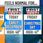
IT’S BEGINNING TO FEEL A LOT LIKE… KC Update Thursday 11/12/26 - Today is roughly 20 degrees colder than yesterday - It feels 25-30 degrees colder (wind chill) - KC’s first freeze of the season by early Friday morning - Friday’s high nearly matches the 30-year average for Christmas Day - Even colder by Saturday morning - Your tire pressure light may turn on your car’s instrument cluster due to the denser/colder air. Just fill it up with a little air & it’ll go away #kcwx #kswx #mowx @KCTV5
1
1
19
1,420
Most accurate KC TV forecast, Wed, Nov 11: KCTV5 Forecast 64/50 the day before; actual 66/50 (high off by 2°, low exact). 1. KCTV5 64/50 · 1.00° 2. KMBC 9 64/48 · 2.00° 3. KSHB 41 62/49 · 2.50° 4. FOX4 60/48 · 4.00° NWS 3.00° · Consensus 2.00°
1
2
191
FROM APRIL TO DECEMBER IN A DAY KC Update Wednesday 11/11/26 - It will feel like the 30s much of (perhaps all) of Thursday - Actual high in the mid-upper 40s may occur before sunrise, then afternoon temps struggle - Friday morning brings KC’s first freeze of the season (kinda late, we usually get it by late October) - Clear sprinkler systems, disconnect hoses - Even colder 20s by Saturday morning #kcwx #kswx #mowx @KCTV5
1
1
7
2,260
Luke Dorris retweeted
Today marks the 51th anniversary of the tragic lost of the #EdmundFitzgerald. The ship departed Superior, WI on Nov 9, 1975 bound for Detroit but sank near Whitefish Point, MI on Nov 10th during a powerful storm over the #GreatLakes. All 29 crew were lost. storymaps.arcgis.com/stories…
28
422
28
2,339
54,435
IS THIS THE NICEST DAY FOR THE REST OF 2026? BIG CHILLY CHANGE AHEAD! KC Update Tuesday 11/10/26 - Good chance today is the last of this year to reach upper 60s/low 70s - Warm ✅ Sunny ✅ Calm ✅ - Still mild Wednesday, but breezy to windy - Thursday is ~20 degrees colder than today - KC’s first freeze of the season Friday - Some may not get out of the 30s Friday - Weekend starts with mid-20s 🥶 #kcwx #kswx #mowx @KCTV5
1
10
973
EARLY RISERS - You can look to the east sky and see Venus shining BRIGHT right before sunrise. It’s quite the sight! @KCTV5 #kswx #mowx
1
6
209
This account tracks the accuracy of KC tv station weather forecasts. Transparency is good for everyone, and I love competition. For the record, I don’t know who runs this. It seems independent.
#1 Kansas City TV forecast for the week of November 2: KCTV5 1. KCTV5 1.64° 2. FOX4 2.07° 3. KMBC 9 2.14° 4. KSHB 41 2.57° For comparison: NWS 1.79°, closest of the rest KCTV5 website 1.64° Average miss of the high and low, 1 day out
12
765
‼️
The most powerful weather app ever is now here! 🌦️📱 Aguacero’s iOS & Android apps are finally released! 🎉 🎨 Fully customizable 📡 Radar, satellite, models & more 🗺️ New: routes + navigation iOS testers: delete the TestFlight version, then install 👇 🍎 apps.apple.com/us/app/aguace… 🤖 play.google.com/store/apps/d…
1
7
824
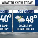
MISTY MORNING, FROSTY START TO THE WEEKEND, BUT 🤌 FOR CHIEFS KC Update Friday 11/6/2026 - Kinda gross this morning with persistent drizzle - Dry afternoon - Coldest day so far this fall - Frosty weekend mornings - Saturday is cool but decent - Sunday is cold for early tailgaters, but the afternoon is spectacular! - Warm surge next week… some hit the 70s #kcwx #kswx #mowx @KCTV5
2
7
815
🍂 Cool November Days 🥶 Frosty nights ahead ☀️ Nice weekend 🏈 Game day is awesome #kcwx #kswx #mowx @Chiefs @KCTV5
9
530
Some sunshine to start your Thursday, but we expect clouds to thicken up at times. High temperatures stay cool in the mid 50s. We are watching for some colder mornings ahead, with the potential for some patchy frost Saturday morning. @KCTV5 #kswx #mowx
2
5
284
Come help those in need before the brutal cold arrives! Come say hi, I’ll be collecting Friday morning.
2
2
8
399
COOLEST DAY IN WEEKS KC Update Wednesday 11/4/26 - Misty morning, with drizzle in spots up to about lunchtime - Mid-50s makes today the coolest since mid-October! It has been a long stretch of 60s & 70s - Cool fall weather sticks the rest of the week - Cold 30s for morning lows this weekend - Weekend is great! Sunday is outstanding for the Chiefs game - Big bounce back next week, flirting with 70s #kcwx #kswx #mowx @KCTV5
1
2
8
1,488
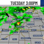
LINGERING DOWNPOURS TODAY, FALL CHILL AHEAD KC Update Tuesday 11/3/26 - Record rain at KCI this morning (2.01”) - Scattered downpours will still be around today, mixed with dry hours - Voters will want umbrella while waiting in lines, just in case - KC’s best chance is 2-4 pm - A front kicks through at that time, bringing drier, cooler, and breezy conditions this evening - Rest of the week is dry & cool fall weather. Nice stretch - Great weekend, but early tailgaters will be chilly #kcwx #kswx #mowx #chiefs @KCTV5
2
14
1,526
Forecast: waterfall from the sky mixed with sunshine
1
2
21
681
NEW for this season, the NWS is expanding “Particularly Dangerous Situation” (PDS) wording to select Blizzard & Ice Storm Warnings. ❄️🧊 PDS is reserved for rare, historic events posing an exceptional threat to life. When you see PDS in a warning, take immediate action!
8
130
19
457
53,786
TODAY’S TORNADO RISK KC Update Monday 11/2/26 - Storms are likely, severe weather is possible today - Multiple rounds possible 2 pm - 1 am (not that entire time, but within that window) - The highest chance for severe storms is 6 pm - midnight - Level 2/5 Severe Risk due to potential damaging wind gusts and tornadoes - Here’s a video update on the tornado risk #kcwx #kswx #mowx @KCTV5
1
3
27
2,710
The MyRadar team has reviewed weather data surrounding the unfortunate crash of N722BD. A rapidly-growing thunderstorm cell appears to be a major factor: myradar.com/layers/metnotes/…
28
166
21
1,493
240,930