

Born & raised in Chicago on the shores of Lake Michigan. Breaking Weather. Travel. Meteorologist for WGN-TV, WGN720.
Chicago, IL
Joined June 2009
- Tweets30.8K
- Following2.4K
- Followers8.6K
- Likes38.1K






Pinned Tweet
I am Mike’s sister, Kathleen; I am here with the heart-breaking news that our dear meteorologist died this morning from lung cancer. He was home, surrounded by love and at peace. Please know he cherished all of you, his Twitter followers & weather enthusiasts. ♥️⛈❄️☔️☀️


Mike Hamernik retweeted
We can see on radar there is a band of lake effect #snow in Evanston. We can use the @NorthwesternU @WeatherBug camera along the Lake Michigan shoreline to see what it looks like inside that snow band. @NWSChicago @MikeHamernik @WGNNews @WGNTV #ilwx


9:50AM Radar Check: Heavy lake effect snow squall rolling into the city & central Cook County.
#ILwx #LakeMichigan
Mike Hamernik retweeted

A little peek of the Chicago skyline through icicles and ice shards deposited along the lakefront // #ILwx

Mike Hamernik retweeted

Per @ILStatePolice, roads have deteriorated and travel is hazardous. Please limit your travel if you can. #DontCrowdThePlow
Road conditions as of 6:55 pm via gettingaroundillinois.com/Wi….


3:12PM Radar Check: New round of snow squalls rolling in. Not quite unite as intense as the one that hit central Chicago earlier this P.M.
Note the thundersnow near Bloomington. ⚡️
1:47PM: Heavy Snow Squall that brought some traffic to a temporary standstill in central Chicago will be moving out over Lake Michigan by 2PM.
Mike Hamernik retweeted
I made this boomerang-esque clip last night from 24 still frames to illustrate the rolling waves churning with ice 🧊🧊 – at Chicago, IL
Winter Storm Warning continues until 6PM. Additional accumulation this afternoon & evening:
-Up to 3” downwind of the lake (Cook, Will, Lake-IN)
-Around 1” or less elsewhere


Noon Radar Update: Downwind lake enhancement over Cook County is clearly visible on this radar loop.
11AM Storm Update:
-Precipitation ETA remains 3-6PM.
-Heaviest snow (1”-2” per hour) is expected between 6PM-Midnight.
-Keep any travel tonight very local as road crews will struggle to keep up with snowfall rates (avoid expressways)
-Storm totals 5”-9” by Sun Eve.


Mike Hamernik retweeted

GOOD MORNING! It's still snowing around the area. @MorganKolkmeyer has your updated forecast all morning on @WGNMorningNews! wgntv.com/live

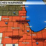
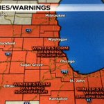
2PM Storm Update: Long duration snowfall tonight into Tuesday.
Slight drop in expected metro snow totals to 4”-7”, although locally higher numbers (8”-9”) downwind of the lake (10-20% of the area) are still possible.


