

Official Twitter account for NWS Central Region to extend the reach of NWS information. Details: http://t.co/iGsuslzVWY
- Tweets5.5K
- Following746
- Followers22.6K
- Likes2.6K








ALT Tabular forecast of wind chills tonight through Monday morning. Widespread wind chills less than 40 below zero are found across North Dakota, with the lowest wind chills less than 50 below zero found to the north and east of the Missouri River.


ALT A Winter Storm Warning has been issued for early Tuesday morning lasting into Wednesday morning. Heavy snowfall will cause significant impacts to travel. Confidence is high that many locations will experience snowfall greater than 5 inches. Now is the time to prepare for the upcoming winter storm.


ALT After a widespread 3-7 inches of rain fell, many roads still remain closed and rivers are still rising. Be very cautious when traveling and never drive over a flooded road.


ALT Right image of map of central U.S. with a blue oval highlighted across Kansas and Missouri, signaling the potential area for accumulating snowfall early next week.



ALT Summary of the ongoing winter storm moving into the Mid-Atlantic states. A large area of Minor/Moderate impacts are expected across the Ohio Valley into the Mid-Atlantic, with some Major impacts possible ("considerable disruptions to daily life").


ALT Winter Storm Potential Increasing There is growing confidence that a storm will produce significant wintry weather beginning later this week. Impacts will begin in the Central Plains by late Saturday, the Ohio and Tennessee valleys on Sunday, and the Mid-Atlantic region early next week. Widespread Heavy Snow Possible Areas in the Central Plains and Mississippi Valley, especially along and north of Interstate 70, may experience heavy snowfall, with a high chance (60-80 percent) for at least 6-inches of snow. Significant Icing Potential in the Mid-South Further south, there are concerns about potentially significant sleet and freezing rain affecting eastern Kansas and the Ozarks, which may extend eastward to the Tennessee and lower Ohio valleys this weekend. Some icing may also occur in parts of the southern Appalachians on Sunday. Additional Forecast Changes Anticipated Uncertainty remains regarding the timing and location of the storm track.

ALT Much of the area currently has a 40-60% chance to see at least minor travel impacts this weekend into Monday due to a winter system moving through the region. These impacts may be from ice, snow, or both. More details on timing and amounts will be determined in the coming days.


ALT The map on the shows where the greatest winter impacts are expected, with low chances near Columbus, 20-30% chances in the Omaha and Lincoln Metro areas, and the higher values near Falls City of 50-60%.


ALT Map of expected winter storm impacts. 30-80% chance of moderate impacts Sunday-Monday, with hazardous driving conditions and potential for closures.

ALT Weeks 3-4 Temperature Outlook (January 4-17) Above normal temperatures likely across the Southwest, including California, Arizona, Nevada, Utah, New Mexico. Below normal temperatures for nearly all of the central and eastern U.S.


ALT Highway bridge during a heavy snowfall. (Credit: iStock).





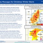
ALT Key message issued Dec 16 for periods of atmospheric river activity likely to impact the West with heavy precipitation, high winds, and possible flooding, Dec 24-28. The composite Week-2 U.S. Hazards Outlook map shows moderate risks (40 to 60% chances) of heavy precipitation and high elevation snow for the Pacific Northwest and northern California, Dec 24 and again Dec 26-27. Moderate risks of heavy snow are shown for parts of the Northern Rockies and Northern Great Basin, Dec 25-28, and high winds across parts of the West, Dec 24-28. Possible flooding is indicated across northern California and southwestern Oregon.