

Image VRA - Simple and Actionable
Fargo, ND
Joined August 2010
- Tweets547
- Following804
- Followers754
- Likes303




@satshot retweeted

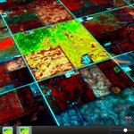
For #crop scouting, using weekly In-season & historic #satellite NIR vegetation images of (yours + neighbours) fields, builds your local knowledge. #precisionag


@satshot retweeted
In-season #satellite NIR images display vegetation #field variability. Many people assume flat #irrigation land is uniform… what can you see?

So, here is our competition @satshot Our analysis is ready to go for VRA #plant2022 application, plus much more detail! I guess we have NO competition! The competition even said there was no reason to scout this field. AMAZING!

@Satshot Satellite image over Mayfield Ky on Dec 11th taken at around noon showing the pathway from SW to NE. #MayfieldTornado #Kentuckytornado

@satshot retweeted
Winter = reviewing multiple #crop years of #satellite NIR, yield data, #soil tests & maps to assess results. Opinions from slick salesman & coffee shop are not reliable crop input recommendations. #precisionag

@satshot retweeted

3 OF 5 WAYS REFERENCE STRIPS DELIVER VALUE: Paired with our system, you can really hone in on reliable NDVI data to determine field health. Then, you can optimize ROI with more precise recs and yield potential data. Find more information here: ow.ly/OB5P50GxMKC

@satshot retweeted
Few Yield maps to show Field variability along with #Satellite images. % yield differences are magnified by adverse weather & field issues. Traditional #Soil sampling for “average” doesn’t show actual N variability #harvest21 #precisionag #westcdnag

@satshot retweeted

The Easy Button for Nitrogen……. osunpk.com/2021/10/13/the-ea…

@satshot retweeted

Check out how next week's speaker, Lanny Faleide with @satshot, is using online web-based mapping in the agriculture industry! He gave us the story behind it all. Check it out! → bit.ly/37FrLqR
@satshot retweeted
We're excited to welcome Lanny Faleide with @satshot and Bart Womack with @eden_grow to next week's #StartupBREW in celebration of @TheGrandFarm's SpaceAg Conference! 💫


@satshot retweeted
Using @satshot with Ninja Ag provides an economical and practical fertility management solution that can be scaled across environments and crops. There’s still time to get started this season. Contact us today! ow.ly/rDlV50DrLm4

Satshot - simple to use in 5 minutes or less.


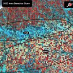
Define your Iowa #derecho damage with FREE 3 month trial @satshot Landscout. Document with GPS pictures Calculate acreage loss. Free trial open to all USA & Canada farmers who had #harvest2020 crop loss. Sign up here satshot.com/contact-us/index…


Satshot 8/10/20 Wind Damage Iowa #cropdamage, #scout2020 Analyze your field in Satshot Landscout for proper insurance adjustment

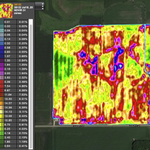
@satshot analysis of the previous raw image in NDVI with 31 zones all controlled by you! Now merge zones down to 5-10 vra shape files using @scout2020 DIY agronomy knowledge in 5 minutes or less in Landscout IPad. That was quick! Why work so hard using drones or airplanes!

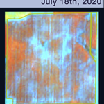
I hope this farmer is using #scout2020 VRA methodology to manage his field. This raw satellite image from @satshot shows many problems.
