
Ingeniero Agrónomo, Especialista Agropecuario, Consultor en Defensa y Seguridad Nacional, conductor de FOTOSINTESIS en El Sol de la mañana
República Dominicana
Joined October 2010
- Tweets55.5K
- Following2.3K
- Followers3.6K
- Likes32.1K





@ingisrael De interés

Hi. Meteorologist here.
This is nonsense. We have not entered a “new age of climate extremes.”
There is no such thing as a “supersized El Niño” and the planet isn’t being “superheated” by climate change either.
First, the correct meteorological term is “very strong El Niño.”
Second, El Niño a natural part of Earth’s internal weather and climate variability. It is just the positive (warm) phase of the El Niño–Southern Oscillation (ENSO). Correspondingly, La Niña is the negative (cool) phase.
The atmospheric circulation component of ENSO in the tropical Pacific is the “Southern Oscillation.” But the resulting warming (cooling) sea surface temperature (SST) response is El Niño (La Niña).
Normally, the thermocline (a transition layer separating warmer mixed water at the surface from cooler water below) in the Pacific Ocean slopes down towards the west. This means that the western Pacific usually has a deep, warm mixed layer of water extending downward from the surface, while the eastern Pacific has a relatively shallow mixed layer. These are “ENSO neutral” conditions.
The sloped nature of the thermocline is maintained by easterly wind stress on the equatorial Pacific ocean surface. The strength of the easterlies is determined by the balance between convection (upward motion) over Indonesia and subsidence (downward motion) in the central and eastern Pacific.
During La Niña, easterlies are stronger than normal because convection is displaced further west. Lower pressure over the Maritime Continent and higher pressure over Tahiti results in a strongly positive SOI index. Higher wind stress pushes even more warm surface water westward, resulting in the formation of an even larger warm pool in the west Pacific near Asia, which steepens the thermocline. This enhances divergence, leading to upwelling of cool, nutrient-rich water in the central and eastern Pacific.
However, if convection moves eastward over the Pacific, the easterlies weaken or even locally reverse (we call these “westerly wind bursts”) and thermocline begins to flatten, allowing warmer water in the west Pacific to slosh eastward, creating a deeper pool of warm water in the central and eastern Pacific. This is El Niño, and this is occurring right now.
The state of ENSO is quantified using the SST anomalies [relative to the most recent 30-year mean; currently, we use 1991–2020] along the equatorial belt. The main area for which SSTAs are monitored is the Niño 3.4 region, which runs from the 120–170th meridians of longitude and 5° north or south of the equator (5°N–5°S, 170°W–120°W). If the three-month averaged SSTA in Niño 3.4 is at least +0.5°C (+0.9°F), then El Niño is declared. If the three-month averaged SSTA is at least −0.5°C (−0.9°F), La Niña is declared.
El Niño (La Niña) events are classified as either being “weak,” “moderate,” “strong,” or “very strong” depending on how far above (below) average SSTs in Niño 3.4 have been for the last three months.
If the three-month averaged SSTA is +0.5–0.99°C (−0.5°C to −0.99°C), then the El Niño (La Niña) is weak.
If it's +1–1.49°C (−1°C to −1.49°C), then the El Niño (La Niña) is moderate.
If it's +1.5–1.99°C (−1.5°C to −1.99°C), then the El Niño (La Niña) is strong.
If it's ≥ +2.0°C (≤ −2.0°), then the El Niño (La Niña) is very strong.
The latest data from CDAS indicate that the Niño 3.4 region is currently +2.9°C (relative to 1991–2020). This means that we are in “very strong El Niño” territory.”
And this has happened several times before. Very Strong El Niños occurred in 1790–93, 1827–28, 1844–45, 1890–91, 1925–26, 1982–83, 1997–98, and 2015–16.
You are nothing but an ignorant, agenda-driven clown.

70
@LunaValienteRD @MartinezPozo GRACIAS por celebrar tan magna ocasión como lo es NUESTRA CONSTITUCIÓN, a pesar de las AUSENCIA de sus GESTORES! Tomás Bobadilla, Buenaventura Báez y el LIBERTADOR de la PATRIA, general PEDRO SANTANA y FAMILIA… @RafaelSalazarSC

Conmemoran el 182 aniversario de la Constitución de la República
cpep.gob.do/NoticiasDetalle/…
@luisabinader @RaquelPenaVice @JosePaliza @jpuribeM14


@LunaValienteRD @Osirisdleon El temblor en PANAMÁ…

2
244
Plátanos en Villa Fundación, en provincia Peravia de República Dominicana acaban de entrar al Libro Guinness de RÉCORDS! Calteluricas felicitaciones para José Arias!
9
795
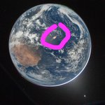
Actualización del ENSO o EL NIÑO 2026/27 wmo.int/es/news/media-centre…

1
125

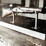
In April 1953, a CIA report arrived on desks in Washington detailing something virtually unknown in the West: a new kind of Soviet infantry weapon observed near Leningrad.
The rifle was so tightly held as a state secret that the agent who saw it could neither photograph it nor get close enough for a proper inspection, and he had no references to consult. All he could do was sketch it from memory.
That rough drawing, dated April 29, 1953, stands as the earliest known Western intelligence record of the AK-47. The report even misclassified it, calling it merely a “new Soviet submachine gun” with a detachable wooden stock, some versions equipped with a folding metal stock reminiscent of wartime German designs.
American intelligence would need years to grasp what they were truly examining, and the Agency continued referring to it as a submachine gun, sometimes even labeling it “Model PPK," well into the mid-1950s.
The weapon shown in that crude sketch had already entered Soviet service in 1949, yet the closed nature of Soviet arms development meant it took four years for even one reported sighting to reach Langley. Within another twenty years, the rifle barely outlined in those pencil lines would become the most widely manufactured and instantly recognizable firearm in history, equipping everyone from Warsaw Pact troops to guerrilla fighters across Africa, Asia, and Latin America. Roughly 100 million have been produced since.
A single sketch drawn from memory under pressure, with no opportunity for a second look, marked the beginning of the West’s long effort to understand the gun that would shape modern warfare more than any other weapon ever created.

137
@LunaValienteRD @adamonzon @GloriaCeballos7 @claudio_mj @FholguinC @ingisrael @DeborahTiempo @MartinezPozo @juliohazim @BebetoDice @RafaelSalazarSC @EROLIVARES Sobre la SEQUÍA en Europa. Recomendamos su lectura. Calteluricos saludos

Cosechas en mínimos, restricciones históricas y la economía estancada. La falta de agua que marchita Europa en este verano de temperaturas extremas ha llevado a la bajada de caudales de los ríos y la escasez de recursos hídricos a unos niveles históricos elpais.com/clima-y-medio-amb…

@LunaValienteRD Revelador! Calteluricos saludos

¿Sabías que el terrorífico mito de las pirañas asesinas que devoran humanos en segundos fue un engaño creado a medida para un presidente de Estados Unidos? Todo fue un sangriento espectáculo teatral en el Amazonas para Theodore Roosevelt. Tira del hilo 🧵👇🏽👇🏽👇🏽


72
@BebetoDice @LunaValienteRD Interesante

El TRABUCO y frente a la Puerta de la Misericordia hace 182 años fue el Trabucazo de MELLA! Así la PATRIA rompió “fuente” y parió a la República Dominicana! @LunaValienteRD


@fcapellan1 Fernando: Especial para ti, ya que, proteges los MANATÍES en la costa norte de nuestro país

1
114
Los familiares y amigos del Dr. Juan Ml. Guerrero de Jesús invitamos a la MISA NOVENARIO el próximo domingo 1 de febrero, a las 12 del mediodía en la Iglesia San Antonio en Gascue. @LunaValienteRD @NassefPerdomo @SusanaGautreau @MartinezPozo @ZOLFM1065

1
4
545
@LunaValienteRD INTERESANTÍSIMA entrevista Mario Moreno a CANTINFLAS

1967, el programa #Efemérides conducido por Jacobo Zabludovsky...el entrevistado: Mario Moreno... la pregunta que tuvo su respuesta: De dónde es #Cantinflas?
Hoy viernes 26 de diciembre entró a la eternidad nuestro amigo y maestro ANTONIO COCCO QUEZADA (1931-2025), antiguo director de meteorología, un gran ser humano un ORGULLO DOMINICANO @INDOMET_RDO @GloriaCeballos7 @LunaValienteRD @Osirisdleon


El la celebración de los 90 años de César Sandino de Jesús, antiguo Secretario de Agricultura y actual Secretario ejecutivo del Consejo Nacional de Agricultura


110


