
Maps, data and running. He/him.
Brighton, England
Joined January 2010
- Tweets2.3K
- Following587
- Followers171
- Likes775







Drew retweeted

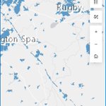
Certificates of Exemption issued for #XLBully dogs in England and Wales, per 10,000 population, mapped by @pablobones from today's @DefraGovUK release
#FOI #opendata teapaw.org/pablobones/status/1825…

I made a layer with it joined to postcode district boundaries and the ONS population estimates, to give a measure of applications per 10,000 population. Data and source links here drive.google.com/drive/folde…

I'm intrigued as to the rationale behind naming your company this. There must be a reason - making it hard to find maybe? Certainly wouldn't make it easier for them to answer the phone though. I imagine them doing it in the style of the Bodyform advert find-and-update.company-info…

Drew retweeted

Very excited to announce the launch of
THE WATERSHED POLLUTION MAP!
River health, landfills, sewage, road run-off, intensive farming, big industry, forever chemicals, abandoned mines, bathing waters, flood risk, protected areas and so much more... 🧵
bit.ly/45GBMRQ

@davidwrench top 0.05%? Guess that makes me a superfan. Helps that my 5 year old loves you too!

Drew retweeted

How many people live in the green belt in England? I get a figure of 1.2 million people, or just over 2% of the total population of England cc @pablobones
More here: statsmapsnpix.com/2023/10/ho…


Drew retweeted
That ONS analysis on rural and urban areas in England and Wales was scheduled for release today, but has now been "removed from the release calendar to allow for further review." ons.gov.uk/releases/comparin…
Updated map showing RAAC-affected schools as of 14/09, along with authority boundaries. Essex still way, way out in front with 57 of the 174 schools affected. Next highest is Birmingham with 6 pinea.app.carto.com/map/ac95…

ALT Map showing schools affected by RAAC
Out of interest, I also looked at where affected schools sit in the Indices of Multiple Deprivation. Perhaps surprisingly schools in the least deprived areas are more affected

Map showing all schools affected by RAAC (that we know of so far) as I couldn't find a public map anywhere. pinea.app.carto.com/map/ac95…

Insect twitter - we found this guy in Brighton. All our ID apps say it's a Buck Moth, but it's not commonly found in the UK. Any idea what it might otherwise be?

You could happily argue (I won't, yet) that this is a very un-Conservative announcement in favouring centralised, state-subsidised mitigation rather than allowing the market free rein to decide what the minimum they can get away with is. And I'm OK with that. 6/7