

Family, Flying, Ice Hockey, Photography, Nature, Cooking, & Coffee. Lucky enough to work for @tableau | 3x Tableau Conference speaker | 2x ESRI UC speaker
In the air above.
Joined March 2011
- Tweets345
- Following609
- Followers90
- Likes352




Pinned Tweet
I created a Map/visualization based on the mainline stored aircraft. You can click on the the locations or type of aircraft and see where they are stored. Based off @UnitedFleetWebs "Status" data. public.tableau.com/profile/r…
Ross Paulson retweeted
To do:
Make maps
Make maps
Make maps
Make maps
Make maps
Make maps
Make maps
Make maps
Make maps
Make maps
Make maps
Make maps
Make maps
Make maps
Make maps
Make maps
Make maps
Make maps
Make maps
Make maps
Make maps
Make maps
Make maps
Ross Paulson retweeted

Check it out! If you missed my #Data23 session, I'm doing an abbreviated version of my presentation on mapmaking in @TableauPublic at the next @HealthTUG!
And by "abbreviated," I mean tighter, fewer mistakes, only 1 or 2 tangents, less rambling...🙃


#DataFam! We're excited to announce our July 26 meeting at 1 PM CDT/2 PM EDT! We've got a great mix of content for you--SciCom with Young Song, Epic EHR data mart implementation with Elaine Sundby, & mapmaking with our own @professorkao! (He's doing an encore of his TC talk!) 1/2


Ross Paulson retweeted

Nice new post from Jim Walseth and @rossp165 on the @tableau Intersects calculation! Fun stuff! 🗺
How to Use the Intersects() Calculation in Tableau tableau.com/blog/how-use-int…

What a view of a 52,000 foot tall storm west of Leesburg, VA. Ice crystals! @dougkammerer @ChuckBell4 @nbcwashington

Great blog post from the amazing @FlerlageKev Alternative Map Projections in Tableau. flerlagetwins.com/2021/03/al…

Seats held by women in national parliaments and governments (source: EIGE) Week 9 of #MakeoverMonday
public.tableau.com/profile/r…
#tableau #tableauPublic


Another #MakeoverMonday Week 7. What's the point of Valentine's Day? When asked...
public.tableau.com/profile/r…

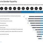
#MakeoverMonday #week6 Perceived Obstacles to Gender Equality. #Viz5 #gender #Equality #TableauPublic #Tableau
public.tableau.com/profile/r…

Countries in Green rely on more than 75% of their energy from renewable sources! 2020 was the first year Europe used more renewable energy than fossil fuel. #MakeoverMonday #week5 #tableau #Tableaupublic
public.tableau.com/profile/r…

Week 4 of #MakeoverMonday Indian Mines. I spent some time building the map background in #mapbox. Learned to filter and adding shapefiles in Mapbox. #datafam
public.tableau.com/profile/r…

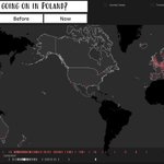
What's going on with Global temperatures?
#Week3 of #MakeoverMonday Published on my #TableauPublic page. public.tableau.com/profile/r…
Data: data.world/makeovermonday/20…

If you need a quick reference for #mapping / #geospatial features in #Tableau (and when they were created), I created a visualization in #TableauPublic.
public.tableau.com/profile/r…. .


#30DayMapChallenge | day 3 polygons. 2018 #kilauea eruption event, #shapefile from @usgsvolcanoes mapped in @tableau
Date Range: 5.3.18 to 8.9.18.

#30DayMapChallenge | Day2 Lines. @FedEx launches 145 aircraft starting at 1am... Created in @tableau and posted on @tableaupublic
public.tableau.com/profile/r…

World of Dots | #30daymapchallenge - day 1
It's not just a graphic, these points are geo-rectified where each point represents one degree of Lat/Lon. Find the Viz and download on @tableaupublic
public.tableau.com/profile/r…
