

Lead @ZoneWatchWX & Alpha Weather Analysis; One mission, to inform people and save more lives. Forecasting since 2010 🇮🇷🇩🇪🇺🇸🇨🇳
Joined June 2020
- Tweets414
- Following95
- Followers1.4K
- Likes782


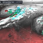


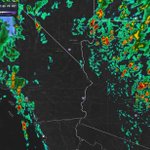
This is a classic eastern Pacific Super El Niño pattern, with tremendous tropical Pacific heat and energy influencing the jet stream. In terms of the El Niño setup, NOT precipitation totals, we're seeing characteristics that could rival or even exceed 1997 in some respects. Our storm season has also started earlier.
What's the result? A split jet stream, essentially two atmospheric belts steering Pacific storms, with the subtropical jet extending directly across Southern California and even into Baja California. Strong tropical convection, potential atmospheric rivers, and an increased risk of severe weather make this setup even more interesting.
My advice? Keep outdoor plans flexible and prepare if you live in flood prone areas. If significant flooding occurs, you're ready. If it doesn't, at least you were prepared.
A detailed article is coming soon, AWA Insiders expect multiple updates on this...
REMINDER: A Super El Niño does NOT automatically mean nonstop storms. However, it can significantly influence the overall atmospheric pattern and how Pacific storms develop and move as it already is doing so...Also, that Jet Stream will wiggle like a snake back and forth but it can lock over CA from time to time...
Note: These images are for illustrative purposes and do not represent the exact expected pattern. The timeframe is still too far out to determine the precise storm tracks, but they provide a general idea of how the pattern could evolve.


Halloween Through November Pattern: Powerful Pacific Jet Stream, Atmospheric River Potential, Heavy Rain and Thunderstorm Threats Across the West| October 31 – Nov 5th
Once again, please read the article for details we know so far. Read the full Update, Zoomable Images Here 👉:
alphaweatheranalysis.com/new…
Stay tuned for more updates. AWA Insiders breaks this down into micro zone regions as well should you need more info.

Good Afternoon, Sunday October 25th, 2026 at approximately 12:05pm PT.
Discussion:
A weakening low pressure system moving through the Four Corners will bring isolated showers to northeastern Arizona and eastern Utah today, while a stronger Pacific system pushes into Oregon and Washington, bringing more widespread unsettled weather through Monday. Western Washington and northwestern Oregon will experience moderate to locally heavy rainfall today, with totals ranging from 1 to 1.5 inches along the Washington coast and Olympic Mountains, wind gusts near 35 mph, and widespread wet road conditions. However, significant flooding is not expected.
Showers will spread into the Inland Northwest tonight and Monday, with locally heavier downpours possible near the Blue Mountains and Idaho Panhandle, along with light snow above approximately 5,000 to 6,000 feet. Already saturated ground will leave portions of eastern Utah vulnerable to localized flash flooding beneath stronger thunderstorms today. Meanwhile, freezing fog could create slippery conditions on elevated surfaces across northern Arizona early this morning before warmer and drier weather returns to the Southwest on Monday. Northern Nevada will experience light valley rainfall, mountain snow, and wind gusts ranging from 30 to 35 mph on Monday. Meanwhile, most of California will remain dry and seasonably warm, although minor coastal flooding around high tide remains possible along vulnerable Bay Area shorelines.
But that is only for now... Halloween is starting to look rather spooky, and Mother Nature may have her own version of scares in store as a potentially more significant storm system takes shape. More details on the evolving setup, timing, and regional impacts will be coming soon.
After weeks of working nonstop, I finally took a much needed break to recharge. That means today will be packed with multiple updates from my team and me, including answers to many of your questions about the upcoming Halloween storm system and what it could mean for your area. Stay tuned, as updates will be coming in waves throughout the day.

Good Morning, Friday October 23rd, 2026 at approximately 11:27am PT.
Discussion:
The Pacific storm begins splitting today, with part of the system moving toward the northern Rockies while a weaker low settles over Southern California and Arizona this weekend. Light showers linger across Southern California through tonight before conditions dry out, followed by localized Santa Ana gusts of 35 to 40 mph in exposed Los Angeles County terrain Saturday, while North Bay mountains could see gusts near 45 mph tonight and vulnerable Bay Area shorelines face minor coastal flooding this weekend.
Arizona becomes cooler and quieter today, although northern Arizona waterways may remain elevated after recent rainfall, with isolated showers and thunderstorms returning to higher terrain Saturday and shifting toward eastern Arizona Sunday. High water remains a concern in parts of southern Utah today, while northern Utah terrain above 9,000 feet could receive 1 to 4 inches of snow, and Nevada’s showers gradually end tonight as snow levels drop near 7,000 feet, bringing light accumulation to a few higher passes. Gusts of 35 to 45 mph across portions of central Washington today could stir up dust, cause isolated tree damage and increase fire danger, while frost threatens sensitive plants in western Oregon tonight before rain chances rise across western Oregon and Washington late Saturday into Sunday. A breakdown will be coming sometime today on the upcoming pattern. AWA Insiders you're going to get in-depth details. Stay tuned for more updates.


Sina Moghaddami retweeted

Swirling winds lifted a trash bin into the air and dragged branches across a Victorville roadway Thursday afternoon. Jolina Renee captured the footage near Highway 395 and Dos Palmas Road. Have you ever seen anything like this before? Read the full article at VVNG.com #Victorville #VVNG #News @NWSSanDiego
vvng.com/video-strong-swirli…
Things are about to get even more interesting across the West Coast. October has already delivered an impressive series of severe storms, but November could bring an entirely different level of activity. The developing pattern is becoming increasingly interesting, especially with a potential surge of tropical moisture originating near the Hawaiian Islands interacting with a low latitude Pacific low pressure system and a powerful jet stream.
From a meteorological standpoint, this combination could become quite significant. A strengthening Pacific jet stream, enhanced upper level divergence, and an increasingly organized moisture plume could work together to produce strong atmospheric lift and support the development of multiple storm systems. Should the subtropical moisture become fully connected with the approaching Pacific trough, the atmosphere could become much more efficient at producing widespread precipitation, with the potential for heavy rainfall, strong winds, significant mountain snowfall, and localized flooding depending on the eventual storm tracks.
What's particularly interesting is the potential for this broader atmospheric pattern to become established rather than simply producing one isolated storm. If the alignment between the jet stream, Pacific low pressure systems, and deep moisture transport holds together, we could enter a prolonged period of active and potentially very stormy weather heading into November.
There are still important details to resolve, particularly regarding the strength, positioning, and timing of these systems... Stay tuned for further updates.

UPDATE: 11am PT Oct 22, 2026
Strong (earlier severe) thunderstorms continue to impact portions of Los Angeles County, the San Fernando Valley, the San Gabriel Valley and the Inland Empire this morning. Several intense thunderstorm cells, particularly near Sylmar and the northern San Fernando Valley, as well as Azusa, Glendora, San Dimas and surrounding foothill communities, where heavy rainfall and frequent lightning are the primary concerns. Additional thunderstorms are affecting portions of Santa Clarita, Burbank, Downey, Long Beach, Pomona, Rialto, San Bernardino and Riverside, with scattered activity extending into neighboring communities. Some of these stronger cells are capable of producing torrential downpours, localized street flooding, dangerous lightning, gusty winds and potentially small hail.
Additional thunderstorm development remains a concern through the day as this active weather pattern continues across Southern California. Stay weather aware, especially if you are traveling across the region. Once the Low Pressure moves out of the region, activity will diminish with time.

SEVERE WEATHER OUTBREAK ROUND 2:
Good Morning, Thursday October 22nd, 2026 at approximately 9:55am PT.
Discussion: The same potent Pacific low responsible for Wednesday’s severe storms, including a potentially violent tornado, widespread large hail, and damaging winds, is moving across the Southwest and Great Basin today. This will shift the strongest activity eastward before much drier air arrives Friday. Southern California will continue to experience showers and isolated thunderstorms through tonight and into Friday morning, with localized street flooding, debris flows near vulnerable burn scars, damaging wind gusts, and a brief tornado still possible around Los Angeles and Ventura counties. Meanwhile, mountain slopes facing the deserts farther southeast could experience wind gusts of 45 to 55 mph today.
Arizona’s greatest severe weather threat shifts from northern Maricopa County this morning into eastern Arizona this afternoon, where rotating thunderstorms could produce hail measuring 1 to 2 inches in diameter, damaging winds, and a few tornadoes. Additional heavy downpours will increase flash flooding concerns, especially over already saturated ground and within normally dry washes. Heavy rain and thunderstorms will keep southern and central Utah at risk for flash flooding through early Friday, while eastern Nevada could experience severe thunderstorms today before colder air lowers snow levels to between 6,000 and 7,000 feet early Friday. Rain will spread into eastern Washington and northern Idaho this afternoon through early Friday, followed by wind gusts of 40 to 50 mph, blowing dust, and increased fire danger across portions of central Washington. Meanwhile, temperatures dropping near freezing could threaten sensitive plants across western Oregon on Friday and Saturday mornings, while western Washington remains mostly dry.
Stay tuned for many more updates as our severe weather coverage continues across the region. Additional alerts, notices, and Insider updates are on the way, including a detailed Halloween forecast breakdown. A comprehensive storm report covering the severe weather, significant impacts, and notable events will also be released once this system moves out of the forecast region.


No offense, but while I do understand that there are significant risk management policies, liability concerns, and technical challenges involved, it really shouldn't take this long in 2026. Technology has advanced far beyond what was possible even a few years ago, and at some point, these lengthy processes start becoming more of a limitation on innovation than anything else.
We already have something similar implemented with @ZoneWatchWX through our smart storm tracks, which not only follow storms but also provide information on their direction, speed, and whether they're strengthening, weakening, or remaining steady. Having an alert move along with a storm isn't exactly groundbreaking technology at this point. The real value comes from how accurately and intelligently that information is processed, updated, and communicated to users in real time. I can understand the political side to it... However, not impressed.

It’s been in development a long time, but finally, “threats-in-motion” likely to come in 2028 as new software is implemented across the National Weather Service. Severe storm warnings will move with the storm. @nwas
UPDATE: 7:15PM MST: An impressive display of intense supercellular thunderstorms continue across central and eastern Arizona this evening, with several powerful cells producing frequent lightning, large hail and damaging winds. Most notably, a well defined hook echo is visible near Forest Lakes, AZ, raising serious concerns for strong storm rotation and the potential for a tornado.
The main areas of concern include Payson, Forest Lakes, Heber, Show Low, Pinetop Lakeside and surrounding communities, where storms could produce hail exceeding 1.5 inches, damaging winds over 60 mph and localized flooding. This event is far from over, with additional rounds of strong to severe thunderstorms possible through tonight and into Thursday.
Stay weather aware as conditions can deteriorate rapidly, especially near the strongest storm cores. I keep checking that im not looking at IL...No, its AZ.


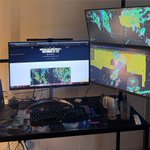
I think I have enough monitors to track everything I need… An all nighter is likely with this severe weather situation. The severe weather coverage continues.

Wow! What an impressive storm.

WATCH: Monster cell dumping golf ball size hail right now in North Phoenix. Severe thunderstorm warning expires at 4:30 p.m. and could bring 2.5" hail and 60 mile per hour winds. Live coverage starts at 4P! @FOX10Phoenix
SEVERE WEATHER OUTBREAK CONTINUES...OCT 21-22
We’re far from over with this significant storm system. Thunderstorm activity across Arizona is expected to intensify further this evening, with the risk for additional strong to severe storms continuing through at least Thursday. Multiple rounds of storms remain possible, and even areas that have already experienced severe weather could see additional impacts as the atmosphere remains favorable for storm development.
For Central and Southern California, the main event has yet to arrive.The greatest thunderstorm risk is expected to develop this evening and continue through the overnight hours, with some storms potentially becoming severe. Heavy rainfall, frequent lightning, damaging wind gusts, and even an isolated tornado remain possible with the stronger storms.
Just because conditions are quiet in your area right now does not mean the threat has passed. Storms can develop and intensify rapidly, especially given the atmospheric conditions in place.
Stay safe, remain weather aware, and stay tuned for more updates as this system continues to evolve.


Trust, reputation, and brand recognition become far more important than the underlying data source itself. When everything becomes increasingly easy to replicate, the brands that have established credibility, built loyal communities, and earned the trust of their users are the ones that will ultimately stand out and survive.
Technology and data can be copied, features can be replicated, and competitors can offer nearly identical products. However, years of building a reputation, maintaining consistency, and establishing genuine trust cannot simply be recreated overnight. This is where the original players, the OGs who have spent years building their brands, gain a significant competitive advantage. At the end of the day, people don’t just choose a product because of what it offers. They choose it because of who stands behind it and how much they trust that brand.
I could even say, the saturation will make it nearly impossible to stand out in the future. Doesn’t matter what you have without a following or trust over years in your brand.

Sina Moghaddami retweeted

This isn’t Tornado Alley, this is Arizona! What a classic, well structured supercell thunderstorm, producing large hail and showing a history of rotation.
These are the types of storms you would typically associate with the Great Plains, but Arizona is getting a taste of that setup today. With plenty of instability, strong wind shear, and favorable atmospheric dynamics in place, these storms are capable of becoming very organized and dangerous rather quickly.
Large hail, damaging winds, and even tornadoes remain possible with the strongest cells. Track it and know when its strengthening or weakening with our exclusive smart storm tracks.


SEVERE WEATHER THREAT ON GOING:
Good Morning, Wednesday October 21st, 2026 at approximately 9am PT.
Multiple cells are already under severe thunderstorm warnings, and a previously tornado warned cell was moving toward Flagstaff, AZ (now under a severe thunderstorm warning). These are dangerous storms that can rapidly intensify and change, with all types of severe weather hazards possible!
Discussion:
A powerful Pacific low pulling in deep tropical moisture moves inland through Thursday, bringing the greatest rain and thunderstorm impacts to California, Arizona, Nevada and Utah. Rain expands across Central and Southern California today, with the heaviest periods around Los Angeles and San Diego tonight and thunderstorms continuing Thursday, bringing risks of localized flooding, debris flows near vulnerable burn scars and damaging gusts, along with isolated coastal waterspouts or brief tornadoes, particularly near Big Sur and portions of the Southern California coast.
Arizona faces multiple rounds of dangerous thunderstorms through Thursday, with the strongest rotating storms favored along the Mogollon Rim and north and east of Phoenix late this afternoon and evening before shifting east Thursday, potentially producing winds of 60 to 70 mph, hail larger than 2 inches and a few tornadoes. Repeated downpours could trigger significant flash flooding across northern, central and eastern Arizona tonight into Thursday, while heavy rain and strong thunderstorms spreading into southern and central Utah make washes and slot canyons especially dangerous. Nevada’s showers and thunderstorms peak Thursday, with a few severe storms possible in eastern areas, while rain reaches far eastern Washington and northern Idaho Thursday into Friday and widespread frost threatens parts of western Oregon Friday morning.
A very busy stretch ahead. Take these threats seriously, never drive through flooded roads, and stay out of washes and slot canyons in affected areas. Stay tuned for rapid updates through AWA Insiders and additional coverage. Image/Video from @ZoneWatchWX including the ML storm tracks.


Arizona Faces Damaging Winds, Large Hail, and an Enhanced Tornado Risk | October 21 to 22, 2026
Read for all the details here: alphaweatheranalysis.com/new…
REMINDER: Read the article as it breaks it down for each region. Need more details? Check out AWA services. Stay tuned for more updates.

CALIFORNIA TRADES WARM AFTERNOONS FOR THUNDERSTORMS A FEW STRONG/SEVERE, AND SIERRA SNOW | OCTOBER 21ST TO 22ND, 2026 details here:
alphaweatheranalysis.com/new…
Covering California impacts, including the t-storm risk. AZ, your breakdown is coming up as well. Stay tuned for more updates! Please read the article for your region, as it will likely answer many of your questions. Need more information or additional details? Check out AWA Insiders.

Good Morning, Tuesday October 20th, 2026 at approximately 8:30am PT.
Discussion:
A Pacific low dropping south off California will pull moisture northward today, setting up a wetter and stormier stretch across California and the Southwest Wednesday and Thursday. Rain reaches the Central Coast late tonight and spreads into Southern California Wednesday, with the heaviest rainfall Wednesday night into Thursday morning bringing localized flooding and possible debris flows near vulnerable Central Coast burn scars, while parts of Southern California also face an elevated severe thunderstorm risk, including damaging winds and the possibility of an isolated tornado or two (brief spin up).
Multiple rounds of heavy rain could trigger flash flooding across northern Arizona and portions of central and eastern Arizona Wednesday and Thursday, with stronger storms capable of producing damaging winds, large hail and an isolated tornado. Southern Utah’s slot canyons and washes could become dangerous as storms move through Wednesday and Thursday, while showers expand across central and eastern Nevada and the southern Great Basin alongside localized gusts of 30 to 40 mph, with much lighter rainfall possible across the southern Mojave Desert. Ahead of the storm, strong rip currents and surf reaching 6 feet create dangerous swimming conditions along San Diego and Orange County beaches today, while gusty winds make Oregon’s outer coastal waters hazardous for small boats through this afternoon. Multiple updates expected today from AWA Insiders to Articles breaking it down section by section. Stay tuned.


